운전 노르웨이 당신을 도시 밖의 장소와 대중 교통이 제한적이거나 드문 곳으로 데려다줍니다. 노르웨이의 자연 경관을 보고 싶다면 여행하기에 좋은 방법입니다. 교통은 안전하고 속도는 적당하며 대부분의 도로는 교통량이 적습니다. 운전자는 운전과 잦은 관광 정차에 충분한 시간을 허용해야 합니다. 장거리, 특히 남-북 방향 및 복잡한 통과 피요르드 풍경, 운전에 시간이 걸린다는 뜻입니다. 예를 들어 전체 범위를 따라 드라이브 도로 E6, 노르웨이의 주요 도로는 약 일주일이 걸립니다.
이해하다


노르웨이 최고의 관광 명소는 대중 교통이 제한된 주요 도시 밖에 있습니다. 자가 운전을 통해 방문자는 원하는 대로 정차하고, 덜 붐비는 장소를 방문하고, 계획을 변경하고, 대중 교통이 제한되거나 없는 외딴 경치 좋은 도로를 방문할 수 있습니다. 시시각각 변하는 험준한 풍경, 노르웨이 최고의 명소는 여유로운 속도로 돌아다니는 것이 가장 좋습니다. 자연 경관은 일반적으로 특정 장소에 국한되지 않습니다. 일부 도시는 크루즈 항구로 널리 알려져 있지만 다른 지역도 똑같이 좋습니다. 대부분의 도로에서는 차창을 통해 주변 경관을 잘 볼 수 있습니다. 고속도로가 거의 없고 대부분의 도로는 일반 2차선 비분할로 되어 있어 쉽게 차를 세울 수 있습니다. 여름에는 어느 곳에서나 거의 24시간 일조량이 유지되며, 북쪽은 해가 지지 않아 방문객들이 언제든지 관광 드라이브를 할 수 있습니다.
노르웨이는 영국보다 넓으며 독일과 거의 같은 면적을 가지고 있지만 북쪽과 남쪽 사이의 거리는 훨씬 더 깁니다. 핀마크, 노르웨이의 최북단 지역은 덴마크보다 넓으며 Finnmark를 통한 운전은 런던보다 글래스고까지 더 깁니다. E6, 노르웨이의 주요 도로는 러시아를 제외한 유럽에서 단일 국가 내에서 2600km가 넘는 가장 긴 도로입니다. 노르웨이의 평범한 휴가 기간에는 일반적으로 노르웨이의 한 부분만 운전할 수 있는 시간이 있습니다.
대부분의 유럽과 마찬가지로 노르웨이는 오른손 운전을 합니다. 노르웨이의 대부분의 자동차에는 전통적으로 수동("스틱 시프트") 변속기가 있었습니다. 2015년 이후에는 컴퓨터 운전자 지원 및 자동 변속기가 탑재된 전기 자동차 및 자동차로 비교적 빠르게 전환되었습니다. 2020년 현재 거의 모든 신차에 자동 변속기가 장착되어 있습니다. 2020년에는 전체 자동차의 약 10%가 배터리로 작동합니다. 예약 시 자동 변속기 차량을 특별히 요청하지 않는 한 렌트 회사는 수동 변속기 차량을 계속 할당할 수 있습니다. 대부분의 도로는 분할되지 않은 2차선이며 오슬로 주변에는 제한된 고속도로 네트워크가 있습니다. 일반 제한 속도는 80km/h이며 도로 상황으로 인해 속도가 느려지는 경우가 많습니다.
자동차를 이용하면 철도가 없고 대중교통이 제한된 외딴 모퉁이까지 갈 수 있지만 일반적으로 주요 도시 내에서는 차가 필요하지 않습니다. 주차는 주요 도시에서 어려운 일이며 비용이 많이 들 수 있습니다. 노르웨이는 다양한 경치 좋은 드라이브를 제공하며 도로 당국은 전국 관광 루트 특히 권장됩니다. 이 경로를 따라 시설이 설치되어 방문객에게 여행을 더 즐겁고 실용적으로 만듭니다.

휘발유(가솔린)는 세금이 많이 부과되므로 비쌉니다. 노르웨이는 미터법과 섭씨를 사용합니다(마일, 갤런 및 화씨는 알 수 없음). 특히 주요 도시에 진입할 때 일부 유료 도로가 있습니다. 통행료는 일반적으로 자동차로 이동하는 총 비용의 일부입니다.
고속도로에서는 보통 과속이 일반적이지만 교통량이 조용하고 대부분의 운전자는 규율을 준수하고 법규를 준수하므로 운전이 일반적으로 쉽습니다. 그러나 일부 도심(예: 베르겐 및 오슬로)은 일방통행 도로가 많기 때문에 처음 방문하는 경우 혼란스러울 수 있습니다. 교통 체증은 거의 없으며 대부분 '러시아워' 주변 오슬로 (도로 E18 및 E6), 금요일 오후 오슬로 외곽, 부활절 휴가 전후. 도시 밖의 교통은 주요 도로에서도 종종 가볍습니다. 다음과 같은 일부 인기있는 목적지에서 게이랑에르 낮에는 좁은 도로에 여전히 많은 교통량이 있을 수 있습니다.
노르웨이의 일부 지역에서는 다음 주유소가 100km 이상 떨어져 있을 수 있습니다. 작은 마을에 멀리 떨어져 있어도 주유소가 항상 있는 것은 아닙니다. 인구가 적은 최북단 지역을 여행할 때는 제때에 탱크를 채우고 제리 캔을 가져오는 것을 고려하십시오.
노르웨이는 겨울이 길고 많은 도로가 몇 달 동안 얼음이나 단단한 눈으로 덮여 있지만 교통은 대체로 방해받지 않습니다. 여러 주요 도로를 따라 온도가 -20°C 또는 -30°C까지 떨어질 수 있습니다. 10월에서 4월 말 사이에 자동차로 노르웨이에 입국하는 방문객은 준비해야 합니다. 방문객들은 겨울철 운전의 어려움을 과소평가해서는 안 됩니다. 겨울마다 주요 도로는 눈과 얼음 위에서 운전할 적절한 기술과 장비가 없는 외국인 운전자에 의해 몇 시간 동안 차단됩니다. 매년 겨울 경찰과 도로 당국은 준비되지 않은 많은 외국인 운전자의 노르웨이 도로 접근을 거부합니다.
노르웨이 도로 다양한 품질을 가지고 있습니다. 주요 도로는 번호 앞에 "E"가 표시된 유럽 고속도로입니다. 예를 들어 E6 스웨덴에서 오슬로를 거쳐 북부 노르웨이의 가장 동쪽에 있는 키르케네스까지의 주요 남북 회랑입니다. 또한보십시오 스웨덴과 노르웨이를 통한 E6. 유럽의 고속도로는 도시, 지역 및 국가를 연결합니다. E18 크리스티안산과 남 노르웨이의 마을을 오슬로와 스웨덴으로 연결합니다. E16 베르겐과 오슬로를 연결하고(Flåm 및 Voss 경유), 7번 도로는 베르겐으로 가는 대체 경로(Hardangervidda 경유)입니다. E39 크리스티안산에서 스타방에르, 베르겐, 올레순을 거쳐 트론헤임까지 이어지는 해안 주요 도로입니다. E-road는 탐색에 탁월합니다. 다른 주요 도로(국도, "riksvei")는 1자리 또는 2자리 숫자가 낮습니다. 이 중 가장 중요한 것은 녹색 배경에 흰색 숫자로 표시됩니다(대부분의 고속도로에서 흰색 바탕에 검은색과 반대). 그러나 도로의 중요성이 품질을 나타내는 것은 아닙니다. E's조차도 좁고 느린 구간이 있을 수 있습니다. 대부분의 노르웨이 고속도로는 E6과 E18에 있지만 E6은 고속도로가 10% 미만인 반면 E18은 고속도로가 거의 50%입니다.
노르웨이 도로의 아스팔트 덮개는 일반적으로 거칠고 일부 다른 국가에서 경험할 수 있는 것처럼 젖어도 매우 미끄럽지 않습니다. 그러나 스터드가 박힌 겨울용 타이어는 겨울 동안 아스팔트를 먹어 치우는 경향이 있어 깊은 자국(또는 고랑)을 남깁니다. 이것은 특히 고속에서 차량을 옆으로 불안정하게 만들 수 있으며, 물 타이어가 채워지면 물 위에 떠 있게 되어 차량을 제어하기 어렵게 할 수 있습니다(얼음이나 눈 위를 운전하는 것처럼). 가파른 산길에서 내리막길을 운전할 때는 저단 기어를 사용하고 엔진이 속도를 제어하도록 하는 것이 가장 좋습니다. 브레이크가 과열되어 브레이크액이 끓을 수 있습니다.

- 일반적인 실수는 다음과 같습니다.
- 낮 시간 동안 헤드라이트를 끄고 운전(헤드라이트는 필수)
- 앞차에 너무 가까이 운전(최소 3초, 겨울에는 더 오래)
- 터널에서 과도하게 감속
- 거리와 운전 시간을 과소평가
- 제한된 시간에 너무 많은 것을 다루려고 하다
- 긴 내리막길에서 브레이크 과열
- 지점에서 지점으로 돌진 (드라이브는 끊임없이 변화하는 풍경을 제공합니다)
거리
방문자는 자주 과소 평가 거리와 운전시간 노르웨이 풍경에서 노르웨이의 많은 지역에서 방문자는 평균 시속 60km(1km당 1분) 이상을 기대해서는 안 됩니다. 일부 온라인 지도 서비스 및 위성 내비게이션(GPS)은 운전 시간을 과소평가하는 경향이 있습니다(킬로미터는 정확함). 페리 횡단, 휴식 및 사진 촬영 시간은 여기에 제안된 대략적인 시간에 추가되어야 합니다. 자동차로 주요 거리:
| 누구에게 누구로부터 | 주요 도로 | 킬로미터 | 소요시간 | 메모 |
|---|---|---|---|---|
| 오슬로-노르드캅 | 2200 | 35시간 순 ≈ 수면 포함 1주 | 나룻배 | |
| 오슬로-보되 | 1200 | 20시간 순 수면 포함 3일 | ||
| 오슬로-베르겐 | 500 | 8 시간 | ||
| 오슬로-크리스티안산 | 320 | 4 시간 | ||
| 오슬로-스타방에르 | 540 | 8 시간 | ||
| 오슬로-트론헤임 | 500 | 8 시간 | ||
| 트론헤임-보되 | 700 | 12 시간 | ||
| 오슬로-게이랑에르 | 450 | 7시간 | ||
| 오슬로-플롬 | 350 | 5 시간 | ||
| 보되-트롬쇠 | 600 | 10 시간 | 나룻배 | |
| 보되-노르드카프 | 1050 | 16시간(2일) | 나룻배 | |
| 베르겐-게이랑에르 | 400 | 7시간 | 페리 | |
| 베르겐-플롬 | 170 | 3 시간 | ||
| 베르겐-크리스티안산 | 470 | 8 시간 | 나룻배 | |
| 올레순-트론헤임 | 300 | 6 시간 | 페리 |
겨울 폐쇄
주변의 인기 도로를 포함한 일부 산길 게이랑에르 겨울철(일반적으로 11월에서 5월)에는 완전히 폐쇄됩니다. 기타 산악 도로는 악천후 시 더 짧은 기간(며칠 또는 1박) 동안 폐쇄될 수 있습니다. 도로는 일반적으로 산길 자체에 대해서만 폐쇄됩니다(영구 정착지 사이). 폐쇄 시간은 날씨와 겨울에 남아 있는 눈에 따라 크게 달라질 수 있습니다.
| 도로 | 부분 | 휴관일(정상) |
|---|---|---|
| 스카스바그–노드캅 (노스케이프) | 10월~4월(임시 개장) | |
| 갈라피엘 | 12~5월 | |
| 도로 51 | 발드레스플라이아 | 12~4월 |
| 도로 55 | 송네펠 | 11~5월 |
| 도로 63 | 게이랑에르– 랑바튼 | 11~5월 |
| 도로 63 | 트롤스티겐 | 10~5월 |
| 도로 243 | 에울랜드–레르달 (Aurland mt 패스) | 11월~6월 |
| 252번 도로 | Tyin-Eidsbugarden | 10~6월 |
| 258번 도로 | 감레 스트라이네펠스베그(오래된 Strynefjell 도로) | 10~6월 |
| 337번 도로 | Brokke-Suleskard(아그더) | 11~5월 |
| 341번 도로 | 스멜러–해닝스버그 | 11~5월 |
| 355번 도로 | 멜펠레트 | 11~5월 |
| 도로 520 | Hellandsbygd–Røldal | 11월~6월 |
| 도로 886 | Vintervollen–Grense Jacobselv(야르피오르드피엘레트) | 11~5월 |
페리


현재 노르웨이의 공공 도로에는 100개가 넘는 페리 횡단이 있습니다. 이 자동차 페리는 페리 교차점이 도로 번호에 포함되고 도로가 부두로 연결되는 등 도로 시스템의 필수적인 부분입니다. 페리 부두는 가능한 한 가장 짧은 교차 지점의 외딴 지역에 위치하는 경우가 많습니다. 자동차 페리는 국도 당국을 대신하여 민간 회사에서 운영합니다. 가격은 교통부가 관리하며 경로 길이에 따라 자동차의 경우 50-300kr이지만 모터 홈의 경우 두 배 이상입니다. 주요 도로의 자동차 페리는 낮 시간에 1시간에 2~3회 출발하며 저녁에는 덜 자주 출발합니다. 일부 중요한 페리는 야간에 운행하고 다른 페리는 23:00 또는 24:00(오후 11시 또는 자정)까지 운행합니다. 횡단은 보통 10-30분 정도 걸립니다. 개인 차량은 일반적으로 예약이 불가능하며 필요하지도 않습니다. 차는 선착장에 도착해 선착순으로 줄을 서서 기다린다. 페리는 일반적으로 대기 중인 모든 차량을 태울 수 있을 만큼 충분한 용량을 갖추고 있으며, 드물게 여행자가 다음 출발을 기다려야 하는 경우도 있습니다. 여행자는 계획에 페리 시간을 추가하는 것이 좋습니다. 페리 횡단은 일반적으로 지도에 피요르드를 가로지르는 점선으로 나타납니다. 페리는 일반적으로 피할 수 없거나 (매우) 긴 우회로를 통해서만 피할 수 있습니다. 레저 여행자를 위해 페리는 고요한 휴식과 피요르드를 가로지르는 즐거운 여행으로 경험을 더합니다. 대부분의 페리는 보호된 물에서 운행되며 파도의 영향을 받지 않습니다. 페리에는 종종 커피와 스낵을 제공하는 카페테리아가 있으며 경우에 따라 정식 저녁 식사를 제공합니다.
도로

도로망 분류:
- 전자 도로. 국제 전자 도로 네트워크의 일부로 번호가 매겨진 도로(국가 번호는 추가되지 않음)는 녹색 바탕에 흰색입니다.

- 국도. E-roads 이외의 다른 주요 도로("녹색 도로"), 녹색에 흰색 표지판:

- 번호가 매겨진 도로. 지역 번호가 매겨진 도로(도로 표지판에 표시), 흰색 바탕에 검은색 표지판:

- 기타 도로. 지역 및 지방 도로.
이 시스템이 반드시 도로 자체의 품질을 나타내는 것은 아니며 고속도로에 대한 접두사 또는 번호 체계가 없습니다. 숫자는 주로 탐색을 위한 것이며 숫자로 도시를 벗어나는 탐색은 때때로 어리석은 경로를 제안하기 때문에 위성 탐색(GPS) 및 온라인 지도 서비스보다 더 안정적입니다. 예를 들어 E6은 오슬로에서 북쪽과 남쪽으로 불과 몇 킬로미터 떨어진 실제 고속도로로 건설되고, 북쪽으로 더 가면 반고속도로가 된 다음 분할되지 않은 일반 2차선 도로로 바뀝니다. 방문자는 위성 항법(GPS)보다 도로 번호를 신뢰해야 합니다. 동서 E-road에는 짝수(예: E10)가 있고 남북 E-road에는 홀수(예: E39)가 있습니다. E6, 노르웨이의 주요 도로인 남북은 이 규칙의 예외입니다. 또한 도로 번호가 겹칠 수 있으므로 도로 확장이 예를 들어 E134와 도로 13 모두가 될 수 있습니다.
.svg/180px-Map_E6_(Norway).svg.png)
.svg/180px-Map_E39_(Norway).svg.png)
방문자는 길이 가파르거나(폭이 좁거나) 악천후(겨울철에는 때때로 몇 시간 또는 며칠 동안 폐쇄됨)에 노출될 수 있으므로 산길을 주의해야 합니다. 4월 하순이나 9월 하순에도 산길에 눈이 내리는 경우가 있습니다. 드물게 여름에도 가장 높은 고개에서 눈과 서리를 만날 수 있습니다. 온도가 해수면에서 10°C 미만인 경우 온도는 1500미터에서 약 0°C 이하일 수 있습니다.
중요한 도로
방문자는 계획 및 탐색을 위한 소수의 주요 도로에 대해 알아야 합니다. 그만큼 E6 노르웨이의 남쪽에서 북쪽 끝까지 2600km를 달리는 가장 중요한 곳입니다. E6은 오슬로 주변의 4차선 또는 6차선 고속 도로에서 외딴 지역(때로는 좁음)의 분할되지 않은 일반 2차선 도로까지 품질과 교통면에서 상당히 다양합니다. E6은 19개 카운티 중 10개 카운티를 통과합니다. 트론헤임의 북쪽은 남북으로 유일한 주요 도로이며 일부 지역에서는 실제로 뿐 도로가 폐쇄되면 스웨덴/핀란드를 통과해야 하는 도로입니다. 오슬로 북쪽(하마르까지) E6은 2015년까지 눈에 띄게 업그레이드되었습니다. 구드브란스달렌 업그레이드가 진행 중입니다(2015년 기준). 여전히 E6은 Ringebu와 Trondheim 사이의 지역 교통을 제공합니다.
그만큼 E39 크리스티안산(Kristiansand)에서 트론헤임(Trondheim)까지 서부 전체를 달리는 서부 피요르드의 주요 도로입니다. 이것은 매우 다양한 품질(대부분 분할되지 않은 2차선), 약 100개의 터널, 떠 있는 다리 및 여러 노르웨이의 상징적인 피요르드를 가로지르는 8개의 페리가 있는 매우 복잡한 도로입니다. 송네피요르드(Sognefjord)와 푀르데(Førde) 사이에는 짧은 길이의 좁은 도로만 남아 있으며 몇 년 안에 업그레이드될 것으로 예상됩니다(2016년 기준). 이 도로는 경치 좋은 길로 길게 뻗어 있지만 대체 경로는 훨씬 더 경치가 좋습니다. Skei와 Byrkjelo 사이에는 55번 도로(동노르웨이로)를 제외하고는 실질적인 대안이 없습니다. 일부 대체 경로(도로 51, 55 및 63)는 4월 또는 5월까지 겨울에 폐쇄됩니다.
그만큼 E18 동/남부의 오슬로 및 기타 인구 중심지를 통과하는 동서 동맥입니다. E6이 더 빠른 오슬로 동부 교외를 제외하고 대부분 넓고 빠른 고속도로로 건설되었습니다. E6과 두 번 교차합니다.
| 노선 | 기술 | 주목할만한 mt 패스 | 페리 | 품질 및 트래픽 | 풍경화 | 대체 경로 |
|---|---|---|---|---|---|---|
| 노르웨이의 주요 도로 노르웨이에서 운전하기 위한 핵심 참고 자료입니다. 에서 할덴 스웨덴 국경에서 키르케네스 러시아 국경에서 총 2628km(스웨덴에서는 약 500km). | Dovre, Saltfjellet(일부는 겨울철 혹독한 날씨에 노출됨) | 1 페리 | 할덴 고속도로 하마르. 러시아워와 주말에 오슬로 주변이나 내부의 혼잡. | 몇 가지 경치 좋은 스트레칭. | ||
| 주요 도로 동서. 스웨덴 국경 Ørje에서 오슬로까지 크리스티안산. | (없음) | 특히 주말과 오후에 오슬로와 오슬로-크리스티안산 근처에서 흔히 발생하는 혼잡. 오슬로 주변과 크리스티안산 인근의 고속도로. | 경치 좋은 스트레칭 | |||
| 그만큼 서부 노르웨이 주요 도로, 피요르드 국가를 통해 1300km. 크리스티안산-스타방에르-베르겐-올레순-트론헤임. | 주로 Romarheimsdalen과 같은 낮은 패스 | 여덟 개의 페리 횡단(유럽의 다른 어떤 도로보다 많음) | 노르웨이에서 가장 복잡한 도로. 작은 고속도로, 일부는 좁고 느립니다. 때때로 스타방에르와 베르겐 주변에서 혼잡이 발생합니다. | 긴 경치가 피요르드 지역을 가로질러 뻗어 있습니다. | ||
| Haukeli-Haugesund 도로 동부 노르웨이에서 | Haukeli (가끔 겨울에 문을 닫음). | (없음) | 특정 기간에 트래픽이 가장 많이 발생하며 대부분 보통입니다. | 경치 좋은 스트레칭. | ||
| 돔바스-롬스달-올레순 도로. 로 들어가는 주요 도로 뫼레 오그 롬스달 군. | (없음) | 교통량 보통, 고속도로 없음 | 기념비적인 계곡과 거대한 피요르드를 따라. | |||
| 헤드마크/외스터달렌 도로. | (없음) | E6 남북(오슬로-트론헤임)에 대한 약간 더 짧은 대안. | 큰 강과 큰 언덕의 전망, 그러나 E6보다 덜 경치 | |||
| 가장 빠르고 짧은 도로 오슬로-베르겐. | 하르당에르비다 산악 고원(겨울에는 종종 폐쇄됨) | (없음) | 일반 도로, 특히 오슬로 근처에서 상당히 많은 교통량이 있는 기간에 | 매우 아름다운 산 고원, 가파른 계곡, 피요르드 전망 | ||
| E39와 평행한 "내부". | Vikafjell(겨울철 노출), Gaularfjell(겨울철 폐쇄) | 2 페리 | 트래픽이 적거나 보통입니다. 분할되지 않은 2차선. 부분적으로 좁거나 가파르다. | 상징적인 피요르드, 폭포, 빙하를 따라 펼쳐지는 경치 좋은 드라이브. 여러 산길. | ||
| 오타달렌-노르드피요르드 도로. E6 연결(구드브란스달렌) ~까지 노드피요르드 부위. | Strynefjell(겨울에는 비정기적으로 폐쇄됨) | (없음) | 트래픽이 적거나 보통입니다. 분할되지 않은 2차선. | 멋진 계곡, 고산 산맥, 아름다운 호수와 피요르드를 지나는 경치 좋은 드라이브. | ||
| 로포텐 도로. 국경을 지나 나르비크 ...에 ㅏ 나 로포텐. | 스웨덴 국경에서 | (없음) | 경치 좋은 드라이브. |

오슬로-베르겐
오슬로에서 베르겐까지의 여행은 경로, 운전 조건 및 드라이브를 따라 정차하는 정류장에 따라 7시간에서 9시간이 소요됩니다. 겨울에는 몇 시간의 운전 시간을 추가할 준비를 하십시오. 그리고 몇 달 동안 일광이 부족할 것이라는 점을 기억하십시오. 오슬로에서 베르겐까지의 모든 경로는 산길을 통과합니다. 이러한 조건에 익숙하지 않은 경우 겨울에 투어에 이틀을 사용하는 것이 좋습니다. 악천후의 빙판길에서 12시간 또는 14시간 운전하는 것은 그다지 좋지 않습니다. 노르웨이의 많은 도로는 상대적으로 교통량이 적고 악천후로 인해 종종 좁고 느립니다. 오슬로와 베르겐 사이의 가장 직접적인 도로는 험난하지만 아름다운 풍경을 통과하며 11월부터 4월까지 거친 날씨의 영향을 받는 경우가 많습니다.

| 이름(산길) | 여정 | 기술 | 메모 | 명소 및 경치 | 거리 |
|---|---|---|---|---|---|
| Filefjell 산길입니다. | Filefjell 산길을 통과하는 공식 주요 도로입니다. E16의 암은 Sandvika에서 E18에 연결됩니다. 메인은 오슬로 공항을 통해 계속됩니다. 개블, 스웨덴. | 다른 산악 횡단보도에 비해 기상 조건으로 인해 단기간에 폐쇄되는 경향이 적기 때문에 겨울에 신뢰할 수 있습니다. 대부분 교통량이 적습니다. E16은 길지만 쉬운 운전이며, 발드레스. Laerdal에서 Bergen까지의 수많은 터널(세계에서 가장 긴 터널 포함). 레르달과 속이다, Lærdalstunnelen을 통해 24.5km의 세계에서 가장 긴 도로 터널은 6km 길이의 큰 동굴로 분리되어 있으며 터널에서 지체된 운전자가 차를 세우고 휴식을 취할 수 있습니다. | 상징적인 피요르드, 폭포, 산, 호수, 문화 유산(벽돌 교회)이 있는 경치 좋은 드라이브. 로맨틱을 통해 발드레스 그리고 야생 송네피오르 지역 보스 그리고 베르겐. | 513km | |
| 헴세달 산길 | 위의 E16에 대한 대안, 일부 긴 언덕, Lærdal에서 Bergen까지 E16과 동일합니다. | 트럭 운전사가 선호합니다. 겨울에는 강풍(눈보라)이 치는 경우에 따라 휴관합니다. | 경치를 통해 헴세달 겨울 스포츠 리조트와 함께. | 474km | |
| 홀-아울란트 루트 | 거대한 Hallingdal 계곡을 지나 호수를 따라 긴 터널을 지나 E16과 합류하는 Aurland까지 가파른 내리막이 나옵니다. | 부분적으로 거칠고 가파르고 좁으며 트럭이 거의 또는 전혀 없습니다. 겨울에는 가끔 문을 닫습니다. | 풍경화. E16에 합류 속이다. | ||
| 하르당에르비다 루트. | Hardangervidda 고원을 가로질러 Hallingdal 계곡을 통과합니다. | Hardanger 다리를 통해(유료). 노트 : 3500kg을 초과하는 차량의 경우 통행료 600NOK(2015년 기준)입니다. E16 Voss-Flåm이 폐쇄된 경우 주요 경로. 일부 트럭은 이 경로를 사용합니다. 주로 관광 시즌(여름 방학)에 교통 체증. Route 7 Hallingdal-Hønefoss는 2014년경에 눈에 띄게 개선되었습니다. | 상징적인 피요르드, 폭포, 산 및 호수가 있는 매우 아름다운 드라이브입니다. 눈보라가 몰아치는 겨울에는 종종 문을 닫습니다. | 455km | |
| 하우켈리 산길 | 험준하고 낭만적인 풍경을 통해 텔레마크. | Gjermundshamn-Årsnes에서 페리 횡단을 포함합니다. Jondal-Tørrvikbygd 및 Kvanndal-Utne에서 대체 교차로. | 경치 좋은 드라이브는 빙하와 호수, 폭포와 피요르드를 지나갔습니다. | 510km |
베르겐-트론헤임
베르겐-트론헤임(Bergen-Trondheim)은 5번의 시간이 소요되는 페리를 타고 해안을 따라 이동하거나 산길을 통과합니다.
| 이름(산길) | 여정 | 기술 | 메모 | 명소 및 경치 | 거리 |
|---|---|---|---|---|---|
| 해안도로 | E39 | 올레순-크리스티안순 | 이 경로는 주로 해안을 따라 5개의 페리 횡단으로 여러 피요르드를 횡단합니다. 페리는 느릴 뿐만 아니라 대기 시간과 승/하차 시간이 포함되기 때문에 요금이 부과되고 시간이 많이 걸립니다. 이 경로는 또한 가장 많은 교통량을 가지고 있으며, 노르웨이 여행자 Bergen-Trendheim이 다른 경로를 선호하기 때문에 현지 교통량입니다. | 스트린 주변의 피요르드는 경치가 좋습니다. 송네피오르(Sognefjord)는 페리 아래 깊이 1260m입니다. | 696km |
| 스트리네펠 | E39-15-E6 | 스트린 오타 | 이 경로에는 페리가 하나 있으며 적어도 여름 시간이 아닌 경우 가장 빠를 것입니다. | 스트린 주변의 피요르드는 경치가 좋습니다. Geiranger로 우회하는 것은 매우 경치가 좋습니다. 송네피오르(Sognefjord)는 페리 아래 깊이 1260m입니다. | 698km |
| 송네펠 | E39-55-15-E6 | 손달 오타 | 이 경로는 페리가 1개 있으며 가장 짧습니다. 여기에는 겨울에 폐쇄되는 까다로운 산악 도로인 55번 도로가 포함됩니다. | 팔짱을 끼고 있는 송네피요르드(Sognefjord)는 경치가 좋습니다. Sognefjell 산도 있습니다. | 652km |
옛 길과 새 길
노르웨이의 많은 도로는 바위나 산악 지형을 통과합니다. 어려운 지점에 새로운 도로 구간이 건설될 때(종종 터널을 통해), 눈사태를 피하기 위해 오래된 도로는 종종 버려지거나 보행자에게 남겨지거나 지역 도로로 사용됩니다. 도로의 오래된 부분은 종종 더 흥미로운 풍경을 제공하며 오래된 도로 엔지니어링 자체는 종종 인상적이거나 흥미 롭습니다. 7번 도로의 Tokagjelet 스트레치는 방문할 수 있는 그러한 도로 중 하나입니다. E16 도로의 유명한 Stalheimskleiva는 훌륭한 파노라마를 제공하며 운전하는 것이 흥미진진합니다. 방문자는 빠른 도로를 따라 서두르기 때문에 이러한 사실을 인지하지 못하는 경우가 많습니다.

차량 및 기어

일반 도로에서는 여름에 특별한 것이 필요하지 않습니다. 겨울에는 사륜구동이 마지막 눈 덮인 도로를 견인하는 데 유용할 수 있지만 일반적으로 일반 도로에서는 필요하지 않습니다. 겨울에는 노르웨이 자동차가 북유럽 품질의 겨울 타이어를 사용합니다(스터드 타이어는 11월 1일부터 허용됨). 체인은 일반적으로 일반 자동차에서 사용하지 않으며 일반적으로 렌탈 회사에서 허용하지 않습니다. 위성 항법(GPS)은 도시와 오슬로 주변에서 유용할 수 있지만 도로 번호로 항법하는 것이 더 안정적입니다. GPS와 온라인 지도 서비스는 때때로 어리석은 선택을 합니다.
노르웨이에서는 수동 변속기가 표준으로 간주됩니다. 자동변속기 차량을 렌트하고 싶으시다면 반드시 렌트카 회사에 주문하세요. 유럽에 거주하고 계시다면 개인용 타이어를 가져오는 것을 고려하되, 겨울(11월~4월)에 도착하는 경우 겨울용 타이어가 필요하다는 점을 유의하시고, 어떠한 상황에서도 눈이나 눈이 예상되지 않더라도 없이 운전을 시도하지 마십시오. 빙. 겨울용 타이어에는 최소 3mm 깊이의 홈이 있어야 합니다. 3500kg보다 무거운 차량(차량 그룹 M1, 3500kg부터 N1)은 겨울 동안 스노우 체인을 가져와야 하며 눈이나 얼음이 예상될 때마다 트럭과 대형 차량의 트레드 패턴 깊이는 최소 5mm를 권장합니다. 디젤 및 기타 액체도 겨울에 발생할 수 있는 낮은 온도를 견뎌야 합니다.
노르웨이는 대부분의 다른 국가보다 더 많은 전기 플러그인 자동차를 보유하고 있습니다. 완전 전기 자동차는 번호판에 "EL" 또는 "EK"가 표시됩니다.
캠핑카/캠퍼밴 이용
몇몇 회사는 "완전히 갖추어진" 모터홈(침대, 작은 주방, 냉장고, 샤워기, 화장실, 난방 등)을 고용하고 합리적인 렌트카와 합리적인 숙박 시설에 지출할 수 있는 비용에 대한 대략적인 표시로 훨씬 더 많은 유연성.
많은 곳에서 불법이지만 휴게소에 밤새 주차하는 것이 일반적입니다. 캠퍼밴을 위해 특별히 설계된 주차장을 찾으십시오. 토지는 일반적으로 사유지이므로 들판이나 도로를 따라 열린 패치에 주차하지 마십시오. 숲 속을 걷고 텐트에서 잠을 잘 수 있는 권리("모든 사람의 권리")는 차량 운전과 캠핑카에서의 수면에는 유효하지 않습니다.
캠핑카(및 캐러밴 또는 텐트가 있는 캠핑 - 일부에는 임대할 오두막이 있음)를 수용할 수 있는 수백 개의 캠프장이 있으며 여기에는 표지판이 잘 설치되어 있습니다. 모두 기본 시설(전기, 화장실, 온수 샤워(분당 지불), 대부분 평평한 땅)이 있으며 일부 시설(신선한 음식 구입, 보트 대여, 공동 주방, 관광 정보 등)이 더 많이 갖추어져 있습니다.
일부는 "산업용" 다양성(수백 대의 밴, 흠 없는 시설, 매우 곧은 길, 잔디가 아닌 자갈, 입력할 키패드, 많은 엄격한 규칙, 고속도로 바로 옆)이고 다른 일부는 더... 느슨한 - 가끔 방문자, 지불에 대한 명예 시스템, 목가적 인 환경, 많은 잔디와 공간. 표지판으로 구분할 수 없으므로 캠핑장이 기분과 선호도에 맞는지 확인하기 위해 드라이브 바이가 필요할 수 있습니다.
대략적인 기준(2011년 8월)으로 전기가 있는 야영장에서의 1박 비용은 약 200kr이지만 범위는 120~300kr입니다. 샤워는 보통 4분에 10kr입니다.
모든 주요 도로와 많은 작은 도로에는 많은 휴게소가 있으며 특히 멋진 휴게소(및 시설)가 있는 환상적인 국가 관광 루트 시스템이 있습니다. 대부분의 휴게소에는 화장실과 피크닉 테이블이 있습니다.
많은 캠퍼밴은 상대적으로 작은 엔진을 가지고 있으며 많은 노르웨이 언덕에서 다른 차량보다 느립니다. 느리거나 대형 차량은 더 빠른 차량이 지나갈 수 있도록 차를 세워야 합니다. 이 규칙은 어느 정도 융통성 있게 적용되어야 합니다. 거울을 확인하고 더 빠른 차량이 줄을 서서 추월할 수 없으면 차를 세우십시오.
페리 가격은 모터홈의 경우 일반적으로 자동차 가격의 두 배 이상입니다. 3.5톤이 넘는 대형 모터홈의 경우 도로 통행료도 두 배 이상입니다.
소송 비용
렌트카는 비용이 많이 들기 때문에 방문객들은 여행의 몇 일, 어떤 부분에서 차가 필요한지 고려해야 합니다. 보통의 엔진을 장착한 소형차는 종종 큰 엔진을 장착한 대형 SUV보다 훨씬 저렴합니다. 공공도로 밖에서 운전하는 것은 불법이기 때문에 큰 4륜구동이 필요하지 않습니다.

차량 자체의 일일 요금은 일반적으로 주요 비용입니다. 휘발유 가격은 덜 중요한 문제입니다. 적당한 엔진을 가진 소형 자동차가 가장 연료 효율이 높습니다. 자동차 페리는 추가 비용이며 여러 도로(특히 서부 피오르드 및 북부 노르웨이 일부)에서 불가피합니다. 대부분의 페리 횡단 시간은 비교적 짧고(10-25분) 페리 요금은 전체 자동차 렌트 비용에 비해 적당합니다. 특별한 관광 페리인 Gudvangen-Kaupanger 및 Geiranger-Hellesylt는 예외입니다. 노르웨이에는 여러 유료 도로가 있지만 대부분의 유료 도로는 보통입니다. 예를 들어 베르겐에 진입하는 경우 25kr이고, 13번/7번 도로에 있는 새로운 Hardanger 다리의 경우 150kr이 예외입니다.
경치 좋은 드라이브
노르웨이는 경치 좋은 드라이브를 많이 제공하며 거의 모든 도로(특히 서부 노르웨이, 산과 북부 노르웨이)가 경치가 좋습니다. 이 중 일부는 이름이 지정되었습니다. 전국 관광 루트 특히 권장됩니다.
전국 관광 루트
National Tourist Routes는 노르웨이의 18개 고속도로로 그림 같은 풍경과 휴게소 및 전망대와 같은 관광 친화적 인프라로 지정되어 있습니다. 이 경로는 총 1,850km(1,150마일)에 걸쳐 있으며 서부 해안, 서부 피요르드, 북부 노르웨이 및 남부 노르웨이 산지에 위치합니다. 두 개의 경로가 국제 E-road 네트워크의 일부를 구성합니다: E10에서 Lofoten을 경유하고 E75에서 Vaanger를 경유합니다. Sognefjellsvegen, Valdresflye 및 Trollstigen과 같은 산길은 겨울철에 폐쇄됩니다. 일부 구간은 좁거나 가파르므로 운전자는 미리 계획하고 내리막 기어를 사용하는 것이 좋습니다.
| 이름 | 도로 번호 | 인상 | 메모 |
|---|---|---|---|
| 게이랑에르-트롤스티겐 | 도로 63 | 성수기에는 정오(11시~14시)에 교통량이 많아 정체가 발생하므로 이른 아침이나 저녁에 운전을 해보세요. 최고점 1000미터. 5월 중순까지 휴관. | |
| 하당에르비다 |  | 바람과 추운 날씨에 노출됩니다. 5월과 9월에 눈과 서리가 내릴 수 있습니다. | |
| 하르당에르 | Hardangerfjord 주변의 클래식 드라이브 | ||
| 갈라피엘레트 | 613번과 610번 도로 | 발레스트란드에서 욜스터까지 | |
| Aurlandsfjellet | 도로 5627 | "눈길" 에울랜드-레르달, 겨울철 휴무 | |
| 송네펠레트 | 도로 55 | 가장 높은 지점은 1400m이며 겨울에는 폐쇄됩니다. | |
| 론단 | 프라이아 폴달에게 | ||
| Helgelandskysten(헬겔란트 해안) | 17번 도로 | 630km 6 페리, 남부 해안 노르드란트 | |
| 로포텐 | Raftsundet 해협에서 Å 마을까지 230km | ||
| 바레인저 | Varangerbotn(E6)에서 Hamningberg까지 160km, 핀마크, 노르웨이의 가장 동쪽 지점을 포함, 도로 341은 겨울에 폐쇄됨 |
기타 경치 좋은 루트
중요한 경치가 펼쳐지는 기타 경로:
| 노선 | 여정 | 인상 |
|---|---|---|
| 릴레함메르-옵달E6의 일부 | ||
| 파게르네스-레르달-속이다-보스 |  | |
| 아우를란트-홀 |  | |
| 손달-포르데 | ||
| Byrkjelo-Sykkylven | ||
| 헬레실트 외르스타 |  | |
| 릴레함메르 온달스네스 올레순 |  | |
| 노토덴-헤우게순 | ||
| 크리스티안산트론헤임 서부 노르웨이를 통해 |
코니쉬
노르웨이의 끝없는 해안선과 수많은 호수를 따라 많은 도로가 있습니다. 거친 풍경 때문에 프랑스와 이탈리아 리비에라를 따라가는 도로와 유사한 멋진 파노라마가 펼쳐지는 긴 코니쉬 드라이브가 종종 있습니다.
몇 가지 주목할만한 코니치
| 도로 | 여정 | 인상 |
|---|---|---|
| 650 | 쇼홀트-발달 | |
| 60 | 우트빅-스트란다 | |
| 79 | Eidfjord-Norheimsund (국가 관광 루트) | |
| 13 | 오다 에이드피요르드 | |
| E16 | 베르겐-보스 |
머리핀 도로

노르웨이에는 특히 Åndalsnes-Geiranger-Stryn 주변의 서부 노르웨이 피요르드 내부 주변에 주목할만한 헤어핀 도로가 있습니다.
- Trollstigen(63번 도로) - 아마도 가장 상징적인 헤어핀 도로, 웅장한 주변 환경
- Geiranger 도로(63번 도로) - 덜 눈에 띄는 디자인이지만 Trollstigen보다 더 많은 회전
- 외르네베겐(Eagles Road, 역시 63)
- 아이코닉한 Lysefjord의 Lysebotn 도로, 인상적이고 바람이 잘 통하는 도로, 27개의 머리핀
- Tindevegen Årdal-Turtagrø(개인, 유료)
- Øvre Årdal - Tyin(도로 53), 가장 공기가 잘 통하는 곳 중 하나
- Strynefjell 산길(구 도로, 258번)
- Vøringsfossen 폭포(7번 도로)의 Måbødalen, 이 구간에는 360도 터널이 있습니다.
- Sognefjellet(도로 55 Skjolden-Lom), 노르웨이에서 가장 높은 도로, 해발 1400m
- Stalheimskleiva(E16에서 우회, Voss와 Gudvangen 사이 Stalheim의 오래된 도로), 매우 가파르고 가파른
- Gaularfjell(도로 13 Balestrand-Førde)
안전 유지
운전 기준은 노르웨이에서 비교적 잘 유지되고 있으며, 교통량은 (통계적으로) 세계에서 가장 안전합니다. 사망률은 50년 동안 꾸준히 하락해 왔으며 2020년은 교통량이 10배임에도 불구하고 제2차 세계 대전 이후 가장 낮은 교통 관련 사망자 수를 기록했습니다. 노르웨이는 구불구불하고 좁은 산길이 많고, 야생동물과 겨울철 날씨로 운전자의 주의가 필요하지만 어려운 여건에서도 사고가 상대적으로 적습니다.

규정은 엄격하게 시행되며(특히 음주, 과속 및 위험한 추월) 속도 제한은 안전한 교통을 유지하기 위해 적당합니다. 속도 제한은 상황에 맞게 미세 조정되므로 항상 속도 제한을 선택한 이유가 있으며 이것이 노르웨이의 안전한 교통을 위한 핵심 이유 중 하나입니다. 노르웨이에서는 제지된 운전 스타일이 표준입니다.
겨울
- 또한보십시오: 겨울 운전
차를 몰다 겨울 conditions may be a real challenge without proper training and experience, this particularly applies to mountain passes all over Norway as well as other roads in Northern Norway. The golden rule for driving on snow, ice and slush: don't rush. Braking distance increases dramatically, increase distance to the car in front of you from the standard 3 seconds to a 5–6 seconds or more. Inexperienced drivers should drive very carefully until they get used to the conditions and the car; experienced drivers always "feel" the contact between tires and road. Powerful acceleration or hard braking quickly tells you how slippery the road is. Do a "brake test" frequently to get precise information on the road surface.

Several main roads such as E6, E16, road 7 and E134 run through mountain passes or other places exposed to wind/snow. During winter (October–April) drivers should plan well and get specific information for critical stretches of road included in the trip. A handful of mountain roads are frequently closed temporarily during bad weather, and the authorities routinely issue road information on radio, TV and the 인터넷; 요구 ☏175, 47 815 48 99 for details, given in Norwegian only on the internet map page.
Convoy driving During blizzards on some roads you are only allowed to drive in a line behind a heavy snowplow, convoy driving, a method called kolonnekjøring in Norwegian. Drivers are then obliged to wait at a gate or sign until the snowplough arrives. Always obtain specific information about mountain roads the day and hours before going. Don't hesitate to ask locals or call the numbers above for last minute information. News reports routinely mention where convoy driving is in operation with road number and name of mountain pass (or other stretch) as key information. There are waiting points with gates and signs at either side of the mountain pass.  "Stop. Wait for snow plough". Convoy driving waiting point on road 7. There are precise rules for convoy driving that must be followed:
|
Some main roads, such as E6, E16 and road 3, also pass through the coldest areas in Norway, these are often much colder (often 10–20 °C, even 30 °C colder) than departure and destination points – drivers should make sure that the car is prepared for very low temperatures (for instance filling up the right diesel quality). Always bring enough clothes and food, always calculate plenty of time. Be prepared to cancel or postpone trips in winter.
Appropriate tires are required on winter roads – the driver is responsible for having the right tires for the conditions, do not try to drive with poor tires. Nordic type winter tires (studded or un-studded) are strongly recommended; these are much better fitted to Norwegian winter conditions than general winter tires. During winter (after November 1) tires of any type are by law required to have a minimum of 3 mm tread depth, while in summer 1.6 mm is legal. Heavy vehicles (over 3,500 kg) must bring chains in winter and minimum tread depth is 5 mm.
터널

Norway's roads have many tunnels, some very long. Tunnels are generally very safe places to drive. In case of fire or smoke in the tunnel note the following: Use the emergency phones inside the tunnel (rather than your mobile phone) as this will inform traffic control exactly where you are. In case of fire, use the fire extinguisher inside the tunnel as this will alert traffic control and the fire brigade.
Never enter a tunnel if there is a red light. All tunnels have names that can be used to inform the police and fire brigades. Keep radio on inside tunnels as traffic control can send emergency messages. Long tunnels have signs indicating distance to exit in either direction. People inside the tunnel are expected to try to get out of the tunnel on their own. In case of fire or accident traffic control should be notified immediately via emergency telephones inside the tunnel. Use fire extinguisher to kill small fires and leave if not possible.
In case of fire in a one-way tunnel:
- Do not turn the car around; this is extremely dangerous.
- Leave the car with emergency lights on.
- Go to the nearest emergency exit.
In case of fire in a two-way tunnel (traffic in both directions):
- If possible, turn the car around, drive out and alert oncoming traffic.
- If it is difficult or dangerous to turn around, leave the car with emergency lights on and 산책 to the exit.
- Walk in the opposite direction as the smoke.
동물
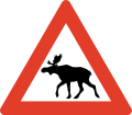
Roads are generally not fenced and animals may stray onto all sorts of roads. You need to look out for deer and moose - a moose collision in particular is very dangerous as these are tall and heavy animals. In the north you will also have to watch out for reindeer.
Moose/elk ("elg") and red deer can run onto the highway particularly at dusk and dawn so take extra care if driving at those times, particularly through forest. Red deer can also jump onto the highway without warning, particularly in Western Norway during late autumn and winter, special "crossing points" have been constructed several places, be aware. Reindeer may happen to walk on the road in Northern Norway. Note the warning signs. The elk, the most dangerous animal on the roads, is most active at full moon, after heavy snow fall and at dusk/dawn.Be extra careful to wild animals on the roads under these circumstances:
- Dusk/dawn.
- Springtime (as moose reject last year's calves and give birth to new ones).
- Edge of forests.
- Bridges across streams.
- Full moon
Several roads pass through pastures with grazing livestock and there may not be any fence to the road. Sheep, cows and goats may stroll on the road. A cattle grid ("ferist") or warning sign typically marks the start of such areas.
도로 상황

Norwegian roads have varying quality. All public roads have asphalt and are generally well maintained, but some popular roads are narrow, with many curves and steep hills. The main roads are the European highways indicated with an "E" in front of the number. 예를 들어 E6 is the main north-south corridor from Sweden via Oslo to Kirkenes in the very east of Northern Norway. European highways connect cities, regions and countries. The E-roads are excellent for navigation. Other main roads (national highways, "riksvei") have low one- or two-digit numbers. Note however that the importance of the road does not indicate quality: even the E's may have narrow and slow sections. The E6 is only partly designed and constructed as motorway. Road qualities indicated by signs or markings:
| 표지판 | 표시 | 메모 |
|---|---|---|
| Motorway or controlled-access highway (also known as A-class motorway). Grade-separeted crossings, wide shoulder and mechanical median barrier. Speed limit 80, 90, 100 or 110 kmh. Some stretches around Oslo and main cities only. | ||
| Semi-motorway or two-lane expressway (previously B-class motorway), speed limit 80 or 90 kmh. | ||
| Two-lane undivided is the standard road quality, narrow or no shoulder. Indicated with a median strip (centre line), sometimes with rumble strip. | ||
| Warning signs and/or no center line indicates a road narrower than two full lanes. |
Driving a car in 겨울 conditions may be a real challenge without proper training and experience, this particularly applies to mountain passes all over Norway as well as other roads in Northern Norway. The golden rule for driving on snow, ice and slush: don't rush. Authorities routinely issue road information on radio, TV and 인터넷. Always obtain specific information about mountain roads the day and hours before going. Don't hesitate to ask locals or call ☏ 47 815 48 991, 175 for last minute information. Always bring enough clothes and food, always calculate plenty of time. Be prepared to cancel or postpone trips in winter.

Some mountain passes, including popular roads around Geiranger are totally closed during winter (typically Nov-May). On the highest mountain passes, such as Sognefjell (road 55), winter conditions can occasionally occur in May and September. Some exposed mountain passes can be closed for some hours or days in winter during strong wind.
Convoy driving ("kolonnekjøring") can also be used. When convoy driving is in effect vehicles have to wait for the snow plow and then drive in a line (convoy) behind the snow plow through the mountain pass or other difficult section. Convoy driving is slow and waiting times can be several hours. Convoy driving procedure:
- Make sure to a have full thank of fuel, there are no petrol stations on convoy stretches
- Bring rope, flashlight and shovel
- Bring food and warm drink
- Bring winter clothes and shoes
- Flash the emergency light when the convoy starts moving
- Keep close to the car ahead
- Stay in the convoy, keep a steady speed
- Don't leave the convoy or try to turn back
- Stay in the car if the convoy halts
- Don't stray from the car if you to stop
터널

Any driving in Norway is not complete without tunnels. There are thousands of them, and they are fascinating to those unfamiliar with them. Most of the tunnels are in Western Norway and Nordland county. The longest is 24 km, but 1–3 km is more common. Road E16 has over 60 tunnels, covering 15% of the entire road. E6 has over 80 tunnels, E39 has over 100 tunnels.
Almost all are lit with "street" lighting, but may be narrower than the regular roads. Driving out from a tunnel, over a bridge spanning a deep gorge, back into a tunnel, then down a 12% gradient is something to be remembered. Some tunnels, particularly underwater tunnels, are relatively steep. Tunnels are generally safe and Norwegian drivers keep the same speed in tunnels as in the open, the main challenge is adapting to the darker tunnel during bright sunshine. Temperatures inside tunnels are usually different than outside, causing ice taps to form on road surface and in ceiling; condense on car windows may also be a problem. Animals may seek shelter inside tunnels. Length of tunnel is indicated at the entrance and for the longer tunnels kilometers to exit is also indicated inside the tunnel. Each tunnel has a name and drivers should use the name to inform the police in case of emergency.
Note that overtaking in a tunnel is dangerous and forbidden in many tunnels.
Rules and regulations

Rules and road signs are generally the same as in the rest of Europe. Virtually all signs use standardised symbols (pictograms), explanatory text in plain Norwegian used occasionally as supplement. Foreign visitors should be aware that police controls are common and that fines are very high. Traffic enforcement cameras are common. Jail sentence and suspension of licence is used for the most serious offences.
방법 오른쪽
- Traffic from right hand has right of way (unless signs or lights). You must yield to traffic from any road to your right, except from separate areas such as parking lots, market square, pedestrian zone, and petrol stations.
- Turning vehicles must yield to pedestrians and bicycles that proceed straight ahead on road or shoulder.
 Traffic on roads with the standard "Yellow Diamond" sign has the right of way. This is widely used for main roads. Traffic from connecting roads will then see the give-way (yield) or stop sign.
 Universal give way (yield) sign.
 Give way for vehicles located within a roundabout.
 Buses have right of way when leaving a bus stop where the speed limit is 60 km/h or less.
 Trains, trams and light rail have right of way even from the left hand side.
- Traffic downhill is expected to yield to traffic uphill if road is too narrow for two cars (important in winter).
 Pedestrians have the right of way at all marked crossings with no traffic lights. You are required to stop even if the pedestrian is not yet in the crossing, only showing intention to cross. You may be severely fined and your driver's licence may be suspended if you don't. This rule is strictly enforced.
 Emergency service vehicles with flashing 푸른 light (red light not used) has absolute right of way. Note: Emergency light is blue, silent response very common (no siren).
 Right turn on red is illegal even if road is clear.
- Opposing traffic must if necessary slow down or pull over on the right hand side (particularly applies to narrow mountain roads).
- Funeral processions have the right of way. People are required to yield, and not interfere or cause an obstruction.
Use of equipment
- Headlights are mandatory even during daylight. If you drive without lights you may find other drivers flashing their headlights at you to inform you.
- An EN standard hazard waistcoat is required in the vehicle, reachable from the driver's seat.
- Using a mobile phone when driving is forbidden.
- Wearing a seat belt is mandatory, also in back seats.
- Winter tires must have a minimum depth of tread of 3 mm. Cars (Vehicle group M1) heavier than 7500 kg (Vehicle group N1 over 3500 Kg) are required to carry snow chains during winter and whenever snow or ice can be expected. A minimum of 5 mm depth of tread is recommended for trucks and heavy cars.
- Using a vehicle's horn is considered impolite and may result in a fine unless used for an emergency.
속도 제한

 The general speed limit is 80 km/h in the countryside/on highways. Because 80 is the default speed limit, the 80-sign is rarely used and 80 is instead implied.
 50 km/h in urban/built-up areas, usually indicated with signs.
- Other speed limits are always indicated with signs; for instance, speed limits on motorways (controlled-access highway). The motorway sign does not imply any particular speed limit.
- Note that there are no specific rules for change of speed limit (as in some other countries) when driving conditions change. The driver is by law required to adjust speed downward to a safe level in, for instance, fog, heavy rain, or snow.
- Norway has some of the highest speeding fines in the world, including confiscating your driver's license and/or jail time (even for foreigners). There are speeding cameras frequently on major roads, and it's not uncommon for unmarked police cars to pull you over. It is highly recommended to use your car's cruise control system to stay at the speed limit.
- Vehicles pulling trailers, and vehicles over 3,500 kg, must not drive faster than 80 km/h ( except motorhomes up to 7500 Kg that can follow the speed limit up to 110 Kmh ), even on motorways with a higher speed limit.
- Speed limits are fine-tuned to conditions for maximum safety, so be aware that speed limits may adjusted slightly for a few kilometers only. For instance some good two-lane undivided roads in sparsely populated areas may have 70 kmh speed limit because of moose hazard or frequent icing.
- The highest speed limit is 110 kmh and used only on short stretches of the best motorways.
사고
- Every person is by law obliged to help and assist at site of accident, even if not involved or guilty.
- Call the police (emergency 112) if persons are injured or killed. Police should also be contacted if animals are injured or killed.
- If no persons are harmed, police should not be called, but drivers involved should resolve the situation themselves (exchange full contact information).
다른
- Don't drink and drive. Your blood alcohol concentration must not exceed 0.2 ‰. One small beer can be enough. This rule is strictly enforced and violators risk a huge fine, a long (or even indefinite) suspension of the driver's licence, and prison time.
- New law from 2013: If you take medications (opiates, benzodiazepines or other narcotics) you are NOT allowed to drive unless you are taking them every day (long-term) for at least 14 days. Even if you have prescription you are not allow to drive if you use them “now and then”. All police checkpoints now check you for drugs as well as alcohol and they have their own “limit table” that if you are over “0,002%” you will go to jail and get your license confiscated (Even with prescription which only says “when needed”). Tourists should be very aware of this, so if you need to take a e.g painkiller you must wait until ALL of the drug has leaved your system.
- On typical Norwegian two-lane road with a narrow shoulder, overtaking is only allowed on long straightaways with plenty of visibility. Drivers are not expected to use the shoulder to facilitate overtaking. Overtake only if really necessary; consider alternatives like taking a short break.
- Overtaking is generally forbidden at crossroads.
- Off-roading is generally forbidden. Motor vehicles must stay on public roads.
 Where a road is not wide enough for two cars to meet, blue signs with a large M indicate passing points (M for "meeting" point).
Signs and markings

원형 교차로

Yield (give way)

Stop (and give way)

Crossroad on priority road

Give way to oncoming traffic

Oncoming traffic must give way

출입 불가

Speed limit (km/h)

Right turn mandatory


While road markings are informative, they are often covered by snow and ice in winter. Unlike other European countries, in Norway yellow lines separate opposing traffic, and white lines separate traffic in the same direction. In general yellow lines should be on your left hand side, while white lines should be on your right hand side. Caution: Yellow lines on your right hand side means you are heading in the wrong direction!
| Marking | 기술 | 목적 | 메모 |
|---|---|---|---|
| Yellow line, Double line | Lane divider for opposing traffic | Crossing illegal | |
| Yellow line, continuous | Lane divider for opposing traffic | Crossing illegal | |
| Yellow line, long dashes, short gaps (warning line or hazard warning line) | Lane divider for opposing traffic | Crossing (overtaking) legal, but risky | |
| Yellow line, short dashes, long gaps (Lane line) | Lane divider for opposing traffic | Crossing legal (good visibility) | |
| Combined line (hazard warning line and lane line) | Regular overtaking hazardous | Observe the line closest to you | |
| Combined line (continuous line and lane line) | Lane divider for opposing traffic | Crossing illegal | |
| (no median/lane marking).These road have punctuated edge lines. | Road too narrow for lane marking | Caution, slow down for opposing traffic | |
| White line, short dashes, long gaps | Lane divider for traffic in same direction (motorways) | Crossing legal, low risk | |
| White line thick, dash and gaps same | Lane divider for special purpose lane (notably bus lane) | Driving in bus and taxi lanes and in high-occupancy vehicle lanes is only permitted as indicated by official traffic signs. Motorcycles, mopeds, bicycles or marked emergency vehicles may also use such lanes. | |
| Hatched area, yellow or white | Used to separate and guide the traffic instead of traffic islands. | It is forbidden to drive on hatched areas |
주차

Parking is generally forbidden if speed limit is over 60 km/h. Parking in inner city is often difficult and usually strictly regulated or expensive. Within downtown 베르겐 parking is generally forbidden except on parking meters or within parking facilities. Parking on meters in Oslo and Bergen is relatively expensive. Electric cars can park for free on parking meters in public streets (applies to all of Norway), while "hybrid" cars including "plug-in hybrids" must pay (as of 2016). "Mot avgift" means that there is a fee for parking. While parking on public streets in Oslo is generally allowed, gradually fewer places are available as streets are redesigned. Illegally parked cars will be fined and in some cases towed at the expense of owner (clamps are not used). Note the use of parking zones where sign applies until invalidated (unlike the basic rule that signs are in force until next cross road).
통행료
![]() There are toll roads in Norway; most of these are part of AutoPass (automatic number plate recognition). Visitors in their own car can register their numberplate for the duration of their visit only, pre-buy kr. 300 worth of tolls, and directly debit their (European) bank account or credit card for top ups. Any un-used funds are returned within 90 days. For rental cars, follow the rental company procedure. Occasionally, it may be necessary to stop and pay for tolls (notably on the small number of private roads), but most are automated (numberplate is photographed while driving under a gantry over the road).
There are toll roads in Norway; most of these are part of AutoPass (automatic number plate recognition). Visitors in their own car can register their numberplate for the duration of their visit only, pre-buy kr. 300 worth of tolls, and directly debit their (European) bank account or credit card for top ups. Any un-used funds are returned within 90 days. For rental cars, follow the rental company procedure. Occasionally, it may be necessary to stop and pay for tolls (notably on the small number of private roads), but most are automated (numberplate is photographed while driving under a gantry over the road).
Motorhomes up to 7500 Kg has the same toll charge as a car under 3500 Kg on roads using Autopass.
용어 사전
- For more information on Norwegian glossary, see the Norwegian phrasebook 조.
_(36359101261).jpg/220px-Hardangerfjorfd_in_a_Nutshell_(42)_(36359101261).jpg)


- anleggsarbeid
- road works/construction ahead
- beiteområde
- grazing livestock
- bensin
- 가솔린
- bomvei/bompenger
- toll road/toll
- dekk
- tire/tires
- 디젤
- 디젤
- fotgjengere
- pedestrians
- 문
- 거리
- gjelder ikke buss
- does not apply to buses
- gjelder høyre felt
- applies to right hand lane
- venstre
- 왼쪽
- gågate
- pedestrian zone
- høyre/høgre
- right hand (side)
- km/t
- kilometers per hour
- kjettinger
- chains
- kjør forsiktig
- drive carefully
- kjørelys
- headlights
- kolonnekjøring
- convoy driving
- lys
- 빛
- vent på brøytebil
- wait for snowplow (snow removal vehicle)
- kuldeport
- tunnel closed with gate to keep frost out
- lengde
- 길이
- olje
- 기름
- omkjøring
- diversion, detour
- over 1 time
- more than 1 hour
- opphøyd gangfelt
- raised pedestrian crossing
- piggdekk
- studded tires
- stengt
- 닫은
- stopp ved rød blink
- stop if red light signal
- særlig stor elgfare
- extraordinary moose hazard
- strekningsmåling
- speed camera for stretch of road
- telehiv, teleskade
- frost bulges, frost heaves, frost cracks
- tele
- frost in ground
- trekkrok
- tow bar, tow hitch, tow hook
- ulykke
- 사고
- vei/veg
- road
- vegen
- the road
- ventetid
- waiting time
- vinterdekk
- winter tires, snow tires (same thing)
일정
