스트루브 측지 호 이다 유네스코 세계문화유산 에 노르웨이, 스웨덴, 핀란드, 러시아, 에스토니아, 라트비아, 리투아니아, 벨라루스, 몰도바 과 우크라이나.
이해하다

스트루브 아크는 측량 삼각 측량 체인 노르웨이 함메르페스트에서 흑해까지 10개국 2,820km에 걸쳐 뻗어 있습니다. 이것은 1816년과 1855년 사이에 천문학자 Friedrich Georg Wilhelm Struve가 수행한 조사의 포인트로, 자오선의 긴 부분을 최초로 정확하게 측정했습니다. 이것은 확립하는 데 도움이되었습니다. 우리 행성의 정확한 크기와 모양 그리고 지구 과학 및 지형 매핑의 발전에 중요한 단계를 표시했습니다. 그것은 다른 나라의 과학자들 사이의 과학적 협력과 과학적 대의를 위한 군주 간의 협력의 특별한 예입니다. 원래 호는 265개의 주요 스테이션 포인트와 258개의 주요 삼각형으로 구성되었습니다. 그만큼 나열된 사이트 34개의 원래 스테이션 포인트가 포함되어 있으며 다른 표시가 있습니다.
등재된 사이트의 대부분은 필드의 작은 게시물이며 방문에 대한 보상이 없을 수 있습니다. 그러나 호의 초점은 Dorpat 천문대입니다. 타르투, 에스토니아.
역사
지구의 형태와 크기는 태초부터 논쟁이 되어왔다. 그럼에도 불구하고 오랜 역사 동안 장비와 방법이 정확한 측정에 적합하지 않아 다음과 같은 상황이 발생했습니다. 크리스토퍼 콜럼버스 스페인에서 서쪽으로 항해하여 인도가 "모퉁이를 돌면" 인도가 될 것이라고 믿거나, 마젤란 그가 짐작했던 것보다 몇 배나 더 큰 태평양을 가로지르는 여행에서 간신히 살아남았다.
삼각측량 거리 측정의 새로운 방법으로 17세기에 발명되었습니다. 일련의 포인트가 삼각형 구성으로 풍경에 배치되었습니다. 두 점 사이의 거리를 측정해야 합니다. 그 후 각 지점에서 그 지점에서 볼 수 있는 다른 모든 지점 사이의 각도를 다음을 사용하여 측정했습니다. 경위. 오돌라이트는 기본적으로 삼각대에 장착된 망원경으로, 정확히 어느 위치에서 회전했는지를 보여주는 눈금과 방향을 미세 조정할 수 있는 십자선과 손잡이가 있습니다.
그 당시 지구는 완전한 구가 아니라는 것이 알려져 있었지만 극지방에서 평평하게 되었는지, 적도를 따라 평평하게 되었는지에 대한 논쟁이 있었습니다. 지구의 둘레는 360°로 정의되었지만 정확히 1도는 몇 도였습니까? 종호의 길이를 측정하기 위해 여러 탐험이 시작되었으며, 특히 라플란드와 페루가 가장 두드러졌습니다. 전 원정대는 프랑스인이 이끌었다. 피에르 모페르튀스 1730년대에 스트루브의 측정은 1세기 후에 같은 선을 사용했습니다. 아이디어는 지구의 모양에 대한 아이디어를 형성하기 위해 다른 위도에서 세로 호를 측정하는 것이 었습니다. 그럼에도 불구하고 호는 Struve 호에 비해 상당히 짧습니다.
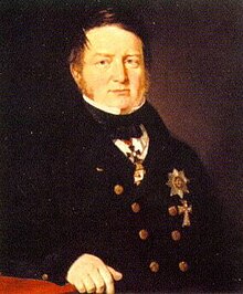
후 나폴레옹 전쟁, 유럽의 왕들과 국가들은 미래의 전쟁에서 성공하기 위해서는 더 정확한 매핑과 측정, 더 정확하게는 지도를 그릴 수 있는 틀이나 그리드가 필요하다는 것을 깨달았습니다. 독일 태생의 천문학자 프리드리히 게오르크 빌헬름 폰 슈트루베 (1793-1864), Dorpat 대학에서 근무(도시의 현대 이름은 타르투), 1812년 이래로 리보니아(현재의 에스토니아와 라트비아 접경지)에서 삼각측량을 담당하고 있던 이 프로젝트는 1819년에 러시아 황제에게 제안되었고, 1820년대에 Gogland와 제카필스 (당시 야콥슈타트). 호의 기준점으로 Dorpat 대학이 선정되었으며, 최근 주변의 삼각측량과 잘 어울립니다. 빌뉴스 으로 칼 테너 (1783-1859) 및 스트루브가 인지하고 통합할 계획이었던 Torne River Valley에서의 Maupertuis의 작업.
Struve가 이끄는 삼각 측량 작업은 1831년까지 북쪽으로 Gogland에 도달했으며 토르니오 1851년까지, 그러나 그는 프로젝트를 이끄는 유일한 사람이 아니었을 것입니다. 테너는 1816~28년, 1835~40년, 1846~51년의 세 단계에 걸쳐 예카필스에서 흑해까지 삼각 측량을 주도했습니다. 북쪽의 스웨덴-노르웨이 땅에서 닐스 셀랜더 (1804-70) Tornio에서 까지의 부분을 조사했습니다. 카우토케이노 1845~52년 및 크리스토퍼 한스틴 (1784-1872) 카우토케이노에서 푸글렌 1845–50.
결과는 1860년에 발표되었습니다. 많은 국가에서 교차된 호는 앞으로 수십 년 동안 측량 시스템의 중추가 되었으며 영국 측지학자 Alexander Clarke가 1858-1880년의 지구 그림에 관한 계산에서 사용하는 호 중 하나가 되었습니다. 당시에 사용 가능한 도구를 고려하면 정확성이 인상적이었습니다. Struve의 계산에 따르면 적도 반경은 6,378,360.7m인 반면 위성 항법을 사용한 현대 측정의 반경은 약 224m 또는 735피트의 차이인 6,378,138.8m입니다.
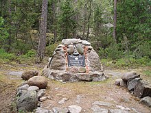
유네스코는 2005년 10개국 당국의 다년간에 걸친 연구 프로젝트를 거쳐 아크를 세계문화유산으로 지정했다. 거의 200년 전에 암석에 구멍을 뚫은 것으로 구성된 조사의 물리적 유적은 별로 볼 것이 없을 수도 있지만 개별 지점은 종종 풍경에 대한 멋진 전망을 제공하며 일부의 경우 인상적인 기념비가 세워졌습니다. 또한 많은 지점에 도달하는 것은 오늘날에도 여전히 다소 모험이며 많은 지점을 방문하면 말과 수레 시대에 수행 된 프로젝트의 방대함이 정말 매력적으로 느껴질 수 있습니다. 북유럽 및 동유럽 전역의 이 위치 집합에 대해 설명합니다.
준비하다
이 여정의 모든 지점을 방문하는 가장 실용적인 방법은 차. 그것은 세계의 진정한 외딴 지역을 통과하지 않지만 특히 여행의 북쪽에서는 서비스 사이의 거리가 길 수 있으며 경로의 전체 거리를 감안할 때 차가 양호한 상태인지 확인해야합니다. 또한, 특히 구 동구권에서 작은 도로는 때때로 열악한 상태에 있습니다.
여행을 하기로 결정했다면 대중 교통, 장거리 하이킹, 히치하이킹 또는 가장 먼 지점에 대한 택시 여행이 길 옆에 있더라도 건너뛸 수 있습니다. 에 의해 전체 여행을 여행 자전거 또는 발 시간과 체력이 있다면 적어도 이론적으로는 가능합니다. 대중 교통으로 각 지점을 오가는 방법은 아래 이탤릭체로 기재되어 있습니다. 정보는 2021년 3월 인터넷 조사를 기반으로 합니다. 최신 일정과 이용 가능한 경로에 대한 유용한 웹사이트는 이 기사의 토론 페이지 또는 여행 일정이 진행되는 국가 및 도시 기사의 둘러보기 섹션에서 찾을 수 있습니다.
포인트 사이를 편안하게 여행하더라도 일부 포인트에 도달하려면 약간의 노력이 필요합니다. 예를 들어 핀란드 남부의 Tornikallio는 바위와 나무 뿌리를 가로지르는 길이 있는 주차장에서 오르막 하이킹을 해야 하며 신체적 또는 시각적 장애가 있는 경우 접근 가능한 것으로 정확히 설명할 수 없습니다.
들어와
호의 지점은 2,820km에 걸쳐 있습니다. 북극권 위에서 흑해에 이르기까지 세계 유산 목록에서 가장 긴 비문 중 하나입니다. 거리가 멀기 때문에 볼 수 있는 방법은 매우 다양합니다.
넓은 지역에 퍼져 있을 뿐만 아니라 이 세계 유산의 구성 요소 중 많은 부분이 주요 도시와 마을 외부에 있습니다. ㅏ 차 합리적인 시간 내에 가능한 한 많은 지점을 방문하고 싶다면 아마도 가장 좋은 방법일 것입니다. 핀란드 만에 위치한 지점은 여전히 접근에 문제가 있을 것입니다.
노르웨이, 스웨덴, 핀란드, 에스토니아, 라트비아, 리투아니아가 회원국이다. 솅겐 지역 벨로루시, 몰도바 및 우크라이나는 그렇지 않으므로 별도의 비자 정권. 대부분의 EU 국민은 이 일정에서 비솅겐 국가에 비교적 번거롭지 않게 접근할 수 있지만 여전히 여권을 소지해야 합니다. 벨로루시는 과거에 "폐쇄" 비자 정책으로 악명 높았지만 이후 EU 시민에 대한 규정을 크게 완화했습니다. Gogland 섬에 있는 Struve Arc의 러시아 부분은 관광객이 접근할 수 없으므로 이 부분을 건너뛰고 핀란드에서 에스토니아로(또는 그 반대로) 바로 여행해야 합니다. 자세한 내용은 개별 국가 문서를 참조하십시오.
가다

노르웨이
북쪽 끝은 유럽에서 얻을 수 있는 가장 북쪽에 있습니다. 여기까지 가려면 다음을 따르세요. 스웨덴과 노르웨이를 통한 E6 스카디에게. 여정의 일부에 대한 대체 경로는 다음과 같습니다. E45, E4 또는 E8 모두 당신이 어디에서 왔는지에 따라 다르지만 남쪽으로 여행하는 동안 후자를 따라 운전할 것입니다. Skaidi에서 94번 고속도로를 타면 Hammerfest까지 가실 수 있습니다.
무엇보다도 비행기에 탑승하고 싶을 수도 있습니다. 트롬쇠 이 지역의 주요 허브이며 그곳에서 함메르페스트까지 비행할 수 있습니다. Hammerfest 공항은 Fuglenes에서 도보로 1km가 조금 넘는 거리에 있습니다. 후르티그루텐 Hammerfest에서도 호출되며 항구에서 Fuglenes까지 만 주변으로 약 2.5km 떨어져 있습니다.
- 1 푸글렌, 함메르페스트, 핀마크 – Fuglenes, "새의 반도"는 북극해가 보이는 언덕에 있는 Hammerfest의 Fuglenes 지구에 있습니다. 포인트는 화강암 받침대에 서 있는 녹색 지구로 표시되며, 이 기념물은 메리디안스토텐.
Skaidi로 되돌아간 다음 E6을 따라 남서쪽으로 운전하여 Alta까지 갑니다. Alta River를 건너기 전에 Kaiskuru로 가는 작은 도로로 좌회전한 후 계속 Raipas로 갑니다.
나머지 일정과 비교하여 알타에 도착하는 선택은 버릇이 있습니다. 버스, 보트 또는 비행기 중에서 선택할 수 있습니다. 알타에 도착하면 운동화를 신어야 합니다. 즉, 아래에 언급된 주차장으로 가는 대중 교통 수단이 없습니다. 항구, 공항 및 가장 가까운 버스 정류장은 도시의 동쪽에 있습니다. 버스로 이동하는 경우 Alta 시내까지 가지 말고 버스가 Altaelva를 건너기 전에 E6의 Storeng 정류장에서 하차하십시오. 공항과 항구에서 E6을 따라 다시 강 건너편으로 걸어갑니다. E6에서 Kjosveien이라는 이름의 도로가 Raipas까지 이어지며 트레일 헤드까지 3.5km가 있습니다.
- 2 라이파스, 알타, 핀마크 – 라이파스 포인트는 까마귀가 날아갈 만큼 알타에서 그리 멀지 않지만 그곳의 길은 알타엘바(알타강) 건너편 라이파스 정착지로 이어진다. 도로 옆에 주차장이 있습니다. 이곳에서 ASL 약 250m 떨어진 릴 라이파스(Lille Raipas) 정상까지 몇 킬로미터 오르막을 하이킹하게 됩니다. 알타에는 E6을 따라 마을 서쪽에 있는 선사시대 암각화라는 또 다른 세계 유산도 있습니다.
Alta에서 남쪽으로 E45를 타고 Kautokeino 방면으로 오십시오.

노르웨이의 다른 두 지점을 방문할 계획이라면 E6으로 다시 내려와 알타 중심부로 가는 버스를 탈 수 있는 곳에서 카우토케이노로 가는 버스를 탈 수 있습니다. 각각 상당한 하이킹이 필요하며 핀란드로 가는 버스가 없을 수도 있으므로 버스를 타고 알타로 돌아가거나 에논테키외(Enontekiö)까지 80km를 하이킹 또는 히치하이킹해야 합니다. 다음 지점에 가려면 Suolovuopmi fjellstue(Suolovuopmi 롯지)에서 하차하여 자갈길을 따라 약 10km, 다음과 같이 지점까지 3km 더 이동합니다. 롯지로 돌아가기 - 텐트를 가지고 다니지 않는 한 이곳에서 잠을 잘 수 있습니다. . .
- 3 루브디드초카, 카우토케이노, 핀마크 – Luvdiidčohkka(Lohdizhjokki 또는 Lodiken으로도 알려짐) 638m ASL 정상에서 방문하기 가장 어려운 지점 중 하나(다음 몇 곳도 마찬가지). 로부터 E45, 북쪽으로 가는 자갈길이 있어 일반 승용차로는 너무 험난할 수 있습니다. 그 자갈길에서 가장 가까운 지점(도로 오른쪽에 빨간 오두막이 있음)에서 정상까지 가는 길을 따라 약 3km의 하이킹이 있습니다.

버스를 타고 가우토케이노까지 계속 이동합니다. 마을의 남쪽에서 도로는 아래와 같이 Avzi로 분기됩니다. Kautokeino에서 Avzi까지 약 11km, 그 지점까지 5km의 추가 하이킹이 있습니다.
- 4 바엘야스바리 카우토케이노, 핀마크 – Kautokeino 마을에서 작은 도로가 동쪽으로 Ávži 마을로 갑니다. 거기에서 스노모빌 트레일로 표시된 길 또는 오히려 자갈 도로가 주요 도로에서 분기됩니다. Baelljasvárri는 585m ASL이며 지점에 도달하려면 다시 몇 킬로미터를 하이킹해야 합니다.
E45를 따라 계속해서 핀란드로 오세요.
Raipas를 방문한 후 몇 가지 지점을 건너 뛰거나 위의 지점 이후 Alta에서 계속하려면 Alta에서 서쪽으로 가는 버스가 없는 것 같으므로 공항으로 이동하여 Tromsø로 날아간 다음 Rovaniemi 행 핀란드 버스를 타십시오. . Skibotn으로 돌아가 E8을 따라 남동쪽으로 계속해서 핀란드로 향합니다.
핀란드로 가는 버스가 없다면 히치하이킹, 매우 긴 도보 또는 일련의 비행을 해야 합니다. 후자는 알타에서 오슬로로, 그리고 그곳에서 헬싱키와 키틸라 또는 스톡홀름으로 그리고 키루나로, 또는 룰레오를 거쳐 파할라로 가는 비행을 의미합니다.
스웨덴 과 핀란드 국경을 따라
황야 지역은 카우토케이노와 에논테키외의 경계 부근(동쪽에서 진입) 또는 카레스반토 근처(남서쪽에서 진입)에서 진입할 수 있습니다. Skibotn 방면에서 오는 경우 버스는 Karesuvanto에서 정차합니다. 스웨덴에서 다음 몇 곳을 방문할 계획이라면 버스에서 내리는 곳이기도 합니다. 또는 버스를 타고 로바니에미까지 계속 이동하여 아바삭사 또는 토르니오 지점까지 건너뛸 수 있습니다.
Enontekiö 센터(Hetta)에 도착했다면 Kilpisjärvi 행 버스를 타고 Karesuvanto까지 가거나 Rovaniemi로 향합니다.
- 5 Stuorrahanoaivi, Tarvantovaara Wilderness Area 북쪽 카레스반토, 에 에논테키외, 핀란드 라플란드 - 카우토케이노-헤타 고속도로의 팔로야르비(Palojärvi) 마을에서 약 29km 떨어진 Tarvantovaara Wilderness Area의 중앙에 있는 가장 멀리 떨어진 지점입니다. 여기에 나열된 다른 "원격" 지점을 오가는 데 일반적으로 몇 시간이 걸리지만 이 경우 질문은 약 이틀입니다. 지점까지 표시되는 트레일은 없지만 노르웨이 국경을 따라 이어지는 스노모빌 트레일을 따라 Palojärvi에서 시작할 수 있습니다. Salvasjärvi에는 핀란드 산림 관리국(Finnish Forest Management Authority)에서 운영하는 개방된 황야 오두막이 있습니다. 한 지점(GPS 장비 및 지도 가져오기)에서 트레일에서 남남서쪽으로 몇 킬로미터를 이동하여 지점에 도달합니다. 야외 활동에 대한 약간의 경험이 있어야 하며 그곳으로 모험을 떠나기 전에 장비를 정리해야 합니다. 북유럽 국가에서의 하이킹 과 북유럽 국가에서의 접근권 소개 기사.
핀란드 고속도로 93으로도 번호가 매겨진 E45는 남쪽으로 Hetta 마을까지 계속 이어지며 서쪽으로는 Palojoensuu까지 이어지며 북서쪽으로는 8번 및 E8번 고속도로와 합동으로 연결됩니다. 카레스반토/카레스안도 횡단. 스웨덴에 진입한 후 스웨덴 고속도로 99를 따라 남쪽으로 운전하십시오. 다음 몇 지점은 이 도로 근처에 있습니다.
Karesuvanto에서 다리를 건너 스웨덴식 철자가 있는 쌍둥이 마을로 이동합니다. 스웨덴 쪽 강을 따라 남쪽으로 향하는 버스가 없기 때문에 Tynnyrilaki는 차 없이 방문하기가 어렵습니다. 아래에 언급된 자갈길의 끝은 카레스안도에서 남쪽으로 30km 이상 떨어져 있습니다.
- 6 "Pajtas-vaara": 틴니릴라키, 키루나 시, 노르보텐스 란 - 국경의 스웨덴 쪽에서; 당신은 국경을 넘을 수 있습니다 카레스반토/카레스안도 또는 무오니오 국경을 따라 스웨덴 고속도로 99를 따라 여행하십시오. Paittasjärvi 호수의 남동쪽 끝(서쪽 해안에 같은 이름의 작은 마을이 있음)에는 표시가 없는 좁은 비포장 도로가 호수의 동쪽 해안을 따라 북쪽으로 갑니다. 약 3-4km 회전 후 우회전해야 하는 분기점이 있습니다. 약 1.5km 후에 Tynnyrilaki라고도 알려진 Pajtasvaara 언덕(445m ASL)으로 이어지는 더 작은 길이 오른쪽에 있습니다. Tynnyrilaki는 핀란드어로 "배럴 탑"을 의미하며 Struve의 팀이 끝에 배럴이 있는 측정 지점에서 막대를 올렸다는 사실에서 이름이 유래되었으며 이 설정은 다음 측정 지점에서 볼 수 있었습니다.
강을 따라 가는 버스는 없지만 카레스안도에서 키루나로 가는 버스는 있습니다. Vittangi까지 여행하고 Pajala로 다른 버스를 타십시오. 마을 앞에서 카레스안도에서 들어오는 99번 국도와 만나는 지점에서 하차하십시오. Jupukka 언덕은 99번 국도를 따라 북쪽으로 약 3km 떨어져 있습니다.

- 7 "Kerrojupukka": Jupukka, 파할라, 노르보텐스 란 - 남쪽으로 같은 고속도로를 따라가면 Pajala 조금 전, 해발 277m의 언덕인 Jupukka 부근과 Jupukka 자연 보호 구역의 중간 지점을 지나게 됩니다. 정상까지 가파른 길이 있는 곳에서 주차장으로 가는 작은 도로 표지판이 있습니다.
분기점으로 다시 하이킹을 하거나 남쪽으로 5km 정도 더 가면 Pajala로 이동합니다. Pajala에서 근무일에 4대의 버스가 이 지점 세트의 끝 근처에 있는 Bothnia 만의 Haparanda로 향합니다. 풀링키 지점으로 가는 스키 리프트는 고속도로 옆에 있는 스반슈타인 마을에서 약 3km 떨어져 있습니다.
- 8 "풀링키": 풀링키, 외베르토르네오, 노르보텐스 란 - 이 지점과 다음 지점은 접근하기가 조금 쉽습니다. 풀링키 언덕(335m ASL)은 스키 리조트, 그리고 스키장 본관에서 정상까지 가는 길 외에 정상까지 스키 리프트(스키 시즌에만 운영)가 있습니다. 스키 리조트이기 때문에 숲이 잘려져 있고 Aavasaksa를 포함하여 Torne River 계곡과 핀란드를 향한 좋은 전망이 있습니다. Pullinki와 강 계곡의 더 남쪽에 있는 Struve의 일부 지점은 지구가 완벽한 구가 아님을 증명한 프랑스 과학자 Pierre Louis Maupertuis에 의해 이미 1730년대에 유사한 측정에 사용되었습니다.
Övertorneå에서 다시 핀란드로 건너 E8을 지나 Rovaniemi 방면으로 몇 킬로미터 이동한 다음 좌회전합니다(Aavasaksanvaara 표지판).
스웨덴 버스를 타고 남쪽으로 더 가면 Övertorneå 버스 정류장에서 하차한 후 다리를 건너 핀란드 Ylitornio의 Aavasaksa 마을까지 걸어갑니다. 8번 고속도로를 건너는 곳까지 약 2.5km, 로바니에미 방향으로 동쪽으로 2.5km 더 가면 도로가 Aavasaksa로 올라가는 교차로가 있고 정상까지는 2.5km입니다. 스웨덴 지점을 건너뛰고 로바니에미에서 출발했다면 아바삭사 마을로 가는 직행 버스가 있고 해당 교차로에서 내릴 수 있습니다.

- 9 아바삭사, 일리토르니오, 핀란드 라플란드
 - Övertorneå/Ylitornio 국경 다리 바로 건너편에 있는 핀란드의 Aavasaksa는 거의 한 세기 반 동안 관광 리조트였습니다. 1881년 핀란드가 러시아의 속주였을 때 러시아 황제 알렉산드르 2세는 방문을 계획하고 큰 통나무 오두막집(케이사린마자) 정상 회담에서 그를 위해 지어졌으며 (그가 암살 당했을 때 여행은 일어나지 않았습니다) 오늘날 그것은 Aavasaksa의 명소 중 하나입니다. 또한 이곳에서 Maupertuis의 탐험에 대한 기념관과 측면에 Struve 명판이 있는 벽돌로 지어진 전망대를 찾을 수 있습니다. Aavasaksa는 핀란드의 국가 경관 중 하나이며 정상(242m ASL)까지 운전 가능한 도로가 있습니다.
스웨덴으로 후퇴하여 99번 고속도로를 따라 남쪽으로 계속 진행합니다.
Perävaara 지점을 방문하려면 Övertorneå 버스 정류장으로 되돌아간 다음 Karungi까지 남쪽으로 가는 버스를 타십시오. 걷다 보면 목록 설명과 같이 숲 전체를 돌아다닐 필요 없이 카룽이 마을에서 지점에 도달할 수 있습니다. 까마귀가 날아갈 때 카룽이까지의 거리는 4km, 북유럽 국가에서의 접근권 적용되지만 거기에서 표시된 경로가 없을 가능성이 있으므로 탐색에 문제가 있을 수 있습니다.
Perävaara를 건너 뛰고 도보를 절약하려면 Aavasaksa에서 Tornio까지 직행 버스가 있거나 Rovaniemi를 통해 여행 할 수 있습니다.
- 10 "페라바라": 페라바라, 하파란다, 노르보텐스 란 - Perävaara는 스웨덴 쪽에 있으며 Torne 강 하류에 있습니다. 지형은 바다에 가까워질수록 더 평평해지고 89m에 불과한 ASL Perävaara는 여전히 주변보다 높게 솟아 있습니다. Karunki 마을과 스웨덴에서 원래 표시가 보존된 유일한 지점 근처의 숲 한가운데에 있습니다. 숲에는 많은 경로가 있지만 Norrbotten의 지역 관리는 Karunki에서 남쪽으로 약 10km 떨어진 99번 고속도로를 따라 운전한 다음 Björkfors 방향으로 730번 국도(스웨덴에서는 번호가 매겨지지 않은 도로임)를 따라 1km 동안 운전할 것을 제안합니다. 숲길을 따라 북쪽으로 1km 이동하면 지정 주차장이 있고, 거기서부터 숲길을 따라 5km를 걸어 정상으로 오르는 길이다.
다시 주요 고속도로로 돌아와 Haparanda까지 남쪽으로 계속 이동하여 핀란드의 Tornio로 건너갑니다. Kemi 방향으로 운전하면 철교 아래를 지나게 됩니다. 다음 교차로에서 우회전하여 Röyttäntie를 따라 남쪽으로 운전하십시오. 강 가지를 건너 다음 길에서 우회전하면 길 왼편에 곧 교회가 보입니다.
Karungi에서 Haparanda까지(또는 Aavasaksa에서) 버스를 타면 Tornio-Haparanda 버스 정류장에서 정차합니다. 이론적으로 여기에서 다음 지점까지 가장 짧은 길은 강을 따라 철교를 건너 핀란드 쪽으로 가는 길이면 거의 교회 옆에 도착할 것입니다. 이 다리는 가끔 화물 운송에 사용되지만 기차를 만날 위험은 낮지만 거의 확실히 불법입니다. 국가를 자유롭게 횡단하다). 따라서 역에서 Tornio로 걸어 들어가 보행자 다리에서 Tornio 강의 주요 지류를 건너 Länsipohjankatu까지 하류로 걸어가서 철도 아래를 건너 Röyttäntie 남쪽을 따라 강 지류를 가로지르는 다리를 건너야 합니다. Parasniementie로 우회전하여 철도 아래를 지나면 곧 왼편에 교회가 있습니다. 이 하이킹은 약 4km입니다. 또는 Tornio에는 대중 교통 수단이 있습니다. 미니 버스는 평일에 매일 몇 번 도시를 순환하며 버스 정류장에서 Röyttäntie/Parasniementie 교차로까지 이동할 수 있습니다.

- 11 알라토니온 키르코, 토르니오, 핀란드 라플란드 - Alatornio 교회는 접근하기 쉬운 지점 중 하나입니다. 적어도 1316년 이래로, 아마도 더 일찍이 장소에 여러 교회가 서 있었습니다. 오늘날 교회의 탑(1797년 완공)은 Struve의 팀, 초기 교회 탑인 Maupertuis가 차례로 삼각측량 탑으로 사용했습니다.
다음 지점에 가려면 주요 고속도로로 되돌아가서 Kemi까지 운전한 다음 계속 따라갑니다. 4번 고속도로 Jyväskylä로, 그 다음 Tampere로.
보행자는 Röyttäntie로 돌아가서 북쪽으로 거의 29번 고속도로(약 2km)인 Putaankatu 거리까지 따라갈 수 있습니다. 교차로 바로 옆에는 버스를 탈 수 있는 버스 정류장이 있습니다. 케미 또는 Kemi-Tornio 공항으로 이동합니다(헬싱키로 이동하여 핀란드어 포인트를 건너뛰거나 Tartu로 이동하려는 경우). Kemi에서 버스를 타고 Oulu까지, Jyväskylä까지, Jämsä까지 계속 이동하여 Oravivuori 지점에 도착합니다. 또는 핀란드 지점을 건너뛰고 육로를 여행하기 위해 헬싱키로 내려가는 기차를 타십시오.
중부 및 남부 핀란드
버스는 9번 고속도로를 따라 이동합니다. Jyväskylä에서 약 35km, Puolakka 도로 교차로에서 버스에서 내린 후 9km를 걸어 Oravivuori에 도착합니다.
- 12 오라비부오리, 코르필라티, 중부 핀란드 — Jyväskylä–Jämsä 도로 9 E63에서 Jyväskylä에서 오는 경우 Puolakka 방향으로, Tampere에서 오는 경우 Saalahti 방향으로 꺾으면 같은 길의 끝입니다. 오른쪽 주차장으로 가는 Struve 체인 표지판이 나타날 때까지 약 10km를 가세요. 거기에서 1km의 오르막 하이킹입니다. 타워에서 Päijänne 호수가 보이는 전망은 훌륭하지만 유네스코 표시가 있는 지점에서는 전망이 소나무에 가려져 있습니다. 오라비부오리는 193m ASL입니다.
주요 도로로 돌아가서 Jämsä 및 Lahti로 계속 이동한 후 Lahti를 지나 4번 고속도로로 이동합니다. Lahti의 남쪽 교차로에서 167번 도로를 타고 Orimattila와 Myrskylä로, 174번 도로를 타고 Artjärvi로 간 다음 1751번 도로를 Porlammi로 향합니다.

Oravivuori에서 같은 길로 다시 고속도로로 가서 Jämsä, Lahti 또는 헬싱키로 가는 버스를 타십시오. 헬싱키에 도착하면 다른 버스를 타고 쿠볼라 Lapinjärvi 바로 앞에서 내리십시오. 처음에는 Porlammi까지, 그 다음에는 Myrskylä까지 그리고 Tornikallio까지 작은 길을 따라 약 14km를 걸어야 합니다. 시골길을 따라 버스 정류장이 있지만 분명히 서비스는 없습니다.
- 13 토르니칼리오, 라핀야르비, 우시마 — Porlammi-Myrskylä 도로에서 표지판을 따라 주차장으로 이동한 다음 도로를 따라 처음으로 200m 후퇴하고 약 400m 오르막을 하이킹합니다. 아마도 겨울에는 좋은 생각이 아닐 것입니다. Pyhäjärvi 호수의 멋진 전망이 있지만 유네스코 표시가 있는 지점에서는 대부분 소나무로 가려져 있습니다. Tornikallio는 98m ASL입니다.
Porlammi를 통해 Lapinjärvi 및 6번 고속도로로 계속 갑니다. 다음 지점은 도달하기 어렵고 매우 어렵습니다. 그들을 건너 뛰고 에스토니아 지점에 도착하려면 페리를 타고 헬싱키로 향하십시오. 그렇지 않으면 중앙 Lapinjärvi에서 167번 도로가 로비사. Mustaviiri행 보트를 예약할 수 있다면 Lovisa 또는 Pyhtää/Pyttis에서 출발할 수 있습니다. 다른 옵션은 육지에 가까이 접근하는 것입니다. 이 경우 도시를 가로질러 드라이브(또는 관광을 위해 정차)하고 왼쪽에 Ungern 요새가 보이면 Hästholmen 방향으로 우회전한 다음 길을 따라 끝까지 가십시오. Söderby의 작은 마을. 섬은 남동쪽으로 10km 미만입니다.
Tornikallio에서 하이웨이 6과 Lapinjärvi까지 같은 도보가 있습니다. 여기에서 몇 가지 옵션이 있습니다. 헬싱키로 돌아가 에스토니아 지점으로 이동하거나 같은 버스를 타고 Vanhakylä(Gammelby)로 이동하여 고속도로 아래를 건너 Lovisa 및 Kotka 방향으로 다른 버스를 타십시오. 같은 시점으로 가시려면 로비사를 지나 버스에서 내리시면 됩니다. Söderby까지 시골길을 따라 약 23km가 있습니다. 그것을 건너 뛰고 Kotka에 Gogland (또는 러시아)를보기 위해 가고 싶다면 버스를 타십시오. 또는 대신 Lapinjärvi에서 Kouvola까지 버스를 타고 Kotka까지 기차를 탈 수 있습니다.
러시아
러시아 당국이 고글란드 섬을 '국경지역'으로 지정했기 때문에 외국인은 특별 허가 없이 섬을 여행할 수 없습니다. 이것은 해외에서 오는 관광을 한 번에 하나씩 소규모 그룹으로 제한합니다. Gogland에는 두 개의 Struve Geodetic Arc 포인트가 있습니다. 15 "호글랜드, Z" 과 16 "마키팔리스".
Gogland로 여행을 떠난 경우 여행은 러시아에서 시작될 가능성이 높으므로 동쪽으로 가십시오. 그럼에도 불구하고, 섬은 해안에서 40km 떨어져 있다고 해도 그렇게 멀지 않은 의미입니다. Gogland는 핀란드어로 "큰 섬"인 Suursaari라고 불리며 핀란드 만 한가운데에 있는 꽤 큰 것입니다. 남북으로 11km, 가장 넓은 지점에서 폭이 3km이며, 100m 이상의 여러 언덕과 해발 173m의 가장 높은 지점이 있습니다. 따라서 해안의 특정 장소(가는 길에 다른 섬이 없는 경우) 또는 Haukkavuori 전망대에서 볼 수 있습니다. 콧카.
에스토니아 지점에 가려면 헬싱키와 탈린 페리로 향하십시오. Gogland 방문 허가를 받았고 러시아에서 여행을 시작할 예정이라면 헬싱키에서 상트페테르부르크로 가는 버스가 종종 Kotka에서 정차합니다. 또는 기차를 타고 러시아행 기차 노선이 있는 쿠볼라까지 가서 그곳에서 동쪽으로 기차를 탈 수 있습니다.
에스토니아
핀란드에서 에스토니아로 이동하려면 자주 이용하는 페리 헬싱키에서 탈린으로 가는 횡단보도. 이 페리는 핀란드 사람들이 재미를 위해 남쪽으로 가고 에스토니아 사람들이 일을 위해 북쪽으로 가는 사람들에게 꽤 인기가 있습니다.
탈린에서 하이웨이 1(E20)을 타고 동쪽으로 약 100km 이동합니다. 라크베레, 도시의 순환 도로를 따라 22번 고속도로의 남서쪽에서 Väike-Maarja까지 그리고 마을을 지나 Ebavere까지. 그런 다음 109번 도로를 따라 Simuna 방향으로 도세요. 러시아에서 Gogland를 방문했다면 E20을 타고 에스토니아 국경까지 갈 수 있습니다. 이반고로드/나르바, Rakvere로 이동하여 위와 같이 계속 진행합니다.
탈린에서 페리를 타고 탈린의 기차역인 Balti Jaam으로 향하고 기차를 타고 Tartu로 이동합니다. Rakke 또는 Tamsalu에서 내려 Simuna 또는 Võivere까지 갈 수 있는 다양한 노선을 운행하는 지역 버스가 있습니다(다른 경우에는 Simuna에서 북서쪽으로 약 4km 거리에 있음). 다음 지점은 마을의 바로 동쪽입니다.
러시아에서 오는 경우 상트페테르부르크-탈린 기차를 타고 Rakvere로 이동하고 거기에서 유사한 지역 버스 중 하나를 타고 Simuna로 이동합니다.
- 17 "위비퍼": Võivere, Avanduse, 레인-비루 - Ebavere-Simuna 도로 옆의 들판 한가운데에는 Võivere 저택의 유일한 건물이 남아 있습니다. 삼각점 역할을 하던 풍차로 지금은 방문자 센터로 복원되었습니다. 풍차 옆에는 유리병으로 보호된 땅의 표지가 있습니다.
- 18 "Katko": Simuna, Avanduse, Lääne-Viru - 다음 지점은 전자에서 그리 멀지 않은 곳에 있습니다. Paasvere로 가는 길을 따라 Simuna의 바로 동쪽에 Simuna 라인의 끝을 표시하는 작은 돌기둥이 들판에 있습니다.

Simuna에서 124번 도로를 타고 Rakke와 22번 고속도로로 오세요. 표지판에는 이미 Tartu라고 쓰여 있으며, 경로는 22번, 39번, 3번 고속도로를 따라 이어집니다.
탈린-타르투 라인의 기차역 중 한 곳으로 가는 지역 버스를 타고 타르투로 가는 기차를 타십시오.
- 19 "Dorpat": Tartu 천문대, 타르투 - Tartu의 오래된 전망대는 Struve 호의 1번 지점이며 이 여정의 핵심이라고 할 수 있습니다. Tartu는 수세기 동안 대학 도시였으며 천문학자가 살고 일하며 삼각 측량 조사를 지휘한 곳입니다. 오래된 천문대에는 천문학 전시회가 있으며 무료 공개 관찰의 밤이 이곳에서 열립니다.
라트비아
지도나 GPS 내비게이터를 꺼내 도로 표지판이 거의 없는 숲과 들판을 통과하는 비포장(때로는 좁은) 도로에서 더 긴 구간을 운전할 준비를 하십시오.
Tartu에서 3번 고속도로를 타고 쌍둥이 도시인 발가/발카 에스토니아-라트비아 국경에 의해 양분되고 P24 이후 스밀텐. Smiltene에서 P27을 따라 Gulbene 방향으로 계속 진행합니다. Ķeņģi의 작은 마을에서 도로를 따라 약 16km, Jaunpiebalga 방면으로 우회전한 후 P33에서 Vecpiebalga 방면으로 가다가 Ērgļi 방면으로 갑니다. Ērgļi에서 Irši 방면으로 P79를 타고 이 도로를 따라 남쪽으로 약 8km 떨어진 곳에 표시가 있습니다.
버스 또는 기차로 Valga로 계속 이동한 후, 거기에서 Riga 방향으로 다른 기차(또는 버스)를 타십시오. 에스토니아 쪽에 기차역이 있는 분할된 도시입니다. 버스로 계속 이동하려면 Valka로 건너야 합니다. 다음 지점은 다시 차 없이 접근하기가 다소 어렵습니다. 건너 뛰려면 Riga까지 계속 진행하십시오. 그렇지 않으면 Cēsis에서 하차하십시오. 매일 아침 일찍 Cēsis에서 출발하여 Ērgļi로 내려가 Jēkabpils와 Daugavpils까지 가는 버스가 하루에 한 대 있습니다. Ērgļi에서 하루 두 대의 지역 버스가 Sestukalns 지점에서 멀지 않은 Barkaizi 버스 정류장까지 모셔다 드립니다. 또는 Ergli에서 도보로 이동할 수 있습니다. 지점은 도시에서 남쪽으로 약 7km 떨어져 있습니다.

- 20 "Sestu-kalns": Ziestu, 소우네야, 지역 마도나 - Sestukalns 마커는 다시 건설 지역에서 약간 떨어져 있지만 차가 있다면 접근하기 어렵지 않습니다. P79 도로에서 숲으로 약 100m 떨어진 언덕(216.5m ASL)은 현재 Ziestu라고 불립니다.
다음 세계 유산으로 등재된 지점으로 바로 가려면 Irši로 계속 이동한 후 Pļaviņas까지 남쪽으로 이동하는 P78 동쪽으로 번호가 없는 도로를 따라갑니다. 거기에서 A6 고속도로에서 Jēkabbils까지 Daugava 강을 따라갑니다.
또는 지금이 국가 최고점을 방문할 기회입니다. Ērgļi로 되돌아가서 P78을 타고 남동쪽으로 짧은 거리를 이동한 다음 P81을 타고 Madona 방향으로 이동합니다. In the village of Vestiena, road signs show the way to Gaiziņkalns, at 312 m ASL the highest hill in Latvia. The hill wasused by Struve's team for triangulation and there's also a marker here (although not part of the world heritage site). From Gaiziņkalns, continue along the same unnumbered road to Bērzaune, by P37 to Pļaviņas and A6 to Jekabpils.
From Ērgļi, catch the same bus you traveled on from Cēsis to get to Jēkabpils. If you've started this leg in Riga (skipped the last point), you can get to Jēkabpils by bus or to Krustpils on the other side of Daugava by train. In the latter case, there's a 5 km walk to get from Krustpils railway station to the point.
- 21 "Jacobstadt": Jekabpils, Region Jekabpils - This marker, unlike the former, is in an urban environment (and one of those easily accessible without a car), in a park nowadays named Struves Parks bordering Daugava.
리투아니아

From Jēkabpils, continue along P75 towards Nereta. From Birži, drive along P72 and P74 to Aknīste. Turn to an unnumbered road leading to Juodupė in Lithuania, and another unnumbered one to Rokiškis. Then continue west along road 122 towards Kupiškis.
Looking at a map, it would seem logical to travel to Daugavpils and towards the Lithuanian points from there. However, public transport across the border from Daugavpils and in northeastern Lithuania are surprisingly scarce. Therefore it's easiest to head up to Riga, take a bus towards Lithuania as far as Panevėžys (stay on the bus to Vilnius if you wish to skip the two next points). Continues by bus or train (one each daily) towards Rokiškis until Panemunėlis. The point is next to the highway and the nearest bus stop, Baltakarčiai, is less than 1 km from the point, whereas there's about 4.5 km of walking from Panemunėlis railway station.
- 22 "Karischki": Gireišiai, Panemunelis, Northern Lithuania - Right next to the road between Rokiškis and Kupiškis, the place is more visible than other rural points as there's a fence around the marker, and elevated viewpoint to have a look around the fields, a little playground and a big parking area.
Continue for a few kilometers further along the road, then turn to a smaller road going south to Kamajai. From there, road 120 southwest to Svėdasai, then road 118 southeast to Utena. Then, the trip continues for almost 70 km along a major road, highway A14 towards Vilnius. Turn west towards Paberžė - the marker is signposted from the main highway.
To continue, you may be in for a walk of around 10 km to Rokiškis. From there, there are a couple of daily buses to Vilnius, and the following point is near the highway. Nevertheless, make sure that the bus stops at the Naujasėdžiai bus stop near the point, apparently buses from as far as Rokiškis skip stops closer to Vilnius. Otherwise you should change buses along the road, for instance in Molėtai. Once off the bus, the point is about 1 km off the highway towards Meškonys and into the woods.
- 23 "Meschkanzi": Meškonys, Nemencine, Eastern Lithuania - This marker is in the hamlet of Meškonys, there's a small parking pocket next to the road and from there a path goes for 200 m slightly uphill through the meadow to the marker.
Continue along the highway to the Lithuanian capital 빌뉴스, whose old town is on the world heritage list. A few kilometers after leaving the marker you will pass another monument next to the highway marking the center of Europe (according to one calculation).If you're collecting world heritage sites, and want one more, don't head straight to Vilnius but turn right to Maišiagala along road 108 and on to Dūkštos and from there towards Kernavė along road 116. Kernavė is an archaeological site and the former capital of Lithuania and features pre-Christian grave mounds. Backtrack to Dūkštos, continue in the same direction via Sudervė, Avižieniai and highway A2 to get to Vilnius.

From Vilnius, head east towards the Belarusian border along Highway A3. When the exit says Naujoji Vilnia, get off the highway and drive northeast passing under the highway. Immediately turn right towards Rukainiai and drive parallel to the highway for 1.5 km or so, then there's a sign guiding you to turn left to get to the next Struve point along gravel roads.
Walk back to the highway and take a bus to Vilnius. The following point is in the eastern outskirts of the Lithuanian capital and is accessible by city bus. Bus 14 takes you to 1-asis Didžiasalis, from the bus stop you should walk east for about 2 km to the hamlet of Paliepiukai where the point is.
- 24 "Beresnäki": Paliepiukai, Nemežis, Eastern Lithuania - This marker sits in the middle of a field just outside Vilnius. This point is fairly simple, an information sign and a bench, but on the upside you can get right next to it by car.
The marker in Paliepiukai is the last one in the Baltic States, and indeed the European Union and Schengen area. To cross into Belarus most nationalities will need a visa and a green card for your car - see our 벨라루스 자세한 내용은 기사를 참조하십시오. Somewhat less bureaucracy is needed to enter Ukraine and Moldova (e.g. western nationalities can generally enter visa-free), so if you want to avoid that you could head west to Marijampolė and Poland, drive via Białystok and Lublin and then turn east to enter Ukraine. Nevertheless if you have your papers in order, get back on the highway and head for the Belarusian border, which isn't that far away. If you want to visit another country high point, this is possible through a short side trip: turn right towards Mednininkai just before the border and drive past the village. Follow the signs to Juozapinės kalnas, to get to Aukštojas, at 294 m ASL the highest point in Lithuania.
벨라루스
From now on be prepared for a different driving experience, much of the rest of the itinerary will take you along rural side roads in comparatively poor countries. The fun doesn't end there; place names in Belarus are often transcribed to Latin letters in more than one way, and may have Russian name with usually with a few vowels and "s" sounds changed which also may be transcribed in different ways.
.jpg/220px-Цюпішкі._Дуга_Струвэ._Пункт_«Тупішкі»_(01).jpg)
After crossing the border, continue towards Minsk (Мінск) along M7. At the town of Kreva (Крэва), get off the highway and drive west along P95. After some 14 km on the road, turn right towards the hamlet of Ciupiški (Цюпішкі).
To get into Belarus, take train from Vilnius towards Minsk. The first point is another one that takes some effort to access by public transit. One option would be taking the train to Smargon (Смаргонь), and from there a bus (there are two daily, leaving early and late in the morning) towards Grodno (Гродна). These go via Halshany (Гальшаны) and stop at the junction to Tyupiski (Цюпішкі) too from where there is about 2 km to the point. If you travel by bus to Minsk, the highway passes Ashmanyany (Ашмяны), from where there might be buses towards Halshany from where you need to walk a bit back towards Tyupiski. To skip this point, remain on the train until Molodechno (Маладзечна) and change to a train going towards Grodno (Гродна).
- 25 "Tupischki": Tupishki, Oshmyany, Grodno Oblast - About 500m southwest of the hamlet lies the marker; apparently at a height of 311 m ASL. It's marked by a small black obelisk with a globe representing the Earth on the top of it.
Get back on the road and continue in the same direction to Haĺšany and on (the road is now numbered P48) to Iuye (Іўе). Take P5 south for a few kilometers to Highway M6, and continue west past Lida (Ліда, a somewhat bigger city) towards the regional capital of Grodno. At Vialikaje Mažejkava (Вялікае Мажэйкава), also known by the Russian name Bolshoe Mozheikovo, turn off the highway to the southeast and drive south to the town of Zhaludok (Жалудок). Continue west along P141 to Rozhanka (Ражанка) and after a little more than 10 km the Lopati marker is right next to the road, on the left-hand side.
Catch the next bus (or stay overnight in Halshany or take a taxi) to get to Lida. From there, continue towards Grodno (Гродна) by train - the same which you would travel on if having skipped the previous point - and travel to Rozanka (Ражанка). The Lopati point is about 6 km east of Rozanka railway station.
- 26 "Lopati": Lopaty, Zelva, Grodno Oblast - The Lopati marker is easily accessible in the middle of a field right next to the P141 road.
After Lopaty, turn back and drive east along the P141 to Belitsa (Беліца). Just before the town, turn to the M11 and drive south past Dziatlava (Дзятлава) and 슬로님 (Слонім) to the southern end of the road, then Highway M1 southwest towards Brest (Брэст) for about 10 km. At Ivatsevitsy (Івацэвічы), turn southeast to the P6 and drive almost all the way to Pinsk (Пінск). Just after crossing Yaselda River, the road makes a sharp bend to the left, and there's a junction going straight ahead and another one immediately afterwards turning right - turn off here and drive northwest parallel to the river towards Motal (Моталь) for a little more than 20 km, just past the village of Moladava (Моладава) to get to the first of a set of three points quite close to each other.
Walk back to Rozhanka. From here you can board the Grodno-Gomel (Гомель) nighttrain, that has cars going to Brest (Брэст) (going back west from Luninets). Travel on that train to Pinsk (Пінск) (no, not Minsk), and from there there are a few daily local buses to Motal. Get off just before Motal (Моталь), in Molodovo (Моладава) or Osovnitsa (Асаўніца), as the point is between these villages, a few kilometers along paths off the road.
- 27 "Ossownitza": Ossovnitsa, 이바노보, Brest Oblast - The point is in a field, about 500 m south of the road between Moladava and Osovnitsa/Asaunitsa. Nevertheless the paths from the road zigzag back and forth so the distance is almost certainly longer. This is again a black pedestal with a black globe on top. Next to it there's a tripod with a "barrel" a few meters above ground.
Continue to Motal (Моталь), and turn south towards Ivanovo/Ivanava (Іванава). After about 13 km, turn right to a smaller road towards the hamlet of Shchekotsk (Шчакоцк), and after 100 m a road or path veers off to the right into the forest to the next marker.

Some more walking is required to get to the next point; 3 km to Motol (Моталь) and another 13 km south towards Ivanovo (Іванава) and a few hundred meters into the forest to get to Chekutsk (Шчакоцк). As there will be even more walking from there before public transportation is available, this is another point people who aren't fans of that may want to skip it. To get directly to the next point, return to Pinsk by bus, and continue west by train to Yanov-Polesski (Янов-Полесский), the station serving Ivanovo.
- 28 "Tchekutsk": Chekutsk, 이바노보, Brest Oblast - Similar in design to the other two points in the region, this marker is in the middle of a pine forest a few hundred meters from the Motal-Ivanava road.
Continue towards Ivanava (Іванава), and when you come to the last town before Ivanava, Lyaskovichi (Ляскавiчы), turn left at the Pereluok Yubileynii (переулок Юбилейный, "Jubileum street"), the 6th street on the left and drive it to the end. The street will first have one-family homes at both sides, then it will change name to Ulitsa Beryozovaya (улица Берёзовая) and there will be houses on the left and forest on the right. The street will end at a field or meadow, with another street or path going to the left. The marker is in that field, more or less straight ahead.
It's 5.5 km to the town of Lyaskovichi, more exactly to the junction of Pereluok Yubileynii (переулок Юбилейный, "Jubileum street") which you should walk east for 1.5 km to the end to get to the next point, which is in the middle of a field.
If you've stepped off the train in Yanov-Polesski (Янов-Полесский), cross over the railway to Ulitsa Chapayeva (вуліца Чапаева), walk it one block to the east and head north on Polevaya Ulitsa (Палявая вуліца) past some industrial plants. After these, turn right and walk Ulitsa Gagarina (улица Гагарина) to its end, turn right again and walk Ulitsa Sovietskaya (улица Советская) to the M10 highway. Cross it and walk along the path with the field on your right side (forest on your left), after a while there's another path veering off right leading to the marker.
- 29 "Leskowitschi": Leskovichi, 이바노보, Brest Oblast - In a field, reportedly it's good to rubber boots when walking here to avoid getting your feet wet. It's again a black marker and a barrel on a tripod.
Get back to the main road, and continue south to Ivanava (Іванава), and get on P144 south towards Rudsk (Рудск) and the village of Kalena (Калена) and through the Mokhro (Мохро)-Dolsk (Дольськ) border crossing into Ukraine.
From the Leskovichi marker, head down to the Yanov-Polesski railway station like in the description above but in the opposite order.
우크라이나 과 몰도바
After the border, the road will get the Ukrainian number P14. Keep going all the way to 루츠크 (Луцьк), with more than 200,000 inhabitants the biggest city on this itinerary since Vilnius. From there, take Highway M19 to Dubno (Дубно) and on to another relatively big city, Ternopil (Тернопіль) (no, not Chernobyl - that's a few hundred kilometers northeast ). From Ternopil, turn east along Highway M12 E50 and drive almost to the next large city, Khmelnytskyi (Хмельницький). About 20 km before, turn north on a smaller road numbered T2302 (though may not be signposted as such) towards Vodychky (Водички). Drive along that road for about 20 km to the twin towns of Maryanivka (Мар'янівка) and Chornyi Ostriv (Чорний Острів) bisected by a railway, and continue north towards Antonivka (Антонівка). Just outside town, take the road that forks off left to the hamlet of Katerinovka (Катеринівка), drive past the hamlet and the point is in the field to the right at some distance from the road.
Take a train to Brest (Брэст). As there does not seem to be any train services into Ukraine, you need to take the bus to Kovel (Ковель). From there, ride the train to Kiev (Київ) until Rovno/Rivne (Рівне) or Shepetivka (Шепетівка) and take a bus to Khmelnytskyi (Хмельницький). This city can serve as a base for exploring three points around it - each of which will entail long walks. To get to the Katerinovka point, take a local train northwest to Chorni Ostriv (Чорний Острів). From the station, walk north halfway to Antonivka (Антонівка), then take the road left to Katerinovka (Катеринівка), walk past the hamlet and the marker is on the right-hand side, about 11 km from the station. Then, backtrack to Chorni Ostriv and Khmelnytskyi.

- 30 "Katerinowka": Katerinowka, Antonivka, Khmelnytskiy 부위 - The Katerinowka marker is about 500 m northwest of the rural road north of Katerinovka. There is a straight path from the road to the point, which is made up of a black stone a bit reminiscent of a gravestone with an inscription in Ukrainian describing Struve's measurement project. Next to it there's a tripod with a small disk on the middle rod.
The last points in Belarus were a set of three close to each other, and the first ones in Ukraine is also a set of three fairly close to each other (though not as close as the Belarusian ones). Backtrack to the M12, drive back 1 km towards Ternopil (Тернопіль) and turn south towards Gvardyiske (Гвардійське). Past that small town, the following point is near the road.
There are (not that frequent) local buses from Khmelnytskyi driving a circular route to Yarmolintsy (Ярмолинці), Gorodok (Городок), past the Felschtin point and back to Khmelnytskyi. Another option are buses west along the M-12 to the Klimkyvtsy (Климківці) bus stop among several gas stations. From there it's a 10 km walk down past Nemichintsy (Немичинці) and Gvardyyske (Гвардійське) to the marker.

- 31 "Felschtin": Felschtin, Hvardiiske, Khmelnytskiy 부위 - Like many other markers in the southern part of the world heritage, this one is also in a field on a little elevated point and is one of those where little hiking is required as it is almost next to the road. Again it is a black stone, a bit larger than the last one, has a tripod setup and a white Orthodox Christian cross next to it.
Continue along the same road to the next bigger town, which is Gorodok (Городок). For a sidetrip to another world heritage site, drive west along P50 to Sataniv (Сатанів), and from there P48 south for some 15 km, after which you should turn west to Ivankivtsi (Іванківці). Just south of that village is the Satankivski botanical garden, listed under the name Satanivska Dacha as one of the components of the Beech forests of Europe 대지. After this natural visit, drive back to Gorodok (Городок). From Gorodok, take P50 east to Yarmolitsi (Ярмолинці), and from there road H03 towards Khmelnytskyi. Just after Yarmolitsi, turn right on a smaller road to the village of Sutkivtsi (Сутківці). Continue along the same road to the village of Baranivka (Баранівка), the point is on the left side of the road just before that village.
From Khmelnytskyi there are local buses to the hamlet of Baranovka (Баранівка) right next to the point; but apparently there are no buses in the other direction - they continue to Krutye Brody (Круті Броди) and from there somewhere without passengers. From the point, there's about 12 km back to the Khmelnytskyi-Yarmolintsy highway, and if you can't flag down a bus back to Khmelnytskyi there, another 3 km to central Yarmolintsy.
- 32 "Baranowka": Baranowka, Baranivka, Khmelnytskiy 부위 - About 100 m off the road in a field surrounded by some trees, this is a simpler marker comprising a black stone with inscription in Ukrainian.
The itinerary will again go along smaller roads for quite some distance. Past Baranivka (Баранівка), in the same direction, the road gets a bit narrower and zig-zags south through the fields, eventually connecting to T2315 (probably unnumbered on signs) between Solobkivtsi (Солобківці) and Zinkiv (Зіньків), head east to the latter, and on to Vinkivtsi (Віньківці). From there, continue east along T2305 to Yaltushkiv (Ялтушків), T0610 to Bar (Бар) and just before that town, turn to T0229 southeast eventually taking you to M21 E583 heading south to Mohyliv-Podilsky (Могилів-Подільський), where the Dnestr river is crossed into Otaci in Moldova. From Otaci, drive along R9 towards Soroca. Some 20 km along that road, the road passes near the village of Rudi with the only point in Moldova on the right hand side of the road.
Moving on from the region around Khmelnytskyi, you can take a train or bus to Vinnytsya (Вінниця), and from there a bus to Mogliv-Podilsky (Могилів-Подільський) on the Dnestr river. Cross the border to Otaci in Moldova and take a bus towards Soroca. It will stop at Rudi, if the bus stops at the junction from the highway that'll be right next to the point, if in the village, you need to walk 2.5 km to the point.
- 33 "Rudy": 루디, Soroca Judetul - The marker is near the Otaci-Soroca highway. A smaller road leads off the highway and then there's a path to the white pedestal with a while globe on the top of it, a marker stone in the ground, and an information sign.

The highway continues to Soroca, from there take Highway M2 down to Orhei 그리고 수도 Chisinau. From there, follow Highway M3 via Comrat and further south. Just before the town of Vulcănești, the road will pass right next to a border crossing back into Ukraine. Turn left, cross the border and drive a short distance to the next town, Bolhrad. From there, south to 이즈마일 (Ізмаїл) at the Danube Delta. A few kilometers to the east is the small town of Stara Nekrasivka (Стара Некрасівка), with the final point in this itinerary.
Continue by bus to Soroca, and on to Chisinau where you probably will arrive at the northern bus station. The southern bus station where buses to Izmail depart from is southeast of the city, some 6.5 km from the northern station. There are city buses going there, if you're not in the mood for a walk, that is. From Chisinau, the bus goes to the south of the country, crosses back into Ukraine and to Izmail (Ізмаїл). From Izmail bus station, there may be local buses to Staro Nekrasivka, other than that it's a 7.5 km walk. Walk east along Pushkina Vulitsya (Пушкіна вулиця) until it ends at a church, walk one block south and then turn left to continue east along Lysova Vulitsya (Лісна вулиця). That street turns into a straight road leading out of Izmail, across a field and into the town of Stara Nekrasivka (Стара Некрасівка) becoming its main street. Almost through the town, turn right at Lenina Vulitsya (Ленина Вулиця) and walk one block south. There it is; the southernmost point.
- 34 "Staro-nekrassowka": Stara Nekrasivka, Nekrasivka, 오데사 부위 - This point is unusually set among single-family homes in the southeast of the town, south of the main road. It's the grandest of the rather modest Ukrainan markers and made up of a black obelisk with inscriptions including the Russian imperial eagle on the top. It's right at the corner of Lenina Vulitsya (Ленина Вулиця) and Poshtova Vulitsya (Поштова вулиця) so no hiking is required.
For where to head next you have more option in this end of the arc than in the top of Europe. The same goes if you're doing the trip in reverse, starting from the south. To get in to Stara Nekrasivka from Northern, Western or Central Europe, head towards Vienna, Budapest, Cluj-Napoca, Brasov and Galati. From further south, you could head towards Trieste, Zagreb, Novi Sad, Timisoara, Brasov and Galati. From the southern Balkans head towards Bucharest and to Galati. There's no road crossing from Romania to Ukraine, so you need to cross into Moldova from Galati and on to Ukraine, alternatively cross the Danube by ferry domestically, drive to Isaccea and take another ferry across to Ukraine. From eastern Europe, you could drive in via Kiev and Odessa.
Getting out (or in if you start here) from the southernmost point means getting back to Izmail. From there you can take a train to Odessa, or stay on the same train all the way to Kiev. Backtracking to Chisinau is another alternative. Romania is close by, you need to travel through Moldova to get there.
안전 유지
Consult the individual country articles for safety precautions.
Some of the points are hard to access and entail hiking uphill or through difficult terrain.
다음으로 이동
Stretching along most of Europe from north to south, there are several places worth visiting near the route of the arc.
If you are at the northern end of the Geodetic Arc, Nordkapp, the northernmost point in Europe reachable by car, isn't far away. Or you could explore Finnmark or travel the Norwegian coast with 후르티그루텐.
In the southern end, you're already in the 다뉴브 삼각주, the Black Sea metropoles of 오데사 과 콘스탄차 are relatively nearby as is the great city of 부카레스트. The other "end" of Europe (in a sense), is 이스탄불, a few hundred kilometers south and on the way there you can explore coastal 불가리아.