
| 북유럽 국가: 덴마크, 핀란드, 아이슬란드, 노르웨이, 스웨덴 바이킹과 고대 노르드 • 역사 • 사미 문화 • 겨울 • 액세스 권한 • 주유 • 등산 • 요리 • 음악 • 북유럽 누아르 |
에서 북유럽 국가 의 핀란드, 아이슬란드, 노르웨이 과 스웨덴 에 적합한 대규모 인구 밀도가 낮은 지역이 있습니다. 황야 배낭 여행 그리고 여러 날의 산장 간 하이킹, 그리고 높은 정상까지의 하이킹을 포함하여 노르웨이의 대부분의 마을과 마을 근처에서도 당일 하이킹을 할 수 있는 지역. 화산이 있는 아이슬란드에서 핀란드의 동부 숲, 노르웨이의 고산 산맥에서 덴마크의 완만한 저지대와 스웨덴 남부에 이르기까지 북유럽 국가에는 다양한 풍경이 있습니다. 그만큼 배회할 자유, 라고도 함 접근할 권리 또는 스웨덴어/노르웨이어 allemansrätten/allemannsretten ("모든 사람의 권리"), 누구에게나 대부분의 자연에 대한 액세스 권한을 부여합니다.
목적지에 따라 1월에서 2월 또는 10월에서 5월을 의미할 수 있는 겨울에는 크로스 컨트리 스키 적어도 많은 지역에서 더 먼 거리를 갈 수 있는 방법입니다. 야생 배낭 여행과 오지 스키는 거의 동일한 활동으로 간주됩니다. 하이킹 코스가 있는 목적지에는 겨울에 스키 트랙이 있는 경우가 많습니다.
아래 조언 중 일부는 자연 경관을 탐험하는 다른 방법과도 관련이 있습니다.
에 대한 페로 제도, 그린란드 과 스발바르, 주요 기사를 참조하십시오.
덴마크의 황야 지역은 다른 북유럽 국가에 비해 매우 작지만 여전히 야외 생활을 할 수 있는 기회가 있습니다. 보다 덴마크의 원시 캠핑.
| 코로나 바이러스 감염증 -19 : 코로나 19 정보: 더 이상 예약 없이는 노르웨이 황야 오두막에 도착할 수 없습니다. 핀란드에서는 시설이 2020년 봄에 문을 닫았다가 재개장했으며 방문객들은 혼잡한 휴식 장소를 피하고 위생, 거리 등에 대한 권장 사항을 주의 깊게 따르도록 요청받았습니다. 비누와 소독제는 제공되지 않으므로 스스로 휴대해야 합니다. | |
| (정보 최종 업데이트 2021년 2월 2일) |
이해하다

| “ | 그는 불이 필요합니다, 그는 지금 오셨습니다, 무릎에 감기로 마비; 방랑자가 갈망하는 음식과 의복 누가 rimy가 떨어졌는지에 대해 잘 알고 있습니다. | ” |
—하바말 | ||
노르웨이, 스웨덴, 핀란드는 백만 평방 킬로미터가 훨씬 넘는 면적을 차지하고 있으며, 이는 오스트리아와 스위스를 합친 것보다 10배나 넓습니다. 하이킹 지역은 습하고 온화한 대서양 피요르드와 노르웨이의 해안, 스칸디나비아 산맥의 야생 고산 높은 봉우리를 거쳐 내륙의 넓은 고원과 깊은 숲까지 포함합니다.
불과 몇 세대 전만 해도 북유럽 국가의 대부분의 사람들은 시골에서 살았습니다. 인구가 희박하고 들판이 빈약한 상황에서 임업, 어업, 열매 따기가 많은 사람들에게 중요한 추가 수입을 제공했습니다. 오늘날 하이킹, 낚시, 베리 따기는 대부분의 지역 주민들에게 휴가의 필수 요소이며 대부분 여름 별장에서 여가를 즐기기에 좋습니다. 모두가 진지한 오지 등산객은 아니지만 꽤 많습니다.
노르딕 야외 전통의 한 측면인 사냥은 이것이 상류층인 지주에게만 허용되었던 국가의 많은 사람들에게 이상합니다. 북유럽 국가들에서 숲은 항상 대부분의 농부들이 소유해 왔으며 이들은 때때로 중요한 보완적인 식량 공급원으로서 사냥을 해왔습니다. 시골에서는 지역 사냥 클럽의 일부가 되는 것이 정상입니다. 광야를 뜻하는 핀란드어, 에라마, 사냥터와 낚시터를 의미하기도 합니다. 옛날에 사람들은 음식과 모피를 얻기 위해 정확하게 트레킹을 갔고, 하이킹에는 적어도 일부 등산객에게는 이 전통의 흔적이 포함됩니다.
외딴 지역조차도 진정으로 손길이 닿지 않은 경우는 거의 없습니다. 북쪽의 대부분의 지역은 순록 사육에 사용됩니다. 대부분의 보호되지 않은 산림은 임업에 사용됩니다. 실제로 대부분의 사람들은 이 사실을 가끔씩만 알아차릴 것입니다.
특히 북부 지역의 인구가 희박하기 때문에 주요 관광 리조트 근처를 제외하고는 산책로가 매우 조용할 것입니다. 트레일 밖에서는 도시 근처에서도 거의 사람을 볼 수 없습니다. 주요 도로 근처에서는 차량 소리가 들릴 수 있지만 인구 밀도가 낮은 지역에서는 곧 침묵만 들릴 것입니다.
기후와 지형

지형의 유형과 기상 조건은 노르웨이의 가파른 산에서부터 핀란드인 Ostrobothnia의 거의 평평한 평원까지, 대서양 연안의 온건하고 비가 오는 기후에서 핀란드 내륙의 거의 대륙성 기후, 남쪽의 따뜻한 온대 기후에 이르기까지 매우 다양합니다. 산의 빙하와 북쪽의 툰드라까지.
노르웨이 국토의 5% 미만이 개발되어 있으며(농지, 도로, 도시), 그 비율은 다른 나라에서도 비슷합니다. 노르웨이에서는 전체 면적의 약 50%가 나무가 없는 단단한 땅과 노출된 암석을 포함하여 숲이 없는 일종의 열린 공간이며, 30% 이상은 숲이고 약 5%는 습지와 습지입니다(특히 동부 노르웨이, Trøndelag 및 Finnmark). , 5%는 담수(강 및 호수)이고 1%는 영구적인 얼음 또는 눈입니다. 핀란드에서는 70%가 숲이고, 열린 공간은 대부분 호수와 습지로 구성되어 있으며, 최북단에는 넓은 황야지대도 있습니다. 또한 스웨덴에서는 습지가 일반적입니다(면적의 약 20%). 아이슬란드의 약 63%는 황량한 풍경, 23%는 일종의 초목, 12%는 빙하, 3%는 호수입니다.
일기 예보 서비스는 일반적으로 좋은 품질을 제공하지만 이를 해석하려면 현지 경험이 필요할 수 있습니다. 바람 상태는 지역 토폴로지에 따라 다르며 기온에 대해서는 많은 예보에서 평균 낮 최대값만 알려지고 변동 및 야간 온도를 추론해야 합니다. 바람은 일반적으로 높고 불모의 산과 외부 해안을 따라 더 강합니다. 특정 날짜의 최고 온도와 최저 온도의 차이는 심각한 날씨 변화가 없는 한 일반적으로 3–15°C(5–30°F) 범위입니다. 맑은 하늘은 일반적으로 추운 밤을 의미합니다. 7월의 평균 최고 낮 기온은 위치에 따라 약 15°C(60°F) ~ 약 23°C(75°F)이며, 1월에는 약 영하 ~ -10°C(15°F), 높은 산 계산되지 않습니다. 극단적인 온도는 여름의 35°C(95°F)에서 북부 내륙 겨울의 -50°C(-55°F)까지 다양합니다.
날씨 예보 서비스와 기후에 대한 정보는 핀란드의 기상 연구소 (스마트폰) 또는 포레카, 노르웨이의 경우 기상청 및 날씨 뉴스 그리고 아이슬란드의 경우 아이슬란드 기상청.
이 지역은 Westerlies와 Subarctic 사이의 경계 지대에 있습니다. 날씨는 특정 기상 시스템에 의해 지배될 수 있거나 날씨 변화를 예측하기 어려울 수 있습니다. 대서양 연안(아이슬란드 및 노르웨이 내/근처)과 고지대에서는 급격한 날씨 변화가 일반적입니다.

높은 산과 빙하는 일년 중 어떤 때는 방문하기 어렵습니다. 고도를 판단할 때 핀란드와 노르웨이의 최북단 지역에서는 나무줄이 400m도 채 되지 않을 수 있음을 기억하십시오. 노르웨이와 아이슬란드의 높은 산에서는 겨울 이후 6월까지 눈이 남을 수 있으며 여름 내내 큰 패치가 남을 수 있습니다. 도보로 노르웨이의 높은 산은 일반적으로 여름 하반기와 초가을에만 방문할 수 있습니다(일반적으로 7월에서 9월까지 방문자는 각 지역에 대한 특정 정보를 얻어야 함).
높은 산의 표면은 대부분 매우 울퉁불퉁하고 종종 느슨한 암석, 바위, 눈, 빙하입니다. 하이킹은 일반적으로 힘들고 좋은 부츠가 필요합니다. 이 거칠고 황량한 표면은 유럽 대륙이나 미국 로키 산맥보다 노르웨이에서 훨씬 더 낮은 고도에서 나타납니다. 해발 1,000~1,500m의 고지대에도 초목이 거의 없고 설원도 여름까지 남아 있는 고산지대다.

낮은 고도에 있지만 수목선 위에는 걷기 쉬운 덤불이 있는 경우가 많습니다. 이것은 핀란드의 최북단과 스웨덴의 높은 산과 숲 사이와 같은 "낮은 언덕"(lågfjäll)의 전형적인 지형입니다. 수목선 근처의 습한 지형은 종종 버드나무로 두껍게 덮여 있습니다(살릭스) 관목, 통과하기가 상당히 번거롭습니다. 계곡에는 주로 낙엽송이 있는 숲이 우거진 경우가 많지만 소나무와 약간 낮은 증류기, 소나무 및 가문비나무 숲이 있는 곳도 있습니다.
소나무와 가문비나무 숲은 북유라시아 타이가 벨트의 가장 서쪽 부분입니다. 타이가 벨트는 핀란드와 스웨덴의 대부분과 노르웨이의 일부(특히 동부 노르웨이와 일부 접경 지역)를 덮습니다. 저지대, 특히 핀란드와 스웨덴의 일부 지역에는 광대한 수렁과 습지도 있습니다. 빙하 시대는 일부 지역에서 풍경에 독특한 롤링 특성을 주는 왼쪽 에스커를 남겼습니다. 핀란드 남부와 스웨덴의 대부분은 얼음이 떠날 때 해수면 아래에 있었고 기반암은 종종 낮은 언덕에서도 볼 수 있으며 충분한 토양이 축적된 곳에서 나무가 자라 언덕 꼭대기에 드문드문 숲을 제공합니다. 일부 지역을 제외하고는 토지의 극히 일부만이 농지입니다. 산림이 지배적이지만 대부분은 임업에 사용되며 많은 개간지가 있습니다. 험준한 지형에 의해 구해진 오래된 숲과 도로와 강에서 충분히 멀리 떨어진 넓은 지역이 여기 저기에 있습니다.
고도 및 지형


가장 높은 고도는 스칸디나비아 반도의 서쪽 부분에서 노르웨이의 최남단에서 노르웨이 중부와 스웨덴과의 접경 지역을 거쳐 트롬 과 핀마크 가장 북쪽에 있는 군. 이러한 고도는 종종 스칸디나비아 산맥이라고 합니다. 가장 높은 정상은 노르웨이의 요툰헤이멘, 최고봉이 2469m입니다. 노르웨이의 약 200개 봉우리는 2000m 이상입니다. 대부분은 요툰헤이멘이지만 론단 과 도브레펠. 스웨덴에서 가장 높은 봉우리는 라플란드 2000m 이상의 소수의 봉우리가있는 노르웨이 국경 근처. 아이슬란드에서 가장 높은 봉우리는 아이슬란드의 인테리어 과 남부 아이슬란드, 2000m 이상의 한 봉우리가 있습니다. 노르웨이의 저지대는 대체로 계곡과 해안으로 제한되어 있습니다. 일반적으로 고도가 높다는 것은 특히 광대한 피요르드(예: 송네피오르)와 같은 바다에서 직접 솟아오른 우뚝 솟은 봉우리 로포텐. 그러나 다음과 같이 더 완만한 지형(높은 고원)이 있는 일부 높은 고도가 있습니다. 하당에르비다 고원, 도브레펠, 동부 노르웨이의 대계곡과 Finnmarksvidda(내부 핀마크 고원). 최북단의 추운 기후 때문에 Finnmarksvidda와 Finnmark의 다른 고지대는 해발 300~500m에 불과해도 다소 척박합니다.
서부지역과 달리 핀란드 숲이나 탁 트인 범위가 있는 완만한 지형이 더 특징입니다. 핀란드의 가장 높은 고도는 약 1300m에 불과하며, 해발 1000m가 넘는 산은 극북 북서쪽에 있는 핀란드의 "팔"에서만 볼 수 있습니다. 동쪽의 몇 가지 예외를 제외하고는 남쪽으로 300m가 넘는 산을 거의 만나지 못할 것입니다. 라플란드. 반면에 핀란드의 대부분은 호수와 시내로 덮여 있습니다.
핀란드에 비해 스웨덴 언덕이 많고 스톡홀름-오슬로 라인 북쪽의 대부분은 주요 도시가 없는 숲이 우거진 황야입니다. 드디어 스카니아, 스웨덴의 최남단 지역은 덴마크, 네덜란드 또는 독일 북부를 더 연상시킵니다. 기본적으로 팬케이크처럼 평평하고 대부분이 농경지입니다.
아이슬란드는 노르웨이와 마찬가지로 불모지입니다. 아이슬란드에서 가장 높은 고도는 아이슬란드 내륙과 북아이슬란드의 트뢴라스카기 산맥에 있습니다. 아이슬란드의 다른 지역에서는 고도가 600미터 미만입니다.
산

노르웨이어에서 "산"("fjell")은 주로 수목선 위로 도달하는 고도를 나타냅니다. 덜 가파르고 상대적으로 평평하며 뚜렷한 봉우리가 없는 나무가 없는 고원은 종종 "vidde"라고 불립니다(아래 목록에는 북쪽의 넓은 Finnmarksvidda와 같은 고원이 부분적으로 포함됨).
스칸디나비아 산맥은 대략 지도와 같이 세분할 수 있습니다.
- A & B: 북극산
- 케브네카이즈를 비롯한 사렉 국립공원, 린겐 알프스 산맥, 로포텐, 스바르티센 빙하, 나르비크, Käsivarsi 황야 지역
- C: 중앙 국경 고지대(노르웨이 및 스웨덴)
- D: 피요르드 산맥
- E: 중앙 산
- F: 남부 고원
계절
여름 하이킹 시즌은 일반적으로 5월 중순에서 9월 초까지입니다. 북부와 높은 산을 제외하고는 6월에 시작되며 일부 지역에서는 7월에도 시작됩니다. 이 시기에는 하이킹이 대부분 쉬우며 연중 다른 시기보다 준비, 기술 및 장비가 덜 필요하지만 일부 목적지는 여전히 까다로운 곳이 있습니다. 대부분의 여름 모기와 갯지렁이는 많은 지역, 특히 6월 말에서 8월까지 북쪽의 수목선 아래에서 골칫거리입니다. 8월의 밤은 어두워지고 아이들은 학교로 돌아가고 일부 관광 시설은 겨울을 위해 문을 닫습니다.
초가을(대부분 9월)은 루스카, 잎이 붉고 노랗게 변할 때 특히 아름다운 광경 라플란드 과 핀마크 (그러나 기간은 종종 짧습니다. 겨울이 일찍 올 수 있습니다). 많은 지역 주민들이 버섯과 링곤베리를 따러 갑니다. 이것은 종종 좋은 하이킹 시즌입니다. 낮에는 일반적으로 온화하지만 밤에 서리가 내릴 수 있고 월말에 첫 눈이 내릴 수 있습니다. 곤충은 대부분 사라졌고 공기는 대체로 상쾌합니다. 반면 늦은 가을(10월–11월)은 대부분의 방문객에게 가장 좋은 계절은 아닙니다. 어둡고 습하며 이상한 강설량이 있지만 믿을만한 적설량이 없습니다(스키 리조트는 개장하지만 인공 눈에 의존하는 경우가 많습니다) . 11월에는 핀란드 남부에서도 때때로 기온이 -15°C(5°F) 이하로 떨어집니다.
한겨울에는 북쪽에서 일출이 전혀 없으며 극도로 춥습니다. 남쪽도 낮이 짧다. 아버지 크리스마스(Father Christmas)의 고향에서 북극의 밤이나 크리스마스를 경험하고 싶을 수도 있습니다(핀란드인들은 그가 라플란드에 살고 있으며 많은 영국인들이 그를 방문하고 있다고 믿습니다). 그렇지 않으면 겨울 하이킹을 위해 남쪽의 2월이나 북쪽의 이른 봄을 선호할 수 있습니다. 스키장 시설을 이용할 예정이라면 겨울 방학의 피크를 참고하세요. 당신은 약간의 타이밍에 의해 이득을 얻을 수 있습니다. 또한보십시오 북유럽 국가의 겨울.
봄은 많은 지역 주민들에게 사랑받는 계절입니다. 날이 밝고 태양이 강하며 자연이 깨어납니다. 광야 하이킹은 여기에 깊은 눈이 있고 그곳에는 맨땅이 있고 많은 물이 있기 때문에 힘들 수 있지만 많은 목적지는 문제가 없습니다. 북쪽과 높은 산에서 6월은 여전히 눈이 녹는 시기이며 시내와 높은 산에서는 눈이 7월 또는 그 이후까지 지속될 수 있습니다. 썩은 눈과 높은 물은 다른 곳의 초여름인 영향을 받는 지역에서 하이킹을 어렵게 만듭니다. 나중에 남아 있는 눈은 종종 단단하여 걸을 수 있을 만큼 단단합니다.
노르웨이의 높은 산에서는 봄이 특히 늦습니다. 6월에도 일부 지역은 스키로만 접근할 수 있습니다. 이것은 노르웨이와 같은 산에서 사실입니다. 요툰헤이멘 과 하당에르비다, 6월까지 눈이 계속될 수 있고 늦은 여름까지 많은 눈이 남아 있을 수 있습니다. 핀란드에서도 한여름 스키 대회가 있습니다. 킬피스야르비). 노르웨이인들은 스키를 타고 계속 갈 수 있는 지역까지 스키를 들고 도보로 하이킹을 합니다.
로밍의 자유

모든 사람의 기본 권리(접근권, 배회 자유)는 도보, 스키 또는 보트로 자유롭게 배회할 권리, 텐트에서 하룻밤을 보낼 권리, 식용 베리와 버섯을 따를 권리입니다. 야생이 아닌 지역에서 권리가 적용되는 지역은 국가마다 다소 다릅니다. 아이슬란드에서 도로 밖의 폐쇄된 지역으로 진입하려면 토지 소유자의 허가가 필요합니다. 일부 세부 사항도 마찬가지입니다. 권리(보다 정확하게는 금지할 토지 소유자의 권리가 없음)는 사려 깊고 특정 법률을 위반하거나 해를 입히는 행위(예: 작물이 자라는 들판을 걷거나 쓰레기를 남기거나 열린 문을 뒤에 두는 것과 같은)를 허용하지 않을 것이라는 기대를 동반합니다. 거주자 또는 야생 동물을 방해합니다. 일부 세부 사항은 법률에 성문화되어 있지만 많은 부분은 해석에 달려 있습니다. 법정 소송은 드물다.
국립 공원 및 기타 "공식" 목적지를 방문할 때 특정 지역에 대한 지침을 읽으십시오. 대부분 제공되는 서비스(지정된 캠프파이어 및 캠핑장 등)는 현지 제한 사항을 보완합니다. 제공되는 흔적을 따라가는 것이 좋습니다(때로는 의무 사항).
보다 액세스 권한 보다 철저한 토론과 특정 국가에 대한 가이드 링크를 참조하십시오.
불
- 또한보십시오: 캠프 불
불을 피울 때는 항상 조심해야 합니다. 그것이 무엇을 의미하는지 확인하십시오. 항상 지켜보고 조심스럽게 꺼야합니다. 특히 북유럽 국가에 널리 퍼져 있는 가문비나무는 가연성 물질을 많이 생성합니다. 가능하면 지정된 캠프파이어 장소를 이용하십시오. 암석(깨지기 쉬운)이나 이탄(확실하게 소화하기 어려운)에 불을 피우지 마십시오. 스웨덴에서는 조심하는 한 허가가 필요하지 않습니다. 아이슬란드에서는 산불이나 기타 피해의 위험이 없는 보호 구역 외부에서 화재가 허용됩니다(그러나 장작이 부족함). 노르웨이에서는 4월 15일부터 9월 15일까지 불을 피우는 것이 일반적으로 금지되어 있습니다. 단, 숲, 건물 및 기타 가연성 물질로부터 충분히 안전한 거리 또는 공식적으로 지정된 장소를 제외하고는 예외입니다. 핀란드에서 사격을 하려면 항상 토지 소유자의 허가가 필요하지만 북부에서는 국유 토지의 대부분에 대한 일반 허가가 있습니다(대상 지역 및 조건 확인). 불을 피우는 것이 반드시 장작을 가져갈 권리를 의미하는 것은 아닙니다. 나무나 미학적 또는 생태학적으로 가치 있는 통나무를 해치지 마십시오. 아이슬란드에서 목재는 특히 희소한 자원이며 공식적으로 허용되지 않는 것으로 간주되지만 다른 국가에서 아무런 해를 끼치지 않는(따라서 받아 들여지는) 것은 확실히 나쁜 것일 수 있습니다. 비상시에는 자신의 판단을 사용합니다.
특히 건조한 환경에서는 야외에서 화기(일회용 그릴 등 포함)를 완전히 금지할 수 있습니다. 핀란드에서는 이러한 금지가 여름에 일반적이며 대부분의 일기 예보에서 "산불 경고"(메사팔로바로이투스/바닝 포르 스코그스브랜드). 봄에는 잔디 화재에 대한 경고가 있을 수 있으며, 이는 심각하지 않지만 여전히 주목할 가치가 있습니다. 캠핑 스토브는 열린 불로 간주되지 않지만 종종 산불을 일으킬 수 있으므로 조심하십시오(그리고 사용한 성냥도 함께). 스웨덴에서는 금지령이 중앙에서 광고되지 않습니다. 금지는 일반적으로 지역 또는 지방 자치 단체 수준에서 응급 서비스에 의해 결정됩니다.
국립 공원 및 이와 유사한 곳에서는 무료로 장작을 제공하는 캠프파이어 장소가 있습니다. 일부 대형 국립 공원 및 야생 지역에서는 근처에 모닥불이 없는 곳에서 불을 피우는 것이 허용될 수 있습니다(해당 지역의 규칙 확인). 너무 큰 불을 피우지 말고 장작을 아껴서 사용하십시오. 장작 중 일부는 기성품이고 일부는 그렇지 않거나 일부는 야외에 있는 경우 사용된 장작 대신 새 장작을 만들어 실내에서 가져와야 합니다. 당신은 일반적으로 자연에서 보충해서는 안됩니다. 특히 외딴 곳에 도끼와 톱이 있는 경우가 많지만 직접 가지고 다니고 싶을 수도 있습니다. 좋은 칼은 기본적인 생존 장비이며 더 이상 하이킹을 할 때 성냥과 마찬가지로 방수 포장된 예비 장비와 함께 휴대해야 합니다.

어려운 조건에서 불을 피우기 위해 일반적으로 숲에서 세 가지 종류의 부싯돌 중 일부를 사용할 수 있습니다. 가문비나무에 낮은 마른 마른 나뭇가지(쉽게 꺾이는 가지만 가져갑니다 – 가문비나무는 쉽게 감염됨), 자작나무 껍질(나무 껍질과 비슷하지 않음) 다른 나무의 것) 또는 수지성 소나무. 세 가지 기술은 서로 다른 기술을 필요로 하므로 사용하기 전에 재료를 가져도 해가 되지 않는 곳에서 훈련하십시오. 가문비나무 나뭇가지를 사용하면 충분한 양의 고급 재료와 충분한 공기와 충분한 열 사이의 적절한 절충안이 필요합니다. 자작나무 껍질을 사용하는 것은 쉽지만 어떻게 작동하는지 확인하십시오. 칼은 나무에서 더 큰 조각으로 떼어내는 데 유용합니다. 소나무의 경우 중요한 것은 잘게 잘게 썰어야 하는 것입니다. 부싯돌로 사용할 수 있는 소나무는 갓 잘라낸 냄새와 오래 전에 죽었지만 썩지 않은 것으로, 종종 그렇지 않으면 분해된 이끼로 덮인 그루터기의 단단한 부분으로 인식됩니다(눈을 훈련하십시오!). 마른 나무가 없는 쓰러진 자작나무 숲에서는 자작나무를 충분히 가늘게 쪼개어 불을 끌 수 있도록 극도로 얇게 만들어야 합니다(더 두꺼운 장작을 사용하여 모기를 막을 수 있으며 마른 후에 충분히). 수목 위에서 마른 나뭇가지를 사용할 수 있지만 충분한 마른 장작을 얻는 것은 어려울 수 있습니다.
빛
북위 때문에 태양은 일 년 중 많은 시간 동안 낮과 밤에 지평선 가까이에서 방황합니다. 황혼은 적도 부근보다 훨씬 더 오래 지속되며 남쪽에서는 30분 이상, 북극의 밤(낮이 없는 경우)에는 몇 시간 동안 지속됩니다.
늦가을과 초겨울에는 일조량이 제한되어 있으며, 특히 늦은 가을에 하늘이 자주 흐려 오리엔티어링이 어려운 울창한 숲, 거친 지형 및 오리엔티어링이 어려운 곳에서는 하이킹을 할 수 있는 시간이 매우 제한됩니다. 겨울에는 눈이 별들도 밤에 약간의 빛을 내는 데 도움이 될 것입니다. 이 정도면 쉽게 개방된 지형에서 익숙해지면 충분할 것입니다. 달빛은 충분히 느낄 수 있습니다.
5월부터 7월까지는 이 지역 전체에서 밤이 매우 밝습니다. 있다 한밤의 태양 극북에서 한 달 반 동안 그리고 한여름 주변의 남쪽에서도 (상대적) 어둠이 몇 시간 동안 지속됩니다. 8월이 되면 밤이 깊어지고 눈이 오기 전인 늦가을에는 매우 길고 어두운 저녁이 있습니다.
맑은 공기, 호수와 설원의 반사, 작은 식물 때문에 높은 고도에서는 여름에 태양 광선이 매우 강할 수 있습니다.
사람들
.jpg/220px-Amanda_Delara_(29519019388).jpg)
모든 정보 센터, 호텔 등의 직원은 일반적으로 영어에 능통하며 관광객을 대상으로 하는 정보는 대부분 영어로도 제공됩니다. 대형 관광지나 호텔 등에는 보통 다국어를 유창하게 구사하는 직원이 있지만 가족 사업을 하는 노인들은 모국어 외에는 반드시 유창한 것은 아니다. 하지만 대부분은 영어로 생존할 수 있으며 고아티에서 태어났지만 여러 외국어를 유창하게 구사하는 사미어를 만날 수도 있습니다.
스칸디나비아 국가의 북쪽은 사미족; 그들은 소수의 지방 자치 단체에서는 대다수이고 다른 지방 자치 단체에서는 큰 소수입니다. 반세기 전의 언어정치 때문에 많은 사미족은 말을 하지 않는다. 사미, 그러나 많은 사람들, 특히 최북단 핀란드어, 스웨덴어 라플란드 및 대부분의 노르웨이어에서 핀마크. 그들은 또한 국가의 대부분의 언어와 국경을 따라, 아마도 이웃 국가의 언어를 사용합니다(스웨덴어와 노르웨이어도 서로 알아들을 수 있습니다). 스웨덴어에는 핀란드어 방언(Meänkieli, Kven, 대다수 언어 추가)을 사용하는 대규모 그룹이 있습니다. 토네달렌 Finnmark의 일부에서.
의 군도에서 우시마, 남부 군도 바다, 땅 그리고 해안 오스트로보트니아 스웨덴어는 전통적인 언어입니다. 핀란드어나 영어로 생존할 수 있지만 스웨덴어를 사용하는 사람들은 핀란드어로 인사하는 것에 그다지 감동하지 않을 수 있습니다.
라플란드와 핀란드 군도와 같이 인구 밀도가 낮은 일부 지역에서 관광은 많은 사람들에게 중요한 추가 수입입니다. 소규모 가족 기업은 반드시 인터넷이나 관광 안내 책자에 광고하지 않습니다. 눈을 크게 뜨고 현지에서 물어봐야 합니다.
목적지
- 또한보십시오: 노르웨이의 하이킹 목적지, 핀란드 국립공원

- 새로 온 사람에게 불이 필요하다
- 무릎이 마비된 상태로
- 남자에게 필요한 고기와 깨끗한 아마포
- 누가 절벽을 건넜는지... – 하바말
자유롭게 돌아다닐 수 있어 어느 곳이든 갈 수 있습니다. 국가의 모든 지역에서 대중에게 공개된 숲이나 다른 종류의 자연이 있습니다. 야생 배낭 여행을 좋아하거나 며칠 동안 길을 떠나고 싶은 사람들은 핀란드, 노르웨이, 스웨덴의 북부 내륙이나 노르웨이 중부 산맥(Jotunheimen, Hardangervidda, Dovre)의 바로 동쪽과 같이 인구가 가장 적은 지역을 찾을 수 있습니다. ), 핀란드 동부와 아이슬란드 내륙에 있습니다. 어떤 곳에서는 길을 보지 않고 한 방향으로 백 킬로미터 이상 또는 그 이하를 걸을 수 있습니다.
노르웨이에는 전국에 당일 하이킹 또는 장거리 트레킹을 위한 트레일이 있습니다. 다른 나라에도 곳곳에 미개발 지역이 있어 숲 속을 산책하거나 베리 따기에 적합하지만, 트레일이나 장거리 트레킹에 적합한 다른 루트의 경우 일반적으로 지도를 조금 더 연구하거나 어느 정도 거리를 여행해야 합니다. 적합한 트레일 헤드.
북유럽 국가의 황야 배낭여행은 기반 시설이 전혀 없는 하이킹을 의미할 수 있으며, 아마도 며칠 동안 아무도 만나지 않고 무언가 잘못되었을 때 혼자 있어야 한다는 것을 의미할 수 있습니다. 이것은 많은 사람들이 찾는 것이지만 실력이 의심된다면 적절한 경로를 선택하십시오. 모든 수준의 타협이 가능합니다.
최고의 하이킹이나 경치가 반드시 국립 공원이나 자연 보호 구역에 있는 것은 아닙니다. 그러나 가장 가치 있는 자연과 가장 아름다운 풍경을 포함하는 "공식적인" 목적지 또는 잘 알려진 목적지를 먼저 고려하는 것이 좋습니다. 이에 대한 정보와 서비스를 찾는 것도 더 쉽습니다.
서로 다른 유형의 보호 영역이 서로 뒤섞이는 경우가 있습니다. 예를 들어, 국립 공원 내부에 엄격한 제한이 있는 지역이나 공원 외부에 덜 제한된 경계 구역이 있을 수 있습니다. 등산객에게 거의 영향을 미치지 않는 보호 구역도 있으며 주로 토지 소유자와 계획 당국의 행동을 제한합니다.
핀란드에서는 국립공원, 황야 지역 및 기타 목적지 중 일부가 핀란드 산림청인 Metsähallitus에서 관리하며, 이 기관은 목적지와 하이킹에 대한 일반적인 정보를 제공합니다. 국립공원.fi. 고객 서비스 센터와 국립공원 방문자 센터에서도 정보가 제공되며, 이곳에서 오두막에 침대를 예약하거나 낚시(또는 사냥) 허가증을 구입할 수 있습니다. 또한 핀란드 국립공원 대부분의 "공식적인" 목적지에 대한 정보가 있습니다.
노르웨이에서는 트레킹 협회 전국의 많은 오두막(산장) 사이에 산책로를 유지합니다.
국립공원

노르웨이에서 "국립공원"은 주로 미개발 지역의 보호 상태를 나타냅니다. 하이킹과 풍경은 종종 공원 밖에서 똑같이 좋습니다. 국립 공원은 종종 등산객의 관점에서 가장 흥미롭고 가장 접근하기 쉬운 황야인 "보호된 경관" 구역으로 둘러싸여 있습니다.
그렇지 않으면 국립 공원이 가장 확실한 목적지입니다. 그들은 특히 볼 가치가 있는 자연을 다루고 있으며, 서비스는 일반적으로 쉽게 이용 가능하며 대부분은 큰 소란 없이 접근할 수 있습니다. 방문자 센터 근처에는 일반적으로 짧은 트레일이 있어 당일 여행과 경험이 적은 등산객을 위해 전형적인 자연을 빠르게 볼 수 있습니다. 더 큰 곳에서는 자신의 길을 걷고자 하는 사람들을 위한 외딴 지역도 있습니다. 일부 다른 국가의 관행과 달리 국립공원에는 도로, 울타리 또는 경비원이 없으며 노르웨이에서는 산책로와 산장만 있습니다.
대부분의 유형의 야생(및 일부 경작) 경관을 포함하는 국립공원이 국가 전역에 있습니다. 핀란드 국립공원, 스웨덴 국립공원, 노르웨이 국립공원, 아이슬란드 국립공원.
방문자 센터("naturum", "nasjonalparkcentre")는 때때로 공원 자체에서 꽤 떨어져 있으며, 종종 해당 지역의 자연과 문화에 대한 유용한 소개를 제공합니다. 사전에 확인할 가치가 있는 영화, 가이드 투어 등이 있을 수 있습니다. 일부 센터는 비수기에는 문을 닫거나 사람이 없습니다.
레크리에이션 지역
레크리에이션 지역은 종종 국립 공원보다 더 쉽게 접근할 수 있으며 제한 사항이 적을 수 있습니다. 대부분의 국립공원보다 규모가 작고 가장 장엄한 풍경을 제공하는 경우는 거의 없지만 대부분은 하이킹에 적합합니다.
핀란드에서 국립 하이킹 지역 Metsähallitus에서 관리합니다.
대부분의 도시에는 적어도 일부 레크리에이션 지역이 있으며 일반적으로 시내 버스를 타거나 시내 중심가에서 도보로 갈 수 있습니다. 일부 마을 외부에는 광범위한 하이킹 가능성이 있습니다. 예를 들어 주변 오슬로 지하철 및 시내 버스가 닿을 수 있는 거리에 잘 관리된 산책로 또는 경로(일부 조명 있음)가 있는 넓은 숲이 있습니다. 베르겐 도심 옆에 여러 산이 있습니다.
대부분의 스키 리조트 주변에는 하이킹 및 스키 루트가 있습니다. 때때로 그들은 국립 공원 트레일 네트워크에 연결합니다.
자연 보호 구역

자연 보호 구역은 일반적으로 가장 엄격한 형태의 보호를 받으며 특정 보호 구역에 대한 규칙을 미리 확인해야 합니다. 그들은 자연을 보호하고 연구를 위해 만들어졌습니다. 일반적으로 더 큰 산책로를 통해 하이킹 코스가 있으며 보호 구역 외부에 숙박 또는 캠핑 시설이있을 수 있습니다. 그것들은 매우 특별하거나 잘 보존된 자연을 포함할 수 있습니다. 그들은 대부분 국립 공원보다 작으며 (오솔길이 있는) 일반적으로 당일 여행이나 하루 하이킹에 적합합니다. 트레일에서 벗어나는 것은 종종 겨울철이나 둥지를 트는 계절이 아닐 때 허용됩니다.
황야 지역
핀란드의 황야 지역 법에 의해 정의된 외딴 지역으로 기반 시설을 구축하거나 전통적인 거래(예: 순록 사육, 사냥 또는 가구용 목재 채취) 이외의 모든 착취에 대한 엄격한 제한이 있습니다. 이 상태는 등산객에게 직접적인 영향은 거의 없지만 준비된 산책로를 원하지 않는 사람들에게는 흥미로운 목적지입니다. 이 지역은 순록 사육에 중요합니다. 어부가 있을 수도 있지만 대부분은 혼자 있을 것입니다. 아마도 며칠 동안입니다. 이 지역에는 산책로와 황야 오두막이 있으며 일반적으로 근처에 관광 서비스가 있습니다. 작은 게임(시즌) 사냥을 위한 라이센스는 일반적으로 사용할 수 있습니다. 예를 보려면 다음을 참조하십시오. 카시바르시, 포이리샤르비 과 무옷카툰투리트.
비공식 목적지
원하는 곳 어디든 하이킹을 할 수 있습니다. "공식" 목적지를 사용하지 않는 일반적인 이유는 당신이 머물고 있는 곳이나 우연히 지나가게 된 곳 근처에서 하이킹을 하거나 돌아다니고 싶기 때문입니다. 더 큰 도시 근처에도 일반적으로 때묻지 않은 자연이 많이 있습니다. 지역 주민들은 종종 국립 공원 및 기타 하이킹 지역과 같은 "공식적인" 목적지를 구분하지 않습니다. 로밍의 자유를 통해 마당, 경작지 등을 멀리하는 한 즐길 수 있습니다. 사람을 만날 때 배려하고 예의 바르고 다른 사람에게 방해가 되지 않도록 노력하십시오.
Most of the countries (about 95% of Norway) is some kind of wilderness where the public is allowed to hike. Even in such wilderness there may be occasional roads reserved for logging, hydro power construction or power line maintenance. In Finland such roads are common in unprotected areas and provide easy access for berry pickers and hikers alike, while ruining the feel of wild nature – choose routes where the forestry roads (and clearings) are not too common. In Norway there are in addition many roads to summer farms (seter) in the forests or mountains or to abandoned farms. Such roads may not be open to public traffic and are usually dead-end roads with minimal traffic. Seters are usually hubs for hiking trails in the area.
등산로

Trails are often meant for use either in summer or in winter. When using them outside the intended season it is important to check the viability of the route. Winter routes are usually meant for cross-country skiing and may utilise the frozen lakes, rivers and bogs, while summer routes may have all too steep sections, go through areas dangerous in wintertime or simply be difficult to follow when marks are covered with snow. When evaluating the route, make sure you understand whether any descriptions are valid for the present conditions. Local advice is valuable.
Usually deviating from trails is allowed, except in nature reserves and restricted parts of national parks, although not encouraged in sensitive areas or areas with many visitors. Many experienced hikers prefer terrain without trails, at least for some hikes.
In addition to hiking trails at separate destinations there are some long distance hiking trails and hiking trail networks connecting nearby protected areas and recreational areas. They usually follow minor roads some or most of the distance, going through interesting natural surroundings wherever possible and sometimes passing by villages and tourist attractions, where you might be able to replenish. Lengths vary from suitable for a one day hike to the extreme European long distance paths. The longest routes are usually created by combining trails of different trail networks, which increases the risk of some parts not being well signed or maintained. There may even be parts missing. As hiking on other persons' land is perfectly allowed, you can make your own adjustments to the routes, but this may sometimes mean walking by a road or through unnecessarily difficult terrain.
On combined trails or trails that pass borders (between countries, municipalities or areas with different protection status), it is quite common that the markings or the maintenance standard change. Check that the same agent is responsible for the trail all the way or be prepared for it to change character. This is no problem if you have the equipment and skill to continue regardless, but can be problematic if you made your decision based on what the first part looked like. The character of the trail can change also for other reasons, such as leaving for the backwoods, reaching higher mountains or crossing mires.

In contrast to many trails in continental Europe, the hiking trails seldom go from village to village, but tend to mostly keep to non-inhabited areas. There is usually no transport (for instance for luggage) available. Where the trails follow traditional routes (from the time before the cars), they usually do so in the wilderness, where few villages are to be found. Newer trails have usually been made for exploring the natural landscape, not to connect settlements. Many trails lead from permanent settlements to shielings (summer farms, seter in Norwegian, fäbod in Swedish, karjamaja in Finnish) in the forest or in the high valleys, then onwards to pastures further into the uplands, high plateaus or high valleys. In Norway, such shielings are often starting points for hiking trails at higher altitudes, DNT lodges are often found at old shielings.
There are trails usable with wheelchair or prams, but this is not typical. Many trails follow quite narrow and rough paths. Even trails that start wide and smooth may have sections that are muddy (possibly with duckboards) or narrow, steep and rocky. This is true also for some very popular trails, such as the one to Trolltunga. Check, if this is important for you.
DNT maintains some 20,000 kilometres of summer trails in Norway. In the fells these are usually marked with cairns, some of which are marked with a red "T". In woods, markings are often red or blue stripes painted on trees. Winter routes and routes where the cairns would be destroyed in winter often have poles instead, also these usually with a red mark. Note that new or little used trails may be less worn than other paths leading astray. Winter routes are often marked with twigs instead of permanent marking, before the main season in spring. Markings in Finland and Sweden follow somewhat different standards.
The DNT trails are also classified: green trails do not require special skills and are often short (those suitable with wheelchair or pram are specially marked as such), blue trails require some fitness and basic skills, red trails require experience, fitness, good footwear and adequate equipment, while black trails can also be hard to navigate. Metsähallitus in Finland has some years ago started with a similar classification (with red and black combined and less emphasis on fitness, as the terrain is less demanding there).
In addition to the classification, DNT gives height profile and estimated time for the trails. The times are calculated for a fit and experienced hiker, excluding breaks – add considerable time to get a realistic estimate of total time needed.
There are three hiking routes in the Nordic countries that belong to the European long distance paths network (long sections are missing or unmarked at least in the Finnish parts):
- E1 hiking trail runs from Italy through Denmark and southern and middle Sweden to Nordkapp in Norway
- E6 hiking trail runs from Turkey through Denmark, southern Sweden and Finland to 킬피스야르비 (the north-west tip of Finland by the Swedish and Norwegian border). You can continue by the Nordkalottleden.
- E10 hiking trail runs from Spain through Germany and Finland to Nuorgam (the northern tip of Finland, by the Norwegian border). 에서 Koli National Park ...에 Urho Kekkonen National Park in Finland the route is known as the UKK route.
그만큼 노드칼로틀덴/Nordkalottruta trail (800 km) goes through Sweden, Norway and Finland offering versatile northern fell landscape, with easy to travel fell highlands, lush birch forests, glaciers and steep-sided gorges.
그만큼 파젤란탈레덴 trail (140 km) and 쿵스레덴 trail (440 km) meander through the national parks of Swedish Lappland, one of Europe's largest remaining wilderness areas.
Some Finnish trails are described by Metsähallitus. For trails at specific destinations, see that destination. There are also trail networks maintained or marketed by municipalities and other entities, such as the Walks in North Karelia 회로망.
Gear

For a basic idea about what to pack, have a look at packing for a week of hiking, 황야 배낭 여행 과 추운 날씨.
Good quality hiking equipment is available in many specialist shops, the largest probably being Partiovaruste / Scandinavian Outdoor Store, owned by a non-profit Finnish Girl and Boy Scout foundation. Such specialist shops should also be able to give good advice. Some equipment is available for rent at some destinations, especially if you are using a guide.
Every hiker must be familiar with the proper equipment for various seasons and areas as well as their style of hiking. In the Nordic area, choosing the right equipment may be particularly challenging outside the warmest summer and for the higher mountains.
Pack so that your spare clothes and outs won't get wet in rain and moist. Most backpacks are water repellent, but few if any are water resistant. Many have an integrated "raincoat", for others one is available as an add-on. Using plastic bags or similar inside the backpack is wise.
연중
- Map – 1:50,000 standard topographical maps with trekking info are generally recommended; 1:25,000 are available for some areas and give greater detail, necessary for hikes in forests, where sight is limited; 1:75,000 and 1:100,000 are usable for good trails but may not give enough details in rough or steep terrain
- Compass – you want robust, low-tech navigation
- First aid kit
- Bottle(s) for water – e.g. used mineral water bottles
- Sunglasses – in summer, on snow and at high altitude
- Sunscreen – particularly at high altitude and where there is sun and snow
- Sleeping bag, hiking mattress and tent – on overnight hikes, unless you know you will get by without
- Food, snacks
- Camping stove – on any longer hike
- Cutlery etc.
- 성냥
- 칼 – carrying a knife in a public place is illegal, unless you have a good reason, carrying it together with camping equipment is acceptable.
- Repair kit covering any essential gear (by your definition of essential on the hike in question – knife, rope and tape will get you a long way)
- Fabric in bright colour, such as a reflexive vest, to aid finding you if need be. Can be your tent, backpack or similar.
- 선택 과목
- satellite navigator (GPS) – not a substitute for map & compass
- Mobile phone (pack watertight and keep off most of the time)
- Binoculars
- Torch, candles: seldom needed in the white nights, but at least in autumn and winter a light source may be needed in the night; many wilderness huts lack electricity
- Towel (light)
- Nordic walking poles, walking staff or similar, to aid in keeping the balance in rough terrain and while fording
여름

On short hikes or in easy terrain you may get by without some of these. The right foot wear is the most important for a successful hike.
- Foot wear:
- Jogging shoes are acceptable on tractor roads and other smooth trails in the lowland
- Rubber boots are good in wet terrain, unless the terrain is too rough for them
- Hiking boots with ankle support and a sturdy sole on rougher trails and in some terrain off trails; some people prefer lighter footwear also on rough ground, do as you wish if you are sure-footed and have strong ankles
- Gaiters or tall (military style) boots useful in muddy areas, after snow fall or in areas with dense low bushes
- For steep hills, on very rocky surface, with crampons or heavy backpacks, stiff, durable mountain boots often needed
- Trousers:
- Flexible, light hiking/sport trousers in synthetic material is useful for most conditions, preferably water repellent, if you have two pairs one pair should probably be suitable for hot weather
- Shirt on body:
- Cotton or synthetic on warm days
- Wool or similar on cool days/high altitudes
- Walking staff can be useful in rough terrain and for fording, Nordic walking sticks also serve some of these needs
- In the backpack
- Mosquito repellent (for the warm season, particularly in the interior), in some areas a mosquito hat is very much recommended
- Wool underwear
- Shirt/jumper (wool or microfleece)
- Wind proof, water repellent jacket
- Raingear (on short hikes the jacket may be enough, on some hikes the raingear should be heavy duty)
- Head cover (for rain, warmth, sun and mosquitoes)
- Neck cover (in high altitude for all but the shortest hikes, otherwise probably not necessary)
- Light gloves/mittens (high altitude, also otherwise if weather can become cold)
- Light footwear for the camp (to let the foots rest and the heavy duty boots dry), possibly also for fording
겨울


Already 15 cm (half a foot) of snow makes walking arduous, and much more is common also in the south, in some areas more than two metres (6 feet) is possible. Walking is thus a serious option only around your base or camp, at much used trails (do not spoil skiing tracks!) or if you know there will be little snow. In addition, in early Winter (November-December) there is little or no daylight. On Norway's Atlantic side heavy snowfalls are common, particularly a bit inland and uphill. Several metres of snow has been recorded along the Bergen railway (near Hardangervidda). In the city of 트롬쇠 the record is more than two meters, in the month of April, more than a metre heavy snow is common. The deep snow typical in Western Norway and Troms county is often heavy and sticky, making hiking really difficult.
Snowshoes probably work as well here as in Canada, and there are snowshoe trails at some destinations, but they are much slower than skis in most Nordic conditions.
This means cross-country skis are necessary for most Nordic winter hiking. Depending on conditions you may get away with skis meant for track skiing, but if you are going to ski off tracks, "real" cross-country skis are much better. There are many options though, mostly depending on whether you are going to mountainous terrain and whether deep loose snow is to be expected. Also check what possibly breaking parts there are, and whether the skiing boots are suitable for all conditions (warm enough etc.).
For clothing, advice for 추운 날씨 대다. You should have light enough clothing not to get too sweaty going uphill (especially important when it is cold, as you will not get dry easily), but also warm enough when having sought shelter for a snow storm.
약간 portable stoves fare badly in really cold conditions. Check that for yours.
Some mobile phones fare worse in cold weather than others. Having the phone off in a sealed bag close to your body protects it and its battery, but it might still not work when needed.
When the sun comes out in earnest, i.e. after midwinter, be careful about snow blindness and sunburn. Mountain goggles are good also in some windy conditions (the snow carried by strong wind sometimes feels like needles).
Most people hiking in winter in the north or in the mountains stay overnight indoors, at wilderness huts. In severe weather it may however be hard to get to the hut, and in some areas there simply are no huts where you would need them. If you might have to sleep outdoors, make sure your equipment is good enough. Some tools for digging snow can come handy. In the south, where temperatures are comparably manageable, even quite cheap winter sleeping bags are enough, at least in mild weather or when sleeping by a fire at a shelter.
Remember that the unmanned huts are usually heated by wood, and it may be as cold indoors as outside (even colder, if temperatures have risen) when you arrive. It will take some time and labour before it gets warm – and if your matches got wet you won't be able to light the fire (unless you find some hidden away in the hut). A good knife, matches, torch and candles are important equipment.
For areas where avalanches are possible, and on glaciers, special equipment is needed.
들어와

From most towns there is some hiking terrain in reach by local bus and by foot. Here is some advice for more remote destinations, such as most national parks.
코치로
There are usually coach connections with stops near your destination. Watch out for express coaches that may not stop at your stop. Connections that start as express may stop at all stops in the far north.
Some destinations do not have direct coach connections. There might be a school bus, a regular taxi connection or other special arrangements to use for the last ten or twenty kilometres.
자동차로
- 또한보십시오: Driving in Sweden, 노르웨이에서 운전하기, Driving in Iceland

There are usually parking areas near the starting points of hiking routes in national parks and at similar destinations. You might, however, want to consider leaving your car farther away and use local transports, to be freer to choose the endpoint of your hike. On the other hand you can drive your car on minor roads without coach connections and stop at your whim – and for planned hikes you often can have a local business drive your car to a suitable location near the endpoint.
You are allowed to drive on some private roads, but not all. In Finland and Sweden roads that get public funding are open for all to use. Generally, unless there is a sign or barrier you are OK (watch out for temporarily opened barriers, which may be locked when you return). Parking may be disallowed in Norway except in designated places, in any case you should take care not to block the road or any exits. Some private roads are built for use with tractors, all-terrain vehicles or similar (or maintained only before expected use) and may be in terrible condition. In Iceland also many public roads (with numbers prefixed with "F") require four wheel drive cars and many mountain roads are closed in winter and spring.
겨울 운전 requires skills and experience, and should be avoided unless you are sure you can handle it. Nordic roads are regularly covered in ice, slush or hard snow during winter. Not all minor roads are ploughed in winter. In Norway even some regional roads are always closed in winter and there is a telephone service (ph 175 in Norway) to ask about temporarily closed roads and road conditions.
보트로
Some destinations are best reached by boat. There may be a regular service, a taxi boat service or the possibility to charter a boat (crewed or uncrewed).
택시로
Taxi rides are expensive, but they may prove worthwhile to avoid hiring a car or bringing your own, and to allow you to choose starting and ending points of the hike more freely.
Sometimes there are special arrangements that can be used, such as a reduced rate or shared regular taxi service, or a possibility to use a taxi transporting children to or from school (minivan taxis are common for these services).
Although taxis in the towns are usually ordered via a calling centre, in the countryside you might want to call the taxi directly. Numbers may be available from the yellow pages of the phone catalogue, from tourist information centres, visitor centres or tourist businesses.
기차로

In Norway and Sweden there are train connections to some hiking destinations. Also in Finland train can be a good option for part of the voyage. Iceland has no railways. Long-distance trains often run 밤새. There may be combined tickets, where you get a reduction on ferries or coaches by booking the voyage in a special way.
In Finland trains are especially useful for getting from the south (Helsinki, Turku, Tampere) to Lapland (로바니에미, Kemijärvi, 콜라리). The overnight trains on this route also take cars (loaded quite some time before departure, and not to all stations, check details). Nearly all trains take bikes. There is usually a smooth transfer to coaches or minibuses to get farther.
스웨덴에서 아비스코 에 룰레오–나르비크 철도(말바난, "Iron Ore Railway") and Porjus on 인랜즈바난 provide railway access into the 라포니아 national park complex or nearby destinations, such as Abisko National Park, Kebnekaise 그리고 쿵스레덴 과 노드칼로틀덴 산책로. Bikes are not allowed on mainline SJ trains, except foldable ones.
In Norway Hardangervidda can be reached directly from the spectacular Bergensbanen railway between 오슬로 과 베르겐, and some stations are available by train only. The Nordlandsbanen (Trondheim–Bodø) railway runs across the Saltfjellet plateau, while the Dovrebanen (Lillehammer–Trondheim) runs across the Dovrefjell plateau. The Malmbanan runs through the Narvik mountains and passes the wild areas at the border between Norway and Sweden.
비행기로

Some destinations are remote. There may be an airport near enough to be worth considering. The airport probably has good connections to the area.
If you want to spend money you might be able to charter a seaplane or helicopter to get to the middle of the wilderness – but part of the joy is coming there after a tough hike and few areas are remote enough to warrant such a short-cut other than in special circumstances. There are flights for tourists to some destinations especially in Sweden, where also heliskiing is practised near some resorts, while such flights are available but scarce in Finland, and air transport into the wilderness generally is not permitted in Norway.
자전거로
Most destinations are reachable by bike. If the destination is remote you might want to take the bike on a coach or train or rent a bike nearby. In Sweden only some trains take bikes. Foldable bikes can be taken also on the others.
By snowmobile
There are networks of snowmobile routes in parts of the countries, e.g. covering all of northern Finland. Rules for driving differ between the countries. Driving around by snowmobile is forbidden at many destinations, but routes by or through the areas are quite common. Ask about allowed routes and local regulations (and how they are interpreted) when you rent a snowmobile. 노트 avalanche 과 ice safety implications and do not disturb wildlife. Maximum speed is about 60 km/h on land, with trailer with people 40 km/h, but lower speed is often necessary.
에 핀란드 driving snowmobile (moottorikelkka, snöskoter) on land requires landowner's permission. Driving on lakes or rivers is free, unless there are local restrictions. There are designated snowmobile routes and tracks especially in the north, leading by national parks and wilderness areas. The snowmobile routes maintained by Metsähallitus ("moottorikelkkareitti", "snöskoterled") are regarded roads and thus cost nothing to use, while snowmobile tracks ("moottorikelkkaura", "snöskoterspår") require buying a permit, giving "landowner permission". Beside Metsähallitus, also e.g. some local tourist businesses make snowmobile tracks. Snowmobile "safaris" (i.e. tours) are arranged by many tourist businesses. Minimum age for the driver is 15 years and a driving licence is required (one for cars or motorcycles will do). Helmets and headlights must be used. Check what tracks you are allowed to use; driving on roads is not permitted, except shorter stretches where necessary, as in crossing the road or using a bridge. 보다 Finnish Lapland#By snowmobile for some more discussion on snowmobiles in Finland.
Snowmobiles are extensively used by the local population in the north, especially by reindeer herders (permits are not needed for using snowmobiles in reindeer husbandry or commercial fishing).
에 스웨덴 snowmobiles may in theory be driven without permission, where driving does not cause harm (there has e.g. to be enough snow), but local regulations to the contrary are common, especially in the north. In the fell area driving is generally restricted to designated routes. Minimum age is 16. A driving licence is needed, a separate snowmobile licence unless the licence is from before 2000 (foreigners might be treated differently, ask). Headlights must be used.
에 노르웨이 all use of motor vehicles in the wilderness is generally forbidden unless specific permission is obtained. A driver's licence covering snowmobile (snøskuter) is needed. Helmets and headlights must be used.
에 아이슬란드 driving a registered and insured snowmobile is allowed when the ground is frozen enough and there is enough snow not to cause harm. Driving in national parks and cultivated lands however is forbidden. A driving licence for cars is needed.
수수료 및 허가증
There are no entrance fees to national parks, wilderness areas or other hiking destinations, and entry is usually allowed from anywhere. There may however be service available for a fee, such as lodging in cabins (which is highly recommended at some destinations) – and of course fees for transportation, fishing permits and the like. Many services of visitor centres are free.
In most nature reserves only marked trails may be used; entry is entirely forbidden for the public to a few nature reserves and to a few restricted areas of national parks. The rules often vary by season: more severe restrictions when birds and mammals have offspring, often April–July, or when there is no snow cover. Otherwise you are mostly allowed to find your own paths.
Picking 먹을 수 있는 berries and mushrooms is allowed even in most nature reserves, with limitations in non-protected areas varying by country. Non-edible species are usually protected in nature reserves. Collecting anything else, including invertebrates, stones or soil is usually forbidden in the reserves, often also in national parks.
Camping in nature reserves is usually forbidden, but there may be a suitable site (with toilet etc.) by the trail just outside the reserve.
어업

There are several systems for fishing permits. Normally you pay for a permit for fishing in general and separately to the owners of the waters or an agency representing them. Some fishing is free. Salmon waters (many inland waters in the north) are often not covered by the ordinary fees, but use day cards instead. Make sure you know the rules for the area you will be fishing in; there are minimum and maximum sizes for some species, some are protected, and there may be detailed local regulations. Note that there are parasites and diseases that must not be brought to "clean" salmon or crayfish waters by using equipment used in other areas without proper treatment (be careful also with carried water, entrails, which can be carried by birds etc.). Tourist businesses and park visitor centres should be happy to help you get the permits and tell about needed treatments.
In Finland, fishing with a rod and a line (with no reel nor artificial lure other than a jig) is free in most waters. For other fishing, people aged 18–64 are required to pay a national fishing management fee (2016: €39 for a year, €12 for a week, €5 for a day). This is enough for lure fishing with reel in most waters, but streams with salmon and related species, as well as some specially regulated waters (not uncommon at the "official" hiking destinations), are exempted. For these you need a local permit. Fishing with other tools (nets, traps etc.) or with several rods always requires permission from the owner of the waters, in practice often a local friend, who has a share. There are minimum sizes for some species, possibly also maximum sizes and protection times. The restrictions are published online at kalastusrajoitus.fi (national restrictions by species and local exceptions by water area), but in practice you probably have to check from a visitor centre, suitable business, local fisherman or the like.
In Norway fishing with a rod and a line is free in salt water (living bait and fish as bait are prohibited). Norway's rivers and lakes are generally private and landowner permission is required. In water with salmon and related species a state fishing licence is also needed.
In Sweden fishing from the shore with hand-held tools (rod-and-line, lure and similar fishing) is generally permitted in the biggest lakes (Vänern, Vättern, Mälaren and Hjälmaren in southern Sweden, Storsjön in Jämtland) and in the sea. For fishing with nets etc. or from a boat, check the regulations. Other waters are mostly private property and a permit is required. The permits can often be bought from e.g. a local petrol station or fishing shop, for some waters also on Internet or by SMS.
In Iceland fishing does require buying an permit from the land owner. This also applies to fishing within national parks.
수렵
The additional meat got by hunting has always been welcome in the countryside, and hunting has remained a common pastime. Especially the hunt on elk get societies together, as the hunt is usually by driving. Among city dwellers hunting can be much more controversial.
For hunting yourself, you need general hunting and arms licences, and a permit for the specific area, time and intended game. Check the regulations well in advance. Some tourist businesses arrange hunting trips. If you are going to use such a service, they can probably help also with preparation and may enable hunting without licences, under their supervision.
The licences are usually easily obtained if you have such in your home country, but regulations are strict and some bureaucracy needed. You should of course acquaint yourself with local arms and hunting law, the game you are going to hunt and any similar protected species.
The permit is usually got either as a guest of a hunting club (which has obtained rights to hunting grounds), through a governmental agency (for state owned land; Finland: Metsähallitus, mostly for the wilderness areas) or through an association administering renting of private land (common in Norway).
Big game hunting in Norway (moose and red deer) is generally reserved for landowners and most forests are private. Reindeer hunting is possible in some areas of Southern Norway, largely on government land in the barren mountains. In Finland big game (including also wolves and bears in small numbers) requires special permits, usually acquired by the hunting club in an area. You may get a chance to join, but probably not to hunt independently.
주위를

Freedom to roam is mostly about getting around by foot or ski, but you may also want to use other equipment. There are often trails but seldom roads inside the protected areas.
You are allowed to use nearly any road, also private ones, unless you use a motorized vehicle. With a motorized vehicle you may drive on most private roads, but not on all (see 자동차로 above), and use of motorized vehicles off road is restricted: usually you at least need landowner's permission. In Norway and Iceland there are also restrictions on the use of bicycles outside trails or tractor roads.
As all Nordic countries are members of the 솅겐 협정 (and have far-reaching cooperation), border controls are minimal. Unless you have something to declare at customs, you can pass the border wherever – and if you have, visiting any customs office before you go on your hike may be enough. This is especially nice on the border between Sweden and Norway, on Nordkalottleden near 킬피스야르비, where Norway, Sweden and Finland have common land borders, in Pasvik–Inari Trilateral Park 근처에 키르케네스 and (for the hardcore backcountry hiker) if combining visits to Lemmenjoki National Park 과 Øvre Anárjohka National Park. The border to 러시아 is quite another matter, paperwork is needed to visit that border area.
당신이 가지고있는 경우 개, be sure to check the procedures: there are some animal diseases that need documented checking or treatment before passing the border.
Dogs should be on leash at all times, except where you know you are allowed to let them free. They can easily wreck havoc among nesting birds and among reindeer. They are disallowed altogether in some areas. In any case you must be capable of calling your dog back if it e.g. finds a wild animal, livestock or another dog.
Orienteering
.jpg/220px-In_the_forest_(Tromsø,_Norway).jpg)
At least on longer hikes you will need a compass, a suitable map and the skill to use them. Official trails are usually quite easy to follow, but there might be signs missing, confusing crossings and special circumstances (for instance fog, snow, emergencies) where you can get lost or must deviate from the route. Finding your way is your own responsibility. ㅏ GPS navigation tool is useful, but insufficient and prone to failure.
Magnetic declination is roughly in the range −15° (western Iceland) to 15° (eastern Finnmark), usually – but not always – negligible on land and in the inner archipelago. Finnish compasses often use the 60 hectomil for a circle scale; declination may be given as mils ("piiru"), i.e. 6/100 of degrees. One mil means about one metre sideways per kilometre forward, 10° about 175m/km.
As anywhere, compasses are affected by magnetic fields, and magnets have become common in clothing and gear, e.g. in cases for mobile phones. A strong magnet, or carrying the compass close to a weaker one, can even cause the compass to reverse polarity permanently, so that it points to the south instead of to the north. Check your gear.
에 대한 핀란드, Maanmittaushallitus makes topographic maps suitable for finding your way, in the scale 1:50,000 (Finnish: maastokartta, 스웨덴어: terrängkarta) for all the country, recommended in the north, and 1:25,000, earlier 1:20,000 (peruskartta, grundkarta) for the south. You can see the map sheet division and codes at 칸살라이센 카르타파이카 by choosing "order" and following directions. The former map sheets cost €15, the latter €12. For national parks and similar destinations there are also outdoor maps based on these, with huts and other service clearly marked and some information on the area (€15–20). Some of these maps are printed on a water resistant fabric instead of paper. For some areas there are detailed big scale orienteering maps, available at least from local orienteering clubs. Road maps are usually quite worthless for hikers once near one's destination.
Newer maps use coordinates that closely match WGS84 (EUREF-FIN, based on ETRS89), older ones (data from before 2005) a national coordinate system (KKJ/KKS/ISNET93; difference to WGS84 some hundred metres). In addition to coordinates in degrees and minutes (blue), metric coordinates are given in kilometres according to some of the old KKJ/YKJ grid, the local ETRS-TM grid and the national ETRS-TM35FIN grid. Old maps primarily show the metric (KKJ/YKJ) coordinates.
The data is free (since spring 2012) and available in digital form, packaged commercially and by hobbyists (but maps included in or sold for navigators are sometimes of lesser quality). The data is used by OSM and thus by OSM based apps. The map sheets are also available for 무료 다운로드 as png files (registration mandatory) at the National Land Survey; topographic raster maps 1:50,000 are about 10 MB for 50×25 km.
Online maps for all the country with Metsähallitus trails and services marked (most municipal and private ones missing) are available for general use 과 모바일 기기.
Explanatory texts are usually in Finnish, Swedish and English. Maps can be ordered e.g. ...에서 Karttakeskus.
에 대한 아이슬란드 있다 sérkort in 1:100,000 scale with walking path information. Online map from the national land survey.
에 대한 노르웨이 있다 Turkart (including trail and hut information etcetera; 1:25,000, 1:50,000 and 1:100,000) and general topographic maps by Kartverket (1:50,000, 1:100,000 and 1:250,000). Maps at 1:50,000 give enough detail for navigation in difficult Norwegian terrain (standard maps in Norway), maps 1:100,000 tend to be too course for hiking. Maps at 1:250,000 can be used for general planning, but not for navigation in the wilderness. Maps can be ordered e.g. ...에서 Kartbutikken 또는 Statens Kartverk[데드 링크]. Electronic maps are available from Norgesglasset. Online map for general planning is provided by the Trekking Association (DNT). The DNT maps also have information on huts and routes. Although the info is in Norwegian, it is in a standard format, quite easy to grasp. Note that walking times are given as hours of steady walk, you have to add time for breaks, and you might not be able to keep the nominal speed.
Lantmäteriet, the Swedish mapping, cadastral and land registration authority, used to publish printed maps of Sweden. Since 1 July 2018 they only publish maps on their website, where it is possible to download maps in the scales of 1:10 000 and 1:50 000.
For fell areas in 스웨덴 there were two map series by Lantmäteriet, Fjällkartan 1:100 000 covering all the fell area, and Fjällkartan 1:50 000 covering the southern fells. The maps included information on trails, huts, weather etcetera, were adapted to the trails and overlapped as needed. They were renewed every three to five years.
For most of the country there is Terrängkartan (1:50 000, 75 cm x 80 cm). The road map, Vägkartan (1:100 000), covers the area not covered by Fjällkartan and includes topographic information. It may be an acceptable choice for some areas.
Lantmäteriet has an online map.
Maps are often for sale in well equipped book stores, outdoor equipment shops and park visitor centres. Maps for popular destinations may be available in all the country and even abroad, maps for less visited areas only in some shops. Ordering from the above mentioned web shops is possibly restricted to domestic addresses.
Note that maps, especially when based on older data, can have coordinate systems other than WGS84.
에 border areas you often need separate maps for the countries. Some electronic maps handle the situation badly (the device showing blank areas of one map instead of information of the other map).
Polaris (North Star) is high in the sky, often seen also in sparse forest, but low enough that the direction is easily seen. 다른 natural orienteering aids include ant nests (built to get as much warmth from the sun as possible, thus pointing to the south), moss preferring the shadow and the boundary between grey and red of pine tree trunks, being lower on one side.
Fording

On marked routes there are usually bridges or other arrangements at any river, but at least in the backcountry in the north, in the mountains and in Iceland there are often minor (or "minor") streams too wide to jump over. In times of high water fording may be difficult or even impossible. Asking about the conditions beforehand, being prepared and – if need be – using some time to search for the best place to ford is worthwhile. Asking people one meets about river crossings ahead is quite common.
In Norway and Sweden it is common to have "summer bridges", which are removed when huts close in autumn. Off season you have to ford or take another route unless there is strong enough ice or snow cover. It is not always obvious from the maps what bridges are permanent (and permanent bridges can be damaged by spring floods). Not all bridges are marked at all on the maps, so you can have nice surprises also.
At some crossings there may be special arrangements, such as safety ropes. At lakes or gentle rivers there may be rowing boats, make sure you leave one at the shore from where you came.
Often the streams are shallow enough that you can get to the other side by stepping from stone to stone without getting wet (at some: if you have rubber boots or similar). The stones may be slippery or may wiggle; do not take chances.
In a little deeper water you will have to take off boots and trousers. Easy drying light footwear, or at least socks, are recommended to protect your feet against potential sharp edges. If you have wading trousers, like some fishermen, you can use those to avoid getting wet. A substitute can be improvised from raingear trousers by tying the legs tightly to watertight boots (e.g. with duct tape). Usually you get by very well without – avoiding drenching boots and raingear would your construction fail.
When your knees get wet the current is usually strong enough that additional support, such as a walking staff or rope, is needed. Keep the staff upstream so that the current forces it towards the riverbed, make sure you have good balance and move only one foot or the staff at a time, before again securing your position. Do not hurry, even if the water is cold. Usually you should ford one at a time: you avoid waiting in cold water or making mistakes not to have the others wait. People on the shore may also be in a better position to help than persons in the line behind.
Unless the ford is easy, the most experienced one in the company should first go without backpack to find a good route. If you have a long enough rope he or she can then fasten it on the other side. A backpack helps you float should you loose your balance, but it floating on top of you, keeping you under water, is not what you want. Open its belt and make sure you can get rid of it if needed.
The established place to cross a river is often obvious. Sometimes an established ford is marked on the map (Finnish: kahlaamo, Swedish, Norwegian: vad, vadested), sometimes it can be deduced (path going down to the river on both sides), sometimes you have to make your own decisions. Always make a judgement call: also established fords can be dangerous in adverse conditions, especially when you lack experience. 위험할 수 있는 강을 건너는 능력에 의존하지 마십시오. 대신 너무 어려워 보이는 경우 필요하지 않도록 충분한 시간을 확보하십시오.
강을 건너야 할 곳을 찾을 때 가장 좁은 곳을 찾지 마십시오. 바로 그곳이 조류가 가장 강한 곳입니다. 적당한 전류와 적당한 깊이의 더 넓은 섹션이 더 좋습니다. 강바닥의 단단한 모래는 아주 흔하지는 않지만 좋습니다. 때로는 계곡에서 강을 건너거나 급류에서 돌을 뛰어 넘을 수 있지만 목숨을 걸고 도박을 하지 마십시오(흔들리거나 미끄러운 바위, 느슨한 이끼 등).
일부 포드에서는 타이밍이 중요할 수 있습니다. 폭우가 내리면 가능한 한 빨리 길을 건너거나 포기해야 합니다. 눈이 내리는 강이나 상류에 빙하가 있는 강은 추운 밤이 지나고 아침에 더 쉬울 것입니다.
일부 강은 충분히 작아질 때까지 상류로 가야 합니다. 이것은 다리가 없거나 높은 수위에서 하이킹을 할 때 발생합니다. 강이 여러 지류가 있는 호수에서 오는 경우 호수 위의 경로를 찾는 것이 종종 해결책입니다. 개별 개울에서 오르내림을 피하기 위해 강 계곡 대신 능선을 따라가는 경로를 따를 수도 있습니다.
드문 경우지만 강을 건너는 가장 좋은 방법은 즉석 뗏목을 사용하는 것일 수 있습니다. 배낭, 방수포, 로프 및 몇 그루의 어린 나무에서. 장비가 비닐 봉지에 잘 포장되어 있고 위험에 처하게 하는 전류가 없는지 확인하십시오.
겨울에는 눈과 얼음 위에서 종종 강을 건널 수 있지만 이것은 양날의 검입니다. 빠르게 흐르는 강의 얼음 두께는 크게 달라지며 극한의 겨울에도 개방된 물 또는 눈 다리로만 덮인 물이 있을 수 있습니다. 이전 회사가 건넜던 눈다리가 무너질 수 있습니다. 경험이 부족하다면 너무 판단에 의존하지 마십시오.
도보로

짧은 하이킹의 경우 특별한 장비가 필요하지 않을 수 있습니다.
대부분의 지역에서 젖은 지형이 예상됩니다. 정비된 등산로는 최악의 장소에 덕보드가 있지만 항상 충분하지는 않습니다.
일부 산악 지역의 지형은 바위가 많아 튼튼한 신발이 필요합니다.
멀리 떨어진 낙지 지역에는 다리가 거의 없으며 지도에 표시된 다리가 누락될 수 있습니다(강 범람으로 파괴되거나 겨울 동안 제거됨). 여울과 아마도 즉석 뗏목을 사용할 준비를 하십시오. 수위는 봄(빙하의 하류: 여름) 또는 장기간의 폭우 후에 매우 높을 수 있으며, 그렇지 않으면 작은 개울에서도 도강이 위험할 수 있습니다. 일반적으로 공원 방문자 센터와 등산객을 대상으로 하는 관광 사업체에서 최소한 표시된 산책로와 해당 지역의 일반적인 상황에 대한 정보를 얻을 수 있습니다. 표시된 경로에서 강을 건널 때 위험하지 않거나 정상적인 조건에서 특별한 기술이 필요하지 않지만 항상 자신의 판단에 따라야 합니다.
일부 지역에는 광대한 습지가 있습니다. 당신이 하나에 나가기 전에, 당신이 그것을 내릴 수 있는지 확인하십시오. 가장 큰 문제는 길을 잃는다는 것입니다. 그래서 포기하고 돌아서면 그곳에서도 너무 어려운 지점을 발견하게 됩니다. 이를 피하면 원래 경로에서 점점 더 멀어질 것입니다. 사용한 경로를 충분히 정확하게 기억하는 것은 놀라울 정도로 어렵습니다.
스키로

겨울 하이킹은 일반적으로 크로스 컨트리 스키. 경험 많은 등산객들은 사람이 손대지 않은 것처럼 보이는 풍경에서 황야 여행을 가능하게 하는 외부 트랙에서도 사용하도록 의도된 스키를 가지고 있습니다. 또한 일반 크로스컨트리 스키를 사용하면 준비된 트랙을 따라 또는 기지 근처에서 놀라운 전망을 경험할 수 있으며 일부 조건에서는 트랙이 없는 더 긴 여행에서도 경험할 수 있습니다.
하이킹 코스가 있는 곳에서는 겨울에 크로스 컨트리 스키 코스가 표시되는 경우가 많으며 스키 트랙이 유지됩니다. 경로는 종종 여름 경로와 다릅니다. 너무 가파른 구간을 피하거나 얼어붙은 호수와 습지를 이용하십시오. 기준이 다릅니다. 도시와 스키 리조트 근처의 루트에는 복선, 자유형 차선 및 조명이있을 수 있지만 오지의 일부 "스키 트랙"은 때때로 설상차를 따라 운전하여 유지됩니다. 일부 스키 루트는 유지 관리가 되지 않아 누군가가 이미 트랙을 따라가는 경우가 아니면 따라가더라도 자신만의 트랙을 만들어야 합니다. 대부분의 트랙은 정기적으로 손질되지만 강설 직후에는 반드시 그렇지는 않습니다. 관광 업체가 마련한 투어에서 때때로 당신을 위해 특별히 만들어진 트랙이 있을 수 있습니다.
스노모빌 트랙이 있는 경우 느슨한 눈에서 스키를 타는 것보다 트랙을 따라가는 것이 더 쉬울 수 있습니다. 하지만 스노모빌은 상당히 빠른 속도로 경로를 따르고 독립적인 운전자가 만든 트랙은 길을 잃을 수 있으므로 주의하십시오.
북부 내륙 지역에서는 겨울의 대부분 동안 기온이 낮을 수 있습니다. 이는 눈이 건조하고 느슨함을 의미합니다(단단한 트랙과 바람에 의해 굳어진 곳 제외). 어떤 날(그리고 밤)은 믿을 수 없을 정도로 추울 수 있습니다. 북극의 밤 스키 가격입니다.
북부에서 스키를 타기 가장 좋은 계절은 낮 기온이 영하 이상으로 올라가서 아침에 얼어붙은 밤이 지나고 좋은 단단한 표면을 제공하는 때입니다. 조심해 눈 실명 과 햇볕에 탐. 일찍 일어나십시오: 강한 햇빛과 따뜻한 날은 눈을 부드럽게 하고 오후에는 잘 정돈된 트랙에서 스키를 타기가 힘들 수 있습니다.
북쪽이나 산에서 좋은 날씨를 즐기면서 날씨가 빠르게 변할 수 있음을 잊지 마십시오. 나무가 없는 지역에서 눈보라에 휘말리는 것은 특히 훈련과 준비가 되어 있지 않은 경우 위험합니다. 또한 늦게 와서 (일부) 밤을 야외에서 보내야 한다면 낮보다 훨씬 추울 것입니다.
밤이 더 이상 춥지 않은 북쪽의 늦은 봄에는 아침에도 눈이 부드러워집니다. 눈이 남아 있다고 해서 반드시 스키가 쉽다는 의미는 아닙니다. 동시에 녹은 눈이 모든 작은 개울에 범람합니다. 마지막 눈에 여행을 계획할 때 조건을 이해했는지 확인해야 합니다.
스케이트로

종종 호수, 강 및 바다의 얼음 상태는 장거리 아이스 스케이팅과 하이킹을 허용합니다. 스케이트로. 얼음 상태를 예측하기 어려울 수 있으므로 혼자 가는 것은 좋지 않지만 클럽과 일부 관광 업체에서 투어를 주선합니다. 얕은 호수가 더 일찍 얼기 때문에 내부 군도는 다소 늦고 바다는 훨씬 늦게(바람, 조류, 지역 강설량 등에 따라 많은 변동 있음) 얼음이 가라앉은 후 눈이 내리지 않거나 약간만 내리는 곳이 있습니다. . 현지 애호가들은 행운을 시험해 볼 곳이나 누구에게 물어봐야 하는지 알고 있습니다. 이런 종류의 스케이팅을 위한 특정 안전 장비를 가져오십시오(가이드가 제공하지 않는 한).
자전거로

자전거 타기는 일반적으로 핀란드, 스웨덴 및 노르웨이 산에서의 자유에 포함되지만 자전거는 흔적을 남기고 침식을 일으킬 수 있습니다. 민감하거나 때묻지 않은 자연을 피하고 싶을 수도 있습니다. 수목선 아래인 노르웨이의 저지대에서는 산책로와 도로에서만 자전거를 탈 수 있습니다. 저지대의 일부 경로에서는 자전거 타기도 금지됩니다. 아이슬란드에서는 오솔길, 도로 및 오솔길에서만 자전거를 탈 수 있습니다.
일부 국립 공원과 야생 지역에서는 일부 트레일을 따라 자전거를 타는 것이 허용 및 권장되지만 보호 지역에서 자전거를 타는 것은 암묵적 또는 명시적으로 금지될 수 있습니다.
평범한 시골에서 자전거를 타고 마을을 가로지르는 작은 도로를 이용하고 텐트에서 밤을 보내며 접근 권한을 이용하고 싶을 수도 있습니다. 찾을 몇 가지 연구 비앤비: 및 이와 유사한 것은 가치가 있음을 증명할 수 있습니다. 예: 좋은 환경에서 차와 빵을 먹고 현지인들과 이야기를 나누십시오. B&B는 종종 수공예품이나 염소 치즈와 같은 자체 제품을 판매합니다. 사전에 전화가 필요할 수 있습니다.
그만큼 랄라르베겐 (Navvy road)는 원래 Oslo-Bergen 철도를 따라 건설된 도로인 인기 있는 자전거 도로입니다.
말
승마는 일반적으로 적어도 핀란드와 스웨덴에서 로밍의 자유에 포함되지만 승마가 캐주얼한 것 이상인 곳에서는 작은 도로와 지형에 영향을 미칩니다. 말을 고용하는 경우 마구간은 아마도 지역 토지 소유자 및 도로 유지 관리인과 약정을 맺을 것입니다. 어떤 경로를 사용해야 하는지 물어보십시오.
보트로

보트로 가장 좋은 경험을 하거나 카누가 가치 있는 색다른 경험을 제공하는 목적지가 많이 있습니다. 일부 지역에서는 지역 비즈니스에서 강 보트로 거리의 일부를 이동하고 도보로 계속 이동할 수 있습니다.
노르웨이에서는 모든 내수면에서 자동차 운송이 금지되며 다른 국가에서는 일부 특정 수역에서 금지됩니다. 개인 교각은 허가 없이 사용할 수 없습니다. 그렇지 않으면 배려하는 한 배를 타고 돌아다니는 데 제한이 거의 없습니다.
카누와 소형 보트는 종종 목적지 근처에서 빌릴 수 있습니다. 요트는 종종 더 큰 도시에서 전세될 수 있습니다. 크거나 빠른 것을 사용하려면 일반적인 규정을 알아야 합니다. 또한보십시오 발트해에서 보트 타기.
내려가는 경우 여울 무엇을 물어야 할지 알 수 있는 충분한 경험이 있어야 합니다. 기꺼이 도와주는 관광 업체가 많이 있습니다. 더 많은 옵션도 있습니다 조용한 카누, 특히 핀란드에서.
카누, 카약 및 기타 보트는 오염을 피하기 위해 적절한 소독 없이 수계 사이를 이동해서는 안 되며(예: 연어 기생충 및 가재 전염병, 보트를 완전히 건조시키는 것으로 충분할 수 있음) 특정 경우에 이를 확인할 필요가 없습니다.
해안가, 큰 호수 및 군도에는 다음과 같은 좋은 기회가 있습니다. 바다 카약. 목적지는 다음과 같습니다. 군도 바다, 호수 시스템 핀란드 레이크랜드 그리고 멜라렌 군도 스빌랜드.
보다

국립 공원에 대한 설명을 훑어보면 보고 싶은 것들에 대한 아이디어를 얻을 수 있습니다.
극북의 겨울 밤, 때때로 남쪽에서 볼 수 있습니다. 북극광 (북극광). 대부분의 아이슬란드, Troms, Finnmark, Norrland 최북단 및 핀란드 Lapland 북부에서는 밤의 50-75%가 맑은 하늘에 발생하며, 광야에서는 횃불 외에는 빛 공해가 없습니다. 야간 시야를 손상시키지 마십시오. . 가능성은 일반적으로 하루가 끝나는 늦은 저녁부터 가장 높지만(하늘이 맑은 경우 저녁에 잠시 외출하고 싶을 수도 있음) 일광 시간이 짧고 운이 좋으면 길을 밝히게 할 수도 있습니다. , 더 강력한 마법을 만듭니다.
당신이 볼 수 있는 다른 현상은 태양이나 달의 빛이 대기의 얼음 결정을 통해 반사될 때 나타나는 태양 개 및 빛 기둥과 같은 후광 현상입니다.
도 있다 한밤의 태양 북극권의 북쪽, 태양이 전혀 지지 않을 때 북부 라플란드와 핀마르크에서 몇 주 동안. 공식적으로 해가 지는 곳에서도 스웨덴 남부를 제외하고는 전혀 어두워지지 않습니다. 반면에 한겨울에는 하루 종일 어두울 것입니다(다시 말하지만 북극권 위에는 북극의 밤 크리스마스 전후에 최대 몇 주 동안). 이것은 구름이 없는 한 오로라를 볼 수 있는 좋은 기회를 제공합니다. 한낮에 몇 시간 동안 일종의 "새벽"이 있을 것이며 눈은 존재하는 작은 빛을 증폭시킬 것입니다. 특히 눈 덮인 나무가 없는 지역에서 달이 없는 맑은 밤은 별이 제공하는 작은 빛(및 잠재적인 북극광)이 실제로 길을 찾는 데 충분할 수 있는 마법 같은 느낌을 줍니다. 눈이 어둠에 완전히 적응하는 데 약 1시간이 걸리므로 횃불(손전등)을 사용하지 마십시오.
눈 겨울에 몇 달 동안 정기적으로 발생합니다. 다시 말하지만, 이번 시즌은 더 일찍 시작하여 북쪽으로 갈수록 늦게 끝납니다. 호수와 어느 정도 바다(대부분의 보스니아 만과 핀란드 만, 때로는 거의 모든 발트해 연안 지역)가 얼어붙어 스키, 스케이트, 얼음낚시를 하거나 심지어 드라이브를 할 수도 있습니다. 빙 겨울에 (그러나 얼음이 충분히 두꺼운 경우에만 현지인에게 물어보고 조심하십시오!). 크로스컨트리 스키는 이동하는 가장 좋은 방법일 수 있습니다. 그만큼 북유럽 국가의 겨울 따뜻한 나라에서 온 방문객들에게는 완전히 새로운 경험이 될 수 있습니다. 대서양 연안과 남부 3분의 1에서는 날씨가 더 따뜻해 눈이 많이 내리지 않을 수 있지만 대신 전자에 많은 비가 내립니다.
겨울 풍경은 기상 조건에 따라 많이 다릅니다. 어떤 조건에서는 서리가 섬세한 구조로 식물을 덮고, 다른 조건에서는 폭설이 나무를 덮고, 어떤 조건에서는 바람이나 해빙으로 인해 나무가 맨손으로 덮입니다. 특히 북쪽 극한의 크라운 눈 하중은 눈 위에 단단한 테두리를 형성하는 습기에 의해 생성됩니다. 북쪽의 가문비나무는 부하에 대처하기 위해 남쪽에 있는 가문비나무와 다르게 자랍니다.

아주 많습니다 숲 아이슬란드를 제외한 이 지역, 거의 아무것도 자라지 않는 높은 산, 북쪽의 고지대와 툰드라. 타이가 – 대부분 소나무와 가문비나무, 일부 자작나무, 예를 들어 아스펜, 알더, 마가목 - 이 지역의 대부분을 차지합니다. 남쪽에는 예를 들어. 너도밤나무와 참나무가 우거진 반면 북쪽으로는 멀리 떨어져 있고 수목선 근처에서는 자작나무가 우세하다.
가을에는 낙엽이 떨어지기 전에 노란색, 주황색, 빨간색으로 변합니다. 낮의 길이와 온도가 이 지역의 최북단 지역에서 더 빠르게 떨어지면서 더 강한 색상을 만듭니다. 핀란드에서는 일부 사람들이 라플란드로 알려진 가을의 색을 보기 위해 여행하기도 합니다. 루스카 (타이밍이 틀려도 좋은 하이킹 시즌).

가장 큰 일부 군도 유럽에서는 스칸디나비아에서 찾을 수 있습니다. 만약 너라면 스톡홀름에서 투르쿠 또는 헬싱키까지 보트 여행, 대부분의 시간 동안 여러 섬을 볼 수 있습니다. 그만큼 군도 바다 투르쿠 외부에는 그 중 약 40,000개가 있습니다(섬도 포함되는 경우). 노르웨이 해안을 따라 매우 길고 산이 많은 군도가 펼쳐져 있습니다. 이 군도를 완전히 경험하려면 후르티그루텐. 물론 섬에서 섬으로 이동하는 소형 페리도 있습니다. 노르웨이 해안을 따라 약 300,000개의 섬이 있으며 이는 유럽의 다른 어떤 나라보다도 많습니다. 작은 군도는 크바르켄 양쪽에서 찾을 수 있습니다. 하이 코스트 근처에 우메오 그리고 근처의 크바르켄 군도 바사, 함께 형성 유네스코 세계문화유산. 또 다른 군도는 다음에서 찾을 수 있습니다. 보후슬렌 바로 북쪽 예테보리. 보고 싶다면 호수 군도, 핀란드 레이크랜드, 특히 사이마, 확실히 갈 곳입니다.
있다 빙하기의 흔적; 모든 지역은 약 10,000년 전까지만 해도 마지막 빙하기에 1km가 넘는 얼음으로 덮여 있었습니다. 에스커는 성장하는 빙하에 의해 물질이 밀려나고 녹는 빙하에서 물이 모래, 자갈 및 돌을 가져온 곳에서 형성되었습니다. 거대한 암석은 얼음에 의해 운반되어 그 기원에서 멀리 떨어져 있습니다(종종 지역 민속에서 거인의 행위에 기인함). 난류의 느슨한 돌 조각 거대한 주전자. 많은 해안의 매끄러운 기반암에서 볼 수 있듯이 빙하가 밀어낸 돌과 자갈이 기반암을 다듬었습니다. 더 작은 규모의 동일한 현상이 기존 빙하에서도 진행 중입니다. Kolvananuuro 자연 보호 구역에서 콘티올라티 25억년 전 빙하기의 흔적이 있습니다. 핀란드 기반암은 세계적으로 가장 오래된 것 중 하나입니다(이것이 산이 누락된 이유입니다: 닳아 없어졌고 스칸디나비아 산은 훨씬 더 젊음).

에 문화적 측면, 핀란드, 노르웨이, 스웨덴 최북단에서 경험할 수 있는 사미 문화. 여기저기서 볼 수 있는 흥미로운 돌과 판화도 있습니다. 암각화, 룬 스톤, 국경 표시 및 기념관이 있습니다. 큰 사냥감(순록과 큰사슴)을 사냥하는 데 사용되는 고대 덫 구덩이는 불모의 고지대에서 볼 수 있습니다. 고대 유물은 기본적으로 법으로 보호된다는 점을 명심하십시오. 노르웨이 고지대와 산 계곡은 여전히 가축을 방목하는 데 사용되며 등산객은 소, 염소, 양, 일부 장소에서는 말을 만날 준비를 해야 합니다. 수천 개의 "여름 농장"("seter", shielings)이 여름 동안 염소와 소에서 치즈와 버터를 생산하는 우유 메이드였습니다. 일부 지역에서는 그러한 실링이 여름 동안 온 가족이 이주하는 반 유목 생활 방식의 일부였습니다. 이 실링은 폐허로 존재하거나 휴가용 오두막으로 유지되며 소수는 여전히 낙농장으로 운영됩니다.
야생 동물
- 또한보십시오: 유라시아 야생 동물
타락한 지역과 북쪽에는 많은 북극 종이 있습니다. 타이가, 특히 동부와 북부에는 서유럽이나 중부 유럽에서는 볼 수 없는 동부 종들이 많이 있습니다. 넓은 삼림 지대와 개발되지 않은 지역이 남아 있기 때문에 유럽의 인구 밀도가 높은 지역에서는 희귀하거나 멸종된 많은 종이 발견되며 심지어 흔합니다.
대부분의 포유류의 경우 가장 흔한 포유류라도 발견하려면 약간의 운이 필요합니다. 캠프에서 너무 많은 소음을 내지 않고 바람을 거슬러 조용히 걷는 것은 기회를 늘리는 데 도움이 될 뿐만 아니라 발견하기 전에 너무 가까워질 위험도 있습니다. 위험한 동물. 많은 동물이 황혼과 새벽에 활동하므로 그 시간에 눈을 뜨십시오. 또한 적절한 동물을 보는 것보다 대변과 발자국(특히 적절한 신선한 눈에서) 및 기타 흔적을 찾을 수 있는 더 큰 기회가 있습니다.
특정 야생 동물을 진지하게 보고 싶다면 가이드를 고용하는 것이 좋습니다. 그들은 기회가 가장 좋은 곳과 시기를 알고 있으며, 자신의 흔적을 보여줄 수 있으며 아마도 당신이 하기 전에 그것을 발견할 수도 있습니다. 은신처에서 미끼로 하룻밤을 보내는 등의 지름길이 있습니다. 가이드가 동일한 파장에 있고 원하는 것을 알고 있는지 확인하십시오.
대형 육식 동물

4마리의 큰 곰(곰, 늑대, 울버린, 스라소니)은 수줍어하며 등산객이 흔적을 발견하더라도 거의 볼 수 없습니다. 노르웨이, 스웨덴, 핀란드는 유럽(러시아 제외)에서 울버린이 있는 유일한 국가입니다. 울버린과 스라소니는 며칠 만에 넓은 지역을 배회합니다. 큰 육식 동물은 새끼를 보호할 곰 어미를 제외하고 인간에게 위협이 되지 않습니다.
있다 곰 (유라시아불곰, 우르수스 아크토스 아크토스) 북부 스웨덴, 핀란드 전체 및 노르웨이 일부에서. 주로 침엽수림에 서식하며 가장 많이 서식한다. 북카렐리야. 겨울에는 잠을 잔다. 월귤나무가 우세한 계절에는 배설물을 쉽게 식별할 수 있습니다. 북미 곰과 달리 그들은 등산객의 음식을 찾는 법을 배우지 않았습니다.
그만큼 늑대 스칸디나비아에서 멸종되었지만 핀란드와 러시아에서 이주한 늑대는 이제 동부 노르웨이 그리고 중부 스웨덴 Värmland. 순록 사육 지역 남쪽의 핀란드 전역에는 늑대가 거의 없습니다. 늑대 자체를 보는 것보다 늑대의 소리를 듣거나 눈 속에서 그들의 발자국을 볼 가능성이 훨씬 더 큽니다. 발자국은 큰 개의 발자국과 비슷하며 대부분 행동을 연구하여 식별됩니다. 늑대는 종종 우회하지 않고 먼 거리를 이동하며, 그 먼 거리에서는 앞발을 왼쪽에서 오른쪽으로, 뒤로 정기적으로 바꿉니다. 무리에서 늑대는 종종 한 마리의 늑대처럼 보이는 일반적인 흔적을 사용합니다.
대부분 울버린 스칸디나비아 가을 지역과 핀란드 호수와 핀란드 북부 사이의 수오멘셀카 유역에서 발견됩니다. 북부와 동부 라플란드에도 개체수가 희박하며 남부 해안에서도 개별 울버린이 발견되었습니다. 그들은 늑대의 귀환으로 많은 이익을 얻었습니다. 그만큼 스라소니 스칸디나비아 반도와 핀란드의 대부분을 돌아다니지만 적은 수의 울버린처럼 수줍음이 많고 거의 볼 수 없습니다. 스라소니는 북미 살쾡이보다 두 배 정도 큽니다.
붉은 여우 모든 지역에서 비교적 많은 수가 일반적입니다. 그만큼 북극 여우 심각하게 멸종 위기에 처했지만 노르웨이의 노력은 좋은 결과를 얻었으며 스칸디나비아 높은 산의 여러 지역과 최북단 핀란드에서 매우 드물게 발견됩니다.
유제류
반야생 순록 순록 사육 지역, 즉 핀란드 북부, 노르웨이, 스웨덴에서 흔히 볼 수 있습니다. 의 인구가 있습니다. 야생 순록 다음과 같은 지역에서 남노르웨이의 삼림선 위 하당에르비다, Reinheimen, Setesdal-Ryfylke 및 도브레펠-론단. 야생이 있다 숲의 순록 에 카이누 수오멘셀카(현재는 해당 지역 외부에도 퍼짐). 순록은 한때 매우 중요한 사냥감이었으며 선사 시대의 덫 구덩이는 여전히 북쪽에서 흔히 볼 수 있는 광경입니다. 숲의 순록을 뜻하는 핀란드어(프루라)는 그 중요성을 보여주는 많은 지명의 일부입니다. 등산객은 순록을 방해해서는 안됩니다.

엘크 (미국인: 무스, 노르웨이인: 엘그, 핀란드어: 히르비), "숲의 왕"은 모든 산림 지역에 존재하며 들판과 공터에서 가장 쉽게 볼 수 있습니다. 무스는 붉은 사슴보다 덜 수줍어하기 때문에 등산객이 가장 흔히 발견하는 큰 사냥감입니다. 붉은 사슴 서부 노르웨이와 남부 스웨덴에 많이 살고, 노루 북쪽을 제외한 모든 지역의 적절한 서식지. 붉은사슴은 주로 숲에 서식하며 여름과 가을에 숲 주변에서도 흔히 볼 수 있습니다. 노루는 저지대의 농장과 정착지 주변에서 자주 볼 수 있습니다. 미국 사람 흰꼬리사슴 핀란드에서는 일반적입니다(1930년대에 도입됨). 운이 좋으면 이들 중 일부를 볼 수 있으며 적어도 대변은 볼 수 있습니다.
미스크소 1940년대에 Dovrefjell에 다시 도입되었으며, 9000년 동안 유럽에 없었으며 현재는 다른 몇 지역에도 무리가 있습니다.
멧돼지 (스웨덴어: 빌즈빈)에서 매우 일반적입니다. 괴탈란드 과 스빌랜드 스웨덴과 남부 핀란드에서. 그곳에서 이주하는 멧돼지는 때때로 다른 지역(예: Østfold 및 Hedmark의 노르웨이 국경 지역)에서 볼 수 있지만 북쪽으로 갈수록 혹독한 겨울을 견디는 데 문제가 있습니다.
기타 육상 포유류

유럽 오소리 매우 일반적이지만 야행성입니다. 추운 지역에서는 겨울 내내 잠을 잔다. 그들은 최북단 지역에 없습니다.
그만큼 수달 노르웨이와 스웨덴에서는 여전히 드물지만 핀란드에서는 다시 꽤 흔해지고 있습니다. 그만큼 비버 핀란드와 스웨덴에서 멸종되었지만 미국 비버(당시 같은 종으로 생각됨)를 사용하여 핀란드에서 다시 도입되었습니다.

레밍스 몇 년에 걸쳐 쓰러진 지역과 그 근처에서 엄청난 수로 발생하지만 그렇지 않은 경우에는 거의 볼 수 없습니다. 레밍 인구 피크는 "레밍의 해"로 알려져 있습니다(레메노르) 이따금 산과 고지대에 밀집해 있을 수 있습니다. 이러한 변동은 올빼미와 새들에게도 큰 영향을 미치며, 일부는 설치류가 드문 경우 둥지를 이동하거나 둥지를 틀지 않습니다. 레밍은 작은 햄스터만한 크기로 위협을 받으면 공격적으로 행동하는 것으로 유명합니다.
그만큼 청설모 타이가와 남쪽에서 흔히 볼 수 있으며 쓰러진 자작나무 숲에서는 거의 볼 수 없습니다. 시베리아날다람쥐 주로 멸종 위기에 처한 오래된 혼합 숲에 서식하며 야행성으로 거의 보이지 않지만 그럼에도 불구하고 핀란드에서는 꽤 일반적입니다(올바른 서식지에서 배설물을 검색하여 발견됨).
의 두 종류가 있습니다 토끼: 산토끼는 대부분의 지역에서 흔히 볼 수 있는 반면 유럽토끼는 핀란드 남부에서 흔히 볼 수 있으며 스웨덴에서는 도입 인구가 적습니다. 전자는 더 작으며(그러나 발은 크고 깊은 눈에 적응), 귀 꼭대기를 제외하고 겨울에는 흰색이며, 혼란스러운 길을 만드는 데 대가입니다(앞뒤로 뛰기, 옆으로 뛰기 등).
다른 육식 동물 너구리(핀란드, 북극권 남쪽), 소나무 담비, 밍크(원래 모피 농장에서 탈출, 현재는 흔함), 유럽 족제비(라플란드 제외 핀란드, 스웨덴 남부 및 노르웨이 남동부), 어민 및 최소한의 족제비. 아메리카 밍크와 그다지 밀접한 관련이 없는 유럽 밍크는 여기에서 멸종된 것으로 분류되며, 부분적으로는 아메리카 밍크에 비해 경쟁이 치열합니다.
조류

당신은 또한 많은 다른 조류, 그리고 봄과 초여름에는 뻐꾸기 소리가 자주 들립니다. 새를 관찰하려면 좋은 쌍안경이 종종 필요합니다.
아이슬란드와 노르웨이에는 해안을 따라 가파른 절벽이 있으며 수천 마리의 물새가 둥지를 틀고 있습니다. 노르웨이의 해안에는 새가 가장 많은 반면, 내륙 고지대에는 새가 더 적습니다. 종종 올빼미나 거친다리 독수리와 같은 희귀한 새(후자는 북부의 들판에 도처에 있음)입니다.
노르웨이의 해안선에는 큰 유럽바다독수리(흰꼬리수리라고도 함)가 가장 많이 서식하고 있습니다. 큰 새는 법으로 보호되며 멀리서만 관찰할 수 있습니다. 많은 수의 독수리, 특히 보되 주변은 자주 볼 수 있음을 의미합니다. 독수리는 1970년대에 DDT와 수은과 같은 화학 물질로 인해 거의 멸종된 후 대규모 보존 프로그램 덕분에 핀란드 해안에서도 흔히 볼 수 있습니다. 피요르드 옆, 스칸디나비아 산맥과 핀란드 북부 내륙(대부분 수오멘셀카에서 북쪽으로)에는 황금 독수리(핀란드어와 스웨덴어로 "왕 독수리"라고 함)도 있습니다.
거친 다리 독수리는 쓰러진 지역 어디에나 있습니다. 올빼미는 쓰러진 황야에 드물게 둥지를 틀고 있습니다. 또한 자이리팔콘, 송골매(둘 다 북유럽 국가에서 멸종 위기에 처해 있음) 및 멀린과 같은 매도 이곳에서 볼 수 있습니다. 큰부엉이는 북부 숲에 둥지를 트고, 북부 매부엉이는 자작나무 숲이나 기타 드문드문 북쪽 숲에, 우랄 올빼미는 타이가에, 유라시아 독수리 올빼미는 극북을 제외한 대부분의 지역에서 적절한 야생 서식지에 둥지를 틀고 있습니다. . 올빼미는 남쪽 숲에서 흔히 볼 수 있습니다. 참매와 유럽 참매는 대부분 지역의 숲에서 흔히 볼 수 있습니다. 일반적인 말벌은 농업 지역에서 흔히 볼 수 있습니다.
많은 새들이 습지에 둥지를 틀거나 먹이를 먹습니다. 많은 조류 보호 구역에는 좋은 전망을 제공하는 오리판과 감시탑이 있는 반면, 오지의 습지는 정의상 수백만 마리의 모기를 통과하고 집으로 돌아오기가 다소 어렵기 때문에 상당한 헌신이 필요한 경우가 많습니다. 둥지를 틀고 있는 새를 방해할 정도). 해안이나 습지 자체 외부에서 일부 습지를 제대로 볼 수 있습니다.
벙어리 백조는 남쪽에서 흔히 볼 수 있습니다. 백조는 핀란드의 국조이자 북유럽 협력의 상징이자 친환경 제품의 상징인 Norrland의 새입니다. 핀란드 중부와 스칸디나비아 남부로 다시 퍼지고 있지만 주로 북부 황야의 작은 호수에 둥지를 틀고 있습니다. 사라지는 것에 관한 Yrjö Kokko의 책은 1950년대에 중요한 눈을 뜨게 하여 자연 보호에 기여했습니다.
야생 호수 안이나 근처에 둥지를 틀고 있는 다른 야생 조류에는 붉은색과 검은색 인후 아비새, 붉은목 호접새, 북부 작은꼬리, 유라시아 청록색 및 흰머리 거위가 포함됩니다.
물
수역에는 또한 발견할 동물이 있습니다. 특히 대서양에서 고래, 물개, 물고기 및 바다에 사는 다양한 작은 생물을 볼 수 있습니다. 갈매기부터 흰꼬리수리까지 다양한 바닷새도 볼 수 있습니다. 희귀한 조우 중 하나는 멸종 위기에 처한 사이마 고리바다표범(사이마안노르파) 사이마호에만 사는 바다표범.
하다

수영 지역 주변의 수십만 호수 또는 바다와 강에서 거의 모든 곳에서 허용되고 가능합니다. 집, 별장 및 개인 동료들과 합리적인 거리를 유지해야 합니다(노르웨이에서는 주거용 건물에서 최소 50미터). 많은 지역에서 모래 해변은 드물지만 해안가의 부드러운 절벽은 핀란드와 스웨덴 해안에서 흔히 볼 수 있습니다(룬달) 및 노르웨이 일부 지역(스바베르그), 때로는 현지인이 선호합니다. 조류, 반쯤 잠긴 통나무, 미끄러운 암석을 조심하십시오. 여름 후반이 되면 호수와 바다(특히 발트해)가 남조류에 감염될 수 있습니다("조류 꽃"), 신경독을 생성합니다. 그런 경우 그곳에서 수영을 해서는 안 됩니다. 그렇지 않으면 물은 일반적으로 깨끗합니다(많은 지역에서 갈색을 띠는 색이 일반적이며 걱정할 필요가 없습니다).
북쪽으로 갈수록 물이 더 차가워지고 북극해 또는 북쪽의 호수 또는 개울에서 수영하는 것은 여름에도 다소 추운 경험이 될 것입니다. 그럼에도 불구하고 일부 지역 주민들은 얼어붙은 겨울에도 찬 물에서 수영하는 것을 좋아합니다. 얼음에 구멍이 뚫립니다(스웨덴어: 박, 핀란드어 아반토) 그 후에는 거의 얼어붙은 물에서 수영할 수 있습니다. 겨울을 테마로 한 많은 이벤트가 있습니다. 겨울 수영.
핀란드에서는 종종 다음과 같이 동반됩니다. 찜질방 사우나에 가는 것은 일년 내내 일반적이지만 전후에 몸을 따뜻하게 하는 목욕입니다. 대부분의 핀란드 호텔과 코티지와 일부 오두막(스웨덴에도 있음)에는 유료 또는 무료 사우나가 있습니다. 더 원시적인 시설에서는 종종 사우나를 직접 데우고 물을 나르고 장작을 만들어야 합니다.
하기에 가능한 자신의 음식을 수집 광야에서. 한여름부터 가을까지 베리와 버섯을 따실 수 있습니다. 먹다 부분). 버섯은 실제로 숲에서 볼 수 있는 가장 위험한 것일 수 있습니다. 당신이 따고 있는 버섯과 가능한 지역 도플갱어를 알고 있는지 확인하십시오. 사냥과 어업 시골에서 꽤 인기 있는 활동이지만 특정 상황에서 낚시를 하는 경우를 제외하고 일반적으로 토지 소유자, 당국 또는 둘 다의 허가가 필요합니다(참조 수수료 부분). 겨울에는 얼음 낚시가 일반적입니다.
하이킹은 도보로 하는 것이지만 다른 방법으로도 이동할 수 있으며 그 중 일부는 그 자체로 경험입니다. 눈이 내릴 때 숲(또는 다른 곳)을 돌아다니고 싶다면, 크로스 컨트리 스키 좋은 대안이 될 수 있습니다. 강, 호수, 바다는 카누, 카약 과 요트 놀이 (참조 주위를 부분). 당신이 좋아한다면 등산, 가장 좋은 기회는 노르웨이 또는 스웨덴의 노르웨이 국경 근처입니다. 이 활동을 위해서는 일반 하이킹보다 더 많은 장비가 필요하며 어떤 경우에는 – 예: ...에 대한 빙하 여행 – 가이드도. 다른 곳은 일반적으로 산이 낮고 가파르지 않기 때문에 도보로 정상에 도달할 수 있습니다. 암벽 등반 대부분의 지역에서 여기저기서 가능합니다.
골드 패닝과 같은 다른 목적지별 활동도 있습니다. 레멘요키 과 탄가바아라 핀란드 라플란드에서.
먹다

당신은 할 수 있습니다 딸기와 버섯을 따다 (일부 자연 보호 구역 제외) 그리고 낚시(일부 낚시는 무료이지만 지역에 따라 다름) 및 때로는 사냥(필요한 서류를 미리 작성해야 함)에 대한 허가를 구입할 수 있습니다. 당신이 얻는 것은 당신의 식사를 더 다양하게 만드는 데 사용될 수 있고 때때로 당신에게 하루를 더 허용할 수 있지만 그것에 의존하지 마십시오. 다른 사람 또는 그들의 집과 오두막 근처에서 열매나 버섯을 따는 것은 무례한 것으로 간주될 수 있습니다.
어디에서나 며칠 동안 먹을 음식은 아주 쉽게 운반할 수 있지만 장거리 여행을 위해서는 신중하게 계획을 세워야 합니다. 대부분의 여행이 광야를 통과하는 경우에도 보충할 수 있는 곳을 지나갈 수 있습니다. 음식은 많은 오두막에서 판매됩니다. 셀베첸트 하이테 (건조 및 통조림 식품 포함) 및 베젠트 하이테 노르웨이와 많은 피엘슈투가 스웨덴에서. In Finland, Iceland and northernmost Norway such "huts" are rare, you will have better luck trying to pass by a camping ground with a well equipped kiosk or a village with a shop, the smallest ones sometimes serving you on request outside normal hours as well, some even delivering purchases to or nearby the trail on agreement.
You can also get meals at some destinations: food is served in the fjällstation in the Swedish fells and betjent hytte in the Norwegian outdoors. In Finland some tourist businesses serve meals also in the wilderness on request (if not too far from usable roads or off-road routes; you could ask them to bring replenishment as well), otherwise you could at least have a good meal before or after your hike – or have a guide catering for the meals. The normal way is to cook one's own food, though, at least most of the time.
You should keep your food (and edible waste) away from rodents, especially at wilderness huts, campfire sites and similar, where they might get accustomed to finding food of hikers, and when staying a longer time at some location.
조리 food over an open fire is nice and you may have plenty of opportunities, but open fires are not allowed when there is a risk of forest fire, and not everywhere. Wilderness huts have stoves, where you can cook your meals, but you are advised to also carry your own camping stove. Check in advance that fuel is available for your stove, in the right package if you use gas; locals typically use denatured alcohol (Sweden: "T-sprit", Finland: "marinoli" or "sinoli", note that also other products sold under the last name) or propane (or propane/butane/whatever), in Iceland mainly the latter [check!].


If you plan picking mushrooms, do make sure you pick only edible ones and treat them correctly, and if you have any doubt in your ability to avoid eating poisonous mushrooms, don't pick any. Beware that some deadly mushrooms may resemble edible ones growing where you come from. Be especially cautious about anything that can be mixed with 아마니타 species such as Death cap and European destroying angel or with Deadly webcap. The false morel 자이로미트라 에스큘렌타 is regarded a delicacy, but is potentially deadly unless carefully prepared the right way. "Safe" mushrooms that are often picked include chanterelles (Cantharellus cibarius) and many species of ceps (볼레투스), e.g. porcini (볼레투스 에둘리스). Most mushrooms are extremely perishable, so handle them with care. Mushroom picking trips with an expert guide are arranged at many locations, or you might have a knowledgeable friend who could give you advice.
Commonly picked berries include bilberry (Vaccinium myrtillus), bog bilberry (V. uliginosum), strawberry, raspberry, lingonberry (cowberry), cranberry, cloudberry and crowberry. There are also poisonous berries, but they should be easy to distinguish from these. The berries can be eaten untreated, although some of them are at their best as juice or jam. Picking cloudberry may be restricted in northern Norway and northern Finland, so check before picking large quantities (eating as much as you want on the spot is always allowed). In Iceland berries may be picked only for immediate consumption.
Choice of food varies very much depending on the length of the journey and possibilities of replenishment – and personal preferences. Also, the season affects choices: in cool weather you might not need a fridge, but many fruits and vegetables dislike freezing temperatures (heard at a winter camp: "may I have a slice of milk, please").
In Finland, a common choice for hiking breakfasts is oat porridge with soup made from berry powder (kissel, fruit soup; Finnish: kiisseli, 스웨덴어: kräm). Lunch should be easy to prepare, an extreme variety being to heat water at breakfast and put soup powder in it at lunch. Sandwiches are common on shorter hikes. If weather and terrain permits, a somewhat more time-consuming lunch can be made. The heaviest meal is usually eaten in the evening (contrary to local practice at home) — often freeze-dried stews or meals with dehydrated mashed potato or pasta combined with e.g. suitable tins. On longer hikes crispbread (näkkileipä/knäckebröd) is often used as snack and accompaniment. Fresh fish made by open fire is a luxury, as is self-made bread or wild herbs as complement. Some prefer to avoid the industrialised food altogether, using home-dried ingredients.
Wash up dishes some distance from the water source and pour used water on land, not in the stream (there is no bear problem here). Washing-up liquids are often unnecessary if you can use hot water. Have somewhere to put used tins and other packages.
음주
.jpg/220px-Øye_waterfall_(cropped).jpg)

In the wilderness you can usually drink good-looking 물 from springs and streams without treatment, and most hikers do. In the Norwegian mountains above the forest line one can often see where water is coming from which makes it easy to assess quality. There is no guarantee, however. A dead elk or reindeer upstream can make you severely ill with no warnings. In general, streams from high ground have the best water, particularly from areas too high for animals to graze. In the high mountains, free-flowing streams offer superb water quality, and lakes in the high mountains also have good water. However, water directly from glaciers including glacial melt water rivers has lots of particles and should be avoided. In periods of warm weather, water in minor slow-running streams can easily become unhealthy. Heavy rains, although they increase the flow, also increase the amounts of unhealthy elements from the ground. Massive reindeer movements, such as at the round-ups in June, can make water in the affected area unhealthy for a few weeks – check your map and take your water upstream.
You might be advised to boil your water for a few minutes unless tested (and it is wise to do so if you have any doubts about the quality; boiling seems to be more effective than filtering) – but drinking the water fresh from a stream is one of the pleasures. Water with visible amounts of 남세균 is unusable also as boiled, but you would probably not drink that anyway.
Where natural water (or snow) can be used, you do not want to carry excess water. Half a litre to one litre per person is usually enough for breaks between water sources. On the Norwegian mountains there is generally plenty water throughout summer, except on ridges and high plateaus. In wintertime you might prefer a thermos bottle.
When planning where to eat or stay overnight, remember that the smaller streams running off fells without glaciers may be dry in hot summers. Have a backup plan with more reliable sources if in doubt.
In populated areas the water is more likely to be unhealthy, e.g. because of roads, settlements or grazing cattle upstream. Also in some boggy areas, and in certain types of terrain in Iceland, good water is hard to find. Tap water is nearly always potable (except in trains, boats and similar); you can expect there to be a warning if it is not.
At lodgings and cooking sites there are usually wells, unless a nearby stream can be used. The water may or may not be usable untreated. If the water is supposed to be good, there should be official test results confirming the quality. The snow is usually clean if it looks so, and can be melted on the stove (if there is both a gas stove and a wood heated one, the wood stove should mostly be used for this, to save gas).
Private wells may not be used without permission, but if you are polite, people at any house will probably be happy to give you water.
자다

You are probably going to carry a tent, at least as a safeguard. Using it is free in the wilderness, but when camping at a site with facilities, you may have to pay for the service.
There are also lodging facilities of varying standards, especially at "official" destinations and maintained trails. In northern Finland there are open wilderness huts (in the south lean-to shelters are more common), where small parties can stay overnight for free. In Sweden and Norway you usually have to pay for the lodging, but the huts have a more hostel like standard, sometimes B&B or hotel like. The "huts" are usually cottages, but some resemble the traditional goahti (kota, kammi, gamme, kåta). Some facilities are meant only for those moving by foot or ski (check separately, if you e.g. are using a snowmobile).
In many wilderness huts there is a wood fired stove for heat and a gas stove for cooking. Do not use gas for warming or for melting snow for water. It takes some time to get the cabin warm in the cold season, but you have warm clothes, don't you.
If you have a dog, check where it is allowed. Usually it is allowed in Finnish wilderness huts if the other users agree, but not in the reservation huts. In Norway there usually is a separate apartment for those with dogs, or a special place for the dogs.
In Finland most wilderness huts are maintained by Metsähallitus, the governmental forestry administration. Many huts in Norway are maintained by "dugnad" (common work) by local clubs of the non profit DNT, Den Norske Turistforening, or administered by DNT. Within the Norwegian DNT-system there are more than 500 lodges available. Svenska Turistföreningen (STF) administers many of the huts in Sweden. There are often discounts for members of the tourist associations involved, and possibly of their sister organisations in other countries. You will also need the key of DNT to access its unmanned huts (deposit of 100 kr for members of DNT, STF, Suomen Latu 과 Ferðafélag Íslands).
Nowadays most Metsähallitus wilderness huts have a page at the nationalparks.fi site, most huts in or near Norway have one at the DNT site ut.no (in Norwegian, but the summary information is in a consistent format), often with links to the official page if any, and many huts in Sweden have a page at the operators site, sometimes also elsewhere. These pages provide basic information, but are sometimes generic. "Overnatting: lite egnet" ("hardly suited for overnight stay") on ut.no may just mean that the hut is not up to DNT standards – the reason may e.g. be lack of mattresses and blankets as in the Finnish open huts. A somewhat more comprehensive description is provided (e.g. "... med sovepose ... er det greitt å overnatte": with sleeping bag ... fine), but may require proper knowledge of Norwegian. STF appends a general description of their huts, which may or may not apply.
In Iceland wilderness huts are maintained by Icelandic travel clubs, with most of them being maintained by The Icelandic touring association 그리고 icelandic travel club útivist.
You might want to stay at a hotel or some other non-wilderness facility before or after your hike. There is also the possibility to rent a cottage as a 베이스 for your hikes, either by the roads, with service in reach, or in the backwoods.
Sleeping bags
There are accommodations with sheets and pillows in some areas, but unless you know you are going to get to use such service every night, you will need to have sleeping bags and hiking mattresses. Mostly the "three season" version, with "comfort" temperature around freezing and "extreme" temperature about -15°C to -25°C ( 5 to -15°F), is the right choice. Freezing night temperatures are possible all the year in the north and in the mountains, most of the year elsewhere, although also night temperatures of 10–15°C (50–60°F) are possible. Sleeping bags for "summer" use are adequate in summer with some luck (sometimes even slumber party bags suffice), but use your judgement before trusting one for a certain hike. A sheet and the right pyjamas will go a long way in making a borderline sleeping bag warmer. In cold weather it is common to use also a cap and possibly other additional garment, but try to reserve dry clothes for that. The clothes used in the day are usually damp, and will give you a colder night than necessary (but it is a judgement call, sometimes you want to dry them in the bag). And note the difference between a borderline sleeping bag and one totally inadequate: your ability to withstand cold is seriously diminished while laying down; a cold winter's night is really incredibly cold. You do not want night temperatures anywhere near the "extreme" figures of the sleeping bag (where most fit men survive a short night, not necessarily unharmed).
If hiking in cold weather, the hiking mattress is not just a luxury, but as essential as the rest of the gear. It need not be expensive, but should be good enough. Double cheap ones are often as good as one expensive, if you sleep between others (the expensive ones are usually wider and less slippery). Air-filled hiking mattresses are not warmer or more comfortable than the ordinary ones, they just save a little space and weight, at the cost of being less reliable.
Unless having some experience or going for extreme adventures, you probably do not intend to sleep outdoors in winter. A good sleeping bag allows sleeping in a tent (sometimes even without) also in cold winter nights, but not in all conditions without quite some skill; fire can make the night warmer, but building and maintaining it is not necessarily easy. For mountain hikes and for winter hikes in the north, unless you have an experienced guide in the company (friend or professional), you should make sure you have some understanding of the worst case scenarios and appropriate survival techniques.
Sleeping bags for the winter are unnecessarily warm indoors. A version with double bags (use only one when in a hut) is probably a good choice. Some use a pair of sleeping bags the other way round: two lighter sleeping bags can be used as one for the winter, given the outer one is big enough. The latter solution allows saving money, at the cost of more weight.
텐트

Even when you plan to use huts, a tent may be a necessary safeguard. Local hikers mostly use tents with waterproof roof and bottom and a mosquito proof but breathing inner layer. The typical size is "2–3 persons". Larger tents are often clumsy and heavy. Good ventilation is key to avoid excessive moisture, but you also want to keep the wind and snow out. In winter moisture is hard to avoid, and often the tent should be dried in a cottage after use. In the fells the tent should be usable also in hard winds (learn how to cope). In warm weather, the sun shining at the tent from three o'clock in the morning can turn it into a sauna. Choose a place with shade in the morning if you want to avoid that.
There are tents warmed by fire, either with a stove (typically the same types as the military uses) or constructed for an open fire (the Sámi lávvu, the Finnish laavu or loue or similar). They are quite commonly used, but weight or need of firewood make them impractical on many wilderness hikes. In some of these, three season sleeping bags are adequate also in cold winter nights.
In spring and autumn, when the nights are not too cold and the mosquitoes are absent, a laavu, loue or tarp tent can be a real alternative also where you cannot keep an overnight fire: lighter than tents, giving shelter in the evening and getting you closer to the nightly nature. With some tents it is possible to use just the inner layer (for mosquitoes) or the outer layer (for wind and moisture), to likewise get closer to the environment.
You might get away without a tent in areas where extreme conditions are unlikely. In Norway, where light packings are the norm, bivvy bags or similar are commonly carried instead, but you should know how to survive in any foreseeable conditions with the equipment you choose.
There are no fees for using the tent in national parks and similar in Finland. There may be a fee in Norway and Sweden, if you want to use facilities of non-free huts (toilets etcetera – which you are supposed to intend to use if you camp nearby).
You are often allowed to camp freely in the backcountry. In minor protected areas, where there is no true backcountry, camping is often restricted to designated campsites, possibly outside the area proper. Camping by infrastructure such as campfire sites and lean-to and cooking shelters is usually allowed (put the tent up at a small distance, so that also others can use the facilities).
Outside protected areas the 접근할 권리 allows camping, as long as you keep the distance to people and do not disturb. If you are staying in the same place for more than one night (or a few, if far enough from people), you should make sure the landowner does not mind. Probably you should ask for permission and give something to show appreciation.
Camping sites do have fees. If you are planning to stay near a camping site you should probably use it and pay the fee – but you are free to find a suitable place for your tent somewhere farther from people, if you prefer.
Lean-to shelters

Lean-to shelters (Finnish: laavu, kiintolaavu; 노르웨이 인: gapahuk; 스웨덴어: vindskydd, skärmskydd) are structures with a leaning roof and three walls, often of timber, with a campfire place near the missing front wall. They are common in Finnish national parks and usually primarily intended for breaks, but can be used for spending the evening or even the night. There is often a pit toilet, a woodshed and some water source nearby.
Although the lean-to shelters are constructed also for overnight stay, you might sleep more comfortably in your tent nearby. The shelters are usually designed so that the fire will be of little use to persons sleeping, to avoid massive consumption of firewood. In Sweden some, but not all, shelters are meant for overnight stays.
There are similar shelters made from tent fabric (Finnish: laavu), which can be carried instead of a tent. Where keeping a big enough fire through the night is possible, they offer a lighter and warmer solution than normal tents – but the firewood is hardly available in non-emergencies unless you know the landowner. Traditionally these, or similar shelters made from spruce branches, were used with a log fire, which would burn steadily through the night (rakovalkea, nying; the dimensions of the logs: an inch an hour, the length of an axe handle per person). Lone Finnish wanderers would use an even lighter loue 또는 erätoveri (a kind of tarp tent) in the same fashion.
Day huts

Day huts (in Sweden: rastskydd, in Finland päivätupa, raststuga) are wilderness huts not meant for staying overnight. They can be nice locations for a lunch break and similar and in emergencies they may be used also for overnight stay.
In many Finnish national parks there are so called "Lap pole tents", primarily used as day huts, but at least some suitable also for overnight stay. They are much more primitive than the normal wilderness huts, their construction inspired by the Sámi timber or peat goahtis.
The Norwegian emergency huts (nødbue) are also commonly used as day huts.
The Icelandic day huts are generally emergency huts (neyðarskýli), run by the local search and rescue teams. Road signs with an red house and a blue border will lead you to the emergency huts.
Open wilderness huts

Open wilderness huts are unmanned and unlocked cottages open for use without any fee. They are typical for the Finnish national parks and wilderness areas, but open wilderness huts exist also in other countries.
Most wilderness huts in Finland Metsähallitus에서 관리합니다. Wilderness huts maintained by others (typically by reindeer herders, fishers, hunters or the border guard) work much in the same way, but are usually not marked as such on official maps. Nowadays many of these other huts are locked, especially at popular destinations.
The wilderness huts may be very primitive, but typically provide at least beds (without mattresses or blankets; traditionally one wide bunk bed for all to share), a table and benches, a stove for heat and cooking (often separate, the latter with gas), firewood, a well or other water source and a guest book. There may be a folder with instructions. There should be a pit toilet nearby (use your own toilet paper). You usually get light by your own candles and torch (flashlight). As heating is by the wood fired stove, it will take some time to get the hut warm in the winter. The capacity varies, with beds for six to twelve persons being typical; sleeping on the floor is not unusual.
Wilderness huts may not be used for commercial overnight stays, but may otherwise be used for one or two nights by anybody moving by foot. In some huts you are explicitly allowed to stay somewhat longer. The ones arriving last have an absolute right to the facilities: if there is no room left, earlier guest have to leave, be it in the middle of the night (such latecomers are probably in dire need of the shelter). Usually there is room for everybody, with proper consideration, but larger parties coming early should go to sleep in their tents instead (or use a reservation hut), to avoid hassle.
If you stay for more than one night, you should put up your tent and keep the hut tidy, so that you easily can leave it for another party turning up (still having some equipment drying and making food indoors is usually no problem). Otherwise the newcomers will probably themselves put their tent up. If the area is busy, you should leave the hut after one night, unless there are special reasons for you to stay (drenched equipment, snowstorm, what have you).
Much of the responsibility for maintaining wilderness huts is by their guests (regular maintenance being done only biennially at many remote huts). Check the stove before using it and report any faults that you cannot repair yourself. Make sure there is dry firewood ready for use (the next party may arrive late, wet and cold).
에 스웨덴 similar wilderness huts can have a fee, paid after the visit by giro forms available at the hut. Unlocked compartments of manned huts (or a small unlocked hut nearby), available for emergencies when the hut is closed outside season, work in a similar way.
에 아이슬란드 too you are supposed to pay for using unlocked wilderness huts. Some of the huts are intended for use in summer only and may lack a stove. There are also emergency huts (usually painted red or orange), where you are not supposed to stay in normal circumstances. If you do use the hut, sign the guest book and tell if you used any of the supplies.
또한 노르웨이 there are open huts for overnight stay in emergencies (nødbue), often used as day huts otherwise. The standard resembles that of Finnish open wilderness huts. In some areas of Norway (particularly those not covered by the trekking association) there are also very basic huts maintained by regional mountain councils.
Locked wilderness huts

Some wilderness huts are locked, with the key available from a park visitor centre or similar location. In Norway the key of DNT is used for most of these, but not all. A few of the Norwegian huts are closed in midwinter, in the hunt season in autumn or in the reindeer calving season in May–June. In Finland booking is compulsory, in Norway typically not possible.
Ubetjent hytte in Norway resembles the open wilderness huts in Finland, but has mattresses, blankets and pillows (use your own sheet bag/sheets). Extra mattresses are available, so that everybody gets a place to sleep even when the hut is crowded. The price is typically 300–500 kr per person for a night, less if you have bought a membership in DNT. Nowadays many of the huts have solar panels for light (the 12V symbol on ut.no pages usually signifies this, not that phones can be charged).
Selvbetjent hytte is also unmanned (except possibly in season), but with possibilities to buy food, which is paid together with the accommodation. The food item selection is intended to be sufficient (but no perishables).
Reservation huts in Finland are often available at popular destinations, meant for larger or commercial parties and those wanting a guaranteed bed. They are often located by an open wilderness hut (and may consist of a separate locked department of this). They are like the open wilderness huts, but often have mattresses, blankets, pillows and cooking utensils. The fee is about €10 per person for a night.
Wilderness huts in Iceland have sleeping bag accommodations (use your own sleeping bags), a WC and either a kitchen or a stove. The huts are open during the summer, closed during the winter. To ensure a place in the hut you should reserve in advance. The price is typically 4500–7000 ISK for a night. Some of the wilderness huts are manned during the summer.
Manned wilderness cottages

In Sweden and Norway it is common to have bigger staffed wilderness cottages in popular areas. You may or may not be able to reserve a bed beforehand and there may be service available, such as food to buy or meals served. The standard is sometimes like that of a hostel or even a hotel.
Fjällstuga in Sweden are often located by trails at 10–20 km distances, equipped with mattresses, blankets, pillows and kitchen utensils. There may be a sauna and a kiosk for buying food (quite limited assortment). The guests are supposed to fetch water, make firewood, clean up etcetera themselves. Booking beds may or may not be possible. Larger parties or persons with dogs should announce their arrival beforehand. Prices vary, typically 150–400 SEK/night/person.
If the cottage is closed outside seasons, there may be an unlocked room available for emergencies (see open wilderness huts above).
The Swedish fjällstation are larger establishments, with both hostel and hotel like lodging, restaurant, self-service kitchen, sauna and other facilities. In season booking beds is recommended. Outside season the fjällstation may be closed, with an unlocked space available for emergencies (see open wilderness huts).
Covid-19 information: Advance reservation is mandatory at staffed Norwegian wilderness huts. For information about how to make a reservation, refer to the hut's page on ut.no.
Betjent hytte in Norway often offer electricity (by the grid or a local source), dinner and breakfast, bedrooms for a few persons each and dormitories, showers and drying rooms. Their web pages usually show weather forecasts for the area. The price for room and meals might be around 800 - 1000 NOK/night/person for members (dormitory prices are often in the range of unmanned huts, i.e. 200–300 NOK).
Off season they may function as unmanned self-service (selvbetjent) or serviceless (obetjent) hytte. Some close entirely.
Rental huts and cottages
If you want a base for exploration of an area you might want to rent a hut or cottage. Some may be available for a single night also. The cottages may be maintained by governmental agencies, tourist businesses, associations or private people. The standards and prices vary wildly.
Statskog in Norway has some 80 cottages for rent across the country for NOK400 per night.
Many former border guard huts, little used open wilderness huts and similar in Finland have been transformed to rental huts. These are usually maintained by Metsähallitus.
Motorhomes, caravans
It is not legal to park a motor-home on most parking places. Usually it is legal to spend the night on a rest area along the roads, but especially in southern Sweden, there have been thefts there. It is recommended to stay at camping sites if having a motorhome. In Finland, using rest areas for caravans is possible at least while visiting some wilderness areas.
호텔
Hotels and other high standard accommodation is used by many hikers before or after a long journey, to get a good rest and as a way to become ready for the civilisation (or for the hike). There are often hotels and other high level accommodation available near "official" hiking destinations. Often most guests are staying at the hotel, enjoying just local facilities, possibly making day trips or the odd overnight trip.
구입

You might want to buy an all-round hiking and handicraft knife, either a Finnish "puukko" or a Sami "leuku" or "niibi", and a Sami wooden cup "guksi" (Finnish: kuksa, 스웨덴어: kåsa). Quality varies from cheap import to masterpieces by local craftsmen – and the price accordingly.
The literature for sale at park visitor centres may be interesting – and a postcard is never wrong. There are some souvenirs to buy, but you probably want to look in real shops also.
Some shops in the country side have an impressing collection of things, worth investigating if something breaks or you lack something essential. They may also be willing to order things for you. Buying food here instead of in supermarkets will help these shops survive, but hiker's specialities, such as freeze-dried foods, may not be available. Opening hours are often short (but sometimes very flexible) and some shops are closed off-season.
You might want to check beforehand where to get products of local artists, craftsmen and craftswomen. Tourist shops may have quite a limited assortment of the real thing, with lots of (possibly imported) kitsch instead.
안전 유지

As the Norwegian mountains have been "discovered" by the world, even people without mountaineering experience have come to think "I have to go there". Countless rescue operations frustrate local authorities and volunteer rescue services, and fatal accidents have not been avoided. The other Nordic countries have similar risks, although the numbers of careless adventurers are smaller.
Nordic hikers usually grow into the hiking tradition from childhood, and often have a great deal of experience and understanding of the dangers before going on their own. When you know what you are doing, most risks can be avoided or given due attention without even thinking twice about it. This is not necessarily the case for tourists. Do heed warnings even when not emphasized, and make sure you are up to your planned adventure.
If you are at all unsure about your skills and fitness or the difficulties on the intended route, talk with somebody who can make an assessment. There are many easy routes, but some routes are easy only for those with enough experience, and that may not always be apparent from the descriptions.
- You are on your own.
- Check the route on a good map and evaluate it. Do not expect stairs, rails or foolproof markings – or any guarantee about the weather. If you head for wilderness views, expect to have to handle the wilderness, whatever that means, sometimes even on busy trails.
- Be aware that in general there are no guards on duty and mostly no fences. Also warning signs are used sparingly in the Nordic countries – do not expect any in the wilderness. People are supposed to have enough experience and to use their own judgement; if something looks dangerous, it probably is. The rare cases of warnings are really serious.
- You do not have immediate help available on your hike, you have to be able to help yourself for quite a while. While cell (mobile) phones add to safety, hikers can not rely on them; in some areas there is no phone coverage in the lowlands and valleys. The obvious minimal precaution is to never go alone and never without experienced enough company.
- Somebody knowing your plans and calling for help if you do not return on time is a good life insurance (if you are delayed, do tell the person or, if that fails, the emergency service).
- Stay warm and dry
- The main hazard in the Nordic countries is 추운 날씨, which can turn minor mishaps into emergencies. Hypothermia can happen even in summer at above freezing temperature. Water and wind increases cooling tenfold and can turn an easy hike into an unpleasant and even dangerous situation. At high altitudes (such as in Jotunheimen) strong wind and snowfall can occur even if there is nice weather in the valleys beneath. Bring basic winter clothing (beanie, gloves, scarf, warm jumper, wind proof jacket) even in summer for higher altitudes and longer hikes.
- Frostbite is a risk at temperatures considerably below freezing, particularly when wind adds to the cooling effect. Frostbite occurs first or primarily in extremities (fingers, toes) and exposed areas of the face. Hypothermia and frostbite are related because hypothermia causes the body to withdraw heat and blood from the limbs to protect the body core. Alcohol, smoking, medical conditions, fatigue and insufficient food and water increase the risk.
- When crossing rivers or lakes in the winter, mind ice safety.
- Wind warnings are given for quite moderate winds – for a reason. In open terrain in the mountains hard winds will make everything more difficult. In the lowland already gale force winds can take down trees and branches.
- 에 mountainous areas there are all the usual risks, including fog, high waters, avalanches (lavin(e)/snøras/snöskred/lumivyöry), and snowstorms even in the summer at sufficient altitudes. Heed the advice and you will be reasonably safe. 또한보십시오 Snow safety 과 등산. Avalanche warnings are given for the slopes of ski resorts and for the general mountain areas. Check them and make sure you understand the implications, especially if you are going off season or off marked trails.
- Know where you are
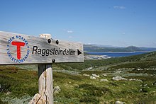 Signs are helpful and convenient, but no substitute for a map and compass. Raggsteindalen in Buskerud.
- It is easy to get lost at ridiculously short distances in unfamiliar terrain. Take a careful look even if you are going only for a minute. Dense forest, fog and open plateaus with no clear landmarks are the most difficult.
- Always take a map and compass with you when leaving the immediate vicinity of your camp (electronics is no substitute, only a supplement – instead of checking battery status you should create a good mental map). Learn to use a compass for navigation and learn to match your map with the terrain.
- If you do get lost, admit it and stop immediately. A few minutes of good rest is surprisingly effective at making you think clearly again. Lines in the terrain can be used to find way back, for instance rivers (rivers can lead you to settlements or to lakes and other points that can be identified on the map), power lines and slopes. But beware of slopes making you change direction and leading you only to a local depression, rivers leading you to hard-to-walk wet terrain, etc. Check the map for what lines are usable.
- Bugs 과 동물
- Mosquitoes and black flies are a nuisance in June and July, especially in Lapland and Finnmark. They do not carry diseases, but repellents, long sleeves, long pants and perhaps a mosquito hat in the worst areas are recommended. Avoid keeping doors and windows open in the evening.
- 진드기 can carry Lyme disease and TBE in some areas (especially south Norway to south-west Finland). The risk is small for a casual visitor, but you may want to take precautions.
- There are big predators like bears, wolves, lynxes and wolverines in the Nordic countries, but they are generally no threat to people, as they will flee in most circumstances once they smell or hear humans. Back out if you encounter bear cubs, as their mother will protect them. Also musk oxen, elks and boars can be dangerous if you go too close.
- If you are hiking in the hunting season (the autumn), in areas where hunting is allowed, you should wear some orange or red clothing. Ask for local advice about whether any areas should be avoided. Hunting season varies by species. Moose hunting is common in the forest areas of Sweden, Finland, East Norway and Trøndelag. Red deer hunting is common in West Norway. Reindeer hunting occurs mostly in the barren mountains.
- Be careful in sun
- Clear Nordic air, high altitude and snow patches can multiply the effect of the sun, which hardly sets during the Nordic summer. Snow blindness is a serious risk, so bring UV-resistant sunglasses, and preferably mountain goggles. Bring sun cream or sun block (sun protection factor). Light can be strong in the highlands even if the sun is not visible.
- Glaciers
 Do not go on your own. 요스테달스브렌 glacier.
- Glaciers are one of the most dangerous places for visitors to the Norwegian outdoors. Never underestimate the power of the glacier. Observe warning signs. Never approach the front of the glacier. A glacier is not a stable piece of ice, it is constantly moving and huge chunks regularly fall off. Snowbridges can obscure crevasses.
- The sun's rays get reflected from the white snow, so it necessary to use sunscreen and sunglasses to protect your skin and eyes. Bring warm clothes for tours on the glacier.
- 하다 아니 enter a glacier without proper equipment and a skilled local guide.


Rules of mountain conduct
Norway's trekking association has compiled a set of rules or guidelines for sensible hiking, "fjellvettreglene":
- Don't go for a long hike without training.
- Tell where you are going.
- Respect weather and forecast
- Be prepared for storm and cold weather even on shorter hikes. Bring a rucksack with the kind of gear needed.
- Listen to experienced hikers.
- Dont hike alone.
- Use map and compass
- Turn back in time, it is nothing to be ashamed of.
- Don't waste your energy. Dig into snow if necessary.
Volcanic eruption

Out of the Nordic countries, Iceland is the only one with active volcanoes.
As a precautionary mesure carry a cell phone and a battery powered radio, and heed to warnings from the Icelandic civil protection about hazardous areas. Listen to either the radio station Rás 1 or Bylgjan. Rás 1 is on the LW frequencies 189 kHz and 207 kHz. For the FM frequencies see the frequency map of Ras 과 frequencies of Bylgjan. Pay attention to any SMS messages you get, as the Icelandic civil protection does send out SMS messages in Icelandic and English to phones in hazardous areas.
Should an eruption occur the ash can spread throughout the whole country depending on the wind direction. Eruptions increase the chance of lightnings and a glacial eruption will generate n flood in rivers with sources at the melting glacier.
Regardless of where you are in the country during an eruption, consider the wind direction and consider whether the wind can spread the ash to you. As an alternative you can use the mobile website of the Icelandic met office. If so, walk high up in the landscape to avoid poisonous gases, cover your nostrils and mouth with a cloth. Should the ash get thick or if you have an asthma, go into the next day or wilderness hut, close windows on the side that the wind blows at, close the chimney and stay there until the wind direction changes.
Should you be in close proximity of an eruption walk opposite to the wind direction to get out of the area. If you have concerns that you cannot abandon a hazardous area in time, do not hesitate to call the emergency number 112.
존경

Many people you meet on remote trails are there to be with nature only. They might not be interested in socializing and will probably frown upon noisy behaviour. It is common, though, to stop and exchange a few words, e.g. about the terrain ahead, and at least some kind of greeting is usually expected when you meet people on (or off) the trail. Some might of course be interested in where you come from. People are often less reserved with strangers when they are in the wilderness.
Smoking is disliked by many and can be a serious hazard. In hot and dry periods a cigarette butt can cause a forest fire (even if "extinguished"), so just like with other litter, avoid leaving them in nature. Smoking indoors is mostly prohibited. Where locals smoke you might follow their example, but otherwise try to be a good example yourself.
Even if there is right of access, wilderness is often privately owned. In Norway only barren high mountains are public (government) property. Trails and bridges are usually maintained by volunteers (the trekking association for instance) or by landowners for the visitors' benefit. 당신은 누군가의 사유지에서 손님임을 명심하십시오. 방목 동물과 방해해서는 안되는 큰 게임이있을 수 있습니다. 쓰레기를 남기지 마십시오. 바위가 많은 해변과 산길을 따라 광야에서 석조 케언즈를 만드는 것이 방문객들 사이에서 점점 인기를 얻고 있습니다. 돌 케언즈는 트레일을 표시하는 데 사용되며 실제로 등산객을 오도할 수 있습니다. 케언즈를 짓는 방문객들은 종종 돌 울타리에서 돌을 줍는데, 그 중 일부는 실제로 문화 유산이거나 사용 중입니다. 단순한 바위라고 해도 이렇게 자연을 바꾸는 것은 불법이다.
유사한 고려 사항이 공유지에 적용됩니다. 라플란드의 대부분은 Sámi가 소유권에 대한 동일한 개념을 갖고 있지 않았기 때문에 정부 소유입니다. 주민들은 마치 땅을 소유한 것처럼 광야에 의존하고 있습니다. 그리고 납세자의 돈으로 시설을 유지 관리하는 곳에서는 공동의 의지의 결과이며 개인 기부와 마찬가지로 취급되어야 합니다.
장소 이름과 유용한 단어
지도와 표지판의 이름은 일반적으로 지형을 나타내므로 일부 풍경 단어를 이해하는 것이 유용할 수 있습니다. 사전에 대규모 지도를 공부할 가능성이 있다면 가장 자주 사용되는 접두사와 접미사의 의미를 확인하고 싶을 수도 있지만 일부는 여기에 나열되어 있습니다. 그들은 종종 지형 특징에 대해 지도에서 명확하지 않은 것을 말하거나 해당 지역의 역사에 대한 힌트를 제공합니다.
사미어 지역에서 지명은 일반적으로 사미어 기원이며, 이것이 분명하지 않은 경우에도 마찬가지입니다. 예를 들어 레멘요키 원래 "따뜻한 강"(Sami: leammi, 핀란드어: lämmin)이 아니라 "사랑의 강"(핀란드어: lempi, lemmen)이 아닙니다. 지역의 지형적 특징은 종종 사미어로 불린다(예: "jåkk", 조카, 스트림에 대한 스웨덴어 대신).
관련된 언어는 복합 명사를 사용합니다. 이름은 일반적으로 단어를 합성하여 만들어지며, 마지막 부분은 그것이 어떤 풍경의 특징인지를 나타냅니다. 예를 들어 요스테달스브렌 에서 만든 이름입니다. 요스테달 (조스테 밸리) 및 브레 (glacier) 즉, 요스테달의 빙하. 종종 단어는 복수형 및/또는 속격으로 되어 있어 단어를 약간 수정하지만, 핀란드어와 Sámi에서는 항상 너무 약하지 않습니다.
또한 노르웨이어와 스웨덴어에서는 정관사("the")가 접미사로 나타나 단어에 통합되므로 브린 방법 빙하.
몇 가지 다른 Sámi 언어가 있으며 맞춤법은 불과 수십 년 전에 표준화되었습니다.
스웨덴어 ä 및 ö는 아이슬란드어로 æ 및 ö, 노르웨이어에서 æ 및 ø로 표기됩니다. å는 핀란드어와 대부분의 사미어에서 o로 표기됩니다. 스웨덴어 ä는 종종 e에 가깝게 발음되며 대부분의 경우 노르웨이어로 e로 표기됩니다. 철자 또는 발음에서 이러한 차이점과 기타 다소 체계적인 차이점을 인식하면 Sámi 지역(핀란드어, 스웨덴어 및 Sámi 철자)의 joki/jåkk/jåkkå/johka와 같은 다른 언어에서 알고 있는 단어를 이해하는 데 도움이 됩니다.
스웨덴어 및 노르웨이어

- 카트/카타
- 지도
- 피엘, 피엘
- 산, 정상, 봉우리
- 비디오
- 높고 탁 트인 고원(수목선 위)
- innsjø, vann, vatn, sjö
- 호수, 연못
- 티에른, 티에른
- 연못, 작은 호수, tarn
- 스코그
- 숲, 숲
- 미르, 케르
- 늪, 늪
.jpg/220px-Besseggen_Hike,_Norway_(14673663307).jpg)
- 어, 탈러스콘
- 스크리, 탈러스 예금
- bre/glaciär, 폰, 스카블
- 빙하, 눈 더미
- 달
- 골짜기
- juv, kløft/klyfta, 라빈
- 협곡, 계곡, 협곡
- elv, bekk/älv, å, 백
- 강, 시내, 개울
- bro/bru, 솜마르브로, 헬로스브루
- 다리, 겨울에 철수하는 다리, 연중 다리
- 배드
- 포드
- stuga/stue, hytte
- 오두막, 오두막
- 푀르폴렌
- 부패
- 스나우펠/칼피엘
- 불모의 산
- 트레그렌세/트래드그렌센
- 나무줄
- 스카이드솜로드
- 보호 지역
- 스티/스티그
- 길, 흔적
- 러스크마르크닝
- 눈 속에서 나뭇가지 형태의 표시
- øy/ö, holme, skär
- 섬, 섬
- foss/fors, vattenfall
- 폭포, 급류
아이슬란드어

- 코트
- 지도
- 떨어졌다, 피얄
- 산
- 하이디
- 높은 개방 고원
- 바튼, 티욘
- 호수, 연못
- 미리
- 늪, 늪
- 피요르뒤르
- 피요르드, 베이
- 요쿨
- 빙하
- 달루르
- 골짜기
- gjá, gljúfur
- 협곡, 계곡, 협곡
- ㅏ
- 강
- 포스
- 폭포
- 에이야, 스커
- 섬, 섬
핀란드어 및 사미어
- 카르타
- 지도
- vuori, tunturi/tuodtar, vaara / várri (várre, várrie, vaerie, vare)
- 산; vuori는 핀란드어의 일반적인 단어이고, tunturi와 vaara는 각각 수목선 너머로 확장되지 않습니다. 그러나 Sámi의 várri는 언덕이나 산(종종 크고 가파른 언덕에 관한 것)에 대한 일반적인 단어이며 종종 vaara로 "번역"됩니다. tunturi/duottarmailbmi는 트리 라인 위의 모든 영역에서도 사용됩니다.
- 카이사/가이사; kero/tseärru; 오아이비; kielas/gielas, 카이타/스카이디; 로바/로아비
- 다양한 형태의 산: 높은 눈 덮인 봉우리; 나무 라인 위의 더미 모양의 산; 트리 라인 위의 둥근 산("머리"); 산등성이; 드문드문 숲이 있는 돌 언덕
- 쵸카
- 정상, 정상
- mäki, kallio, harju/puoldsa
- Hill, (언덕의) 단단한 바위, esker
- skäidi, selkä/cielgi
- 산등성이, 분수령 지역(바다나 큰 호수도 셀카)/산 옆에 자작나무가 있는 능선
- 파타/파테
- 높고 가파른 언덕
- järvi/jávri (jávrre, avrre, havrre, jávrrie, jaevrie, jävri, jäu'rr, jauri, jaure, jaur)
- 호수, 연못
- 베시
- 이름에서 종종 "호수"를 의미하는 물
- lähde, 칼티오/갈두
- 봄
- 람피
- 연못, 작은 호수, tarn
- lahti/luokta (luoktta, loekte)
- 만
- niemi/njárga (njárgga, njarka)
- ...곶

- suo, rahka, räme, aapa/aaphe, jänkä/jeäggi, vuoma/vuobme
- 늪, 늪지; suo는 일반적인 단어이고 나머지는 다른 유형입니다. vuoma/vuobmi also valley
- 팔사
- 서리 마운드(수렁 또는 습지)
- 야티코
- 빙하, 눈 더미
- 락소
- 골짜기
- rotko, kuru/autsi, ävdzi, 고르사
- 협곡, 계곡, 협곡
- joki/johka (jåhkå, juhka, johke, jåkkå, jåkk), eno/eädnu, puro, oja/ája,
- 강, 시내, 개울; joki/johka는 일반적인 단어이고, eno는 상당히 크며, puro는 작습니다, oja는 작습니다.
- 칼라모
- 포드
- 메사; kuusikko, männikkö, koivikko 등
- 숲, 숲; 다른 수종의 후자의 숲(kuusi=spruce, mänty=pine, koivu=자작나무)
- 라자
- 경계, 한계
- 푸라자
- 나무줄
- 라자비요히케
- 국경지대
- 쿠시메셴 라자
- (북부) 가문비나무("kuusi") 숲의 한계
- 폴쿠, 레이티
- 길, 흔적
- mökki, pirtti, tupa; 업/감미
- 오두막, 오두막; 잔디 오두막
- 시이다
- 사미 마을 또는 커뮤니티

- 세이타/시에디
- 영, 신성한 물건
- 사리, 루오토
- 섬, 섬
- koski, niva, kurkkio, kortsi/gorzze
- 급류, 후자는 가파르고 돌
- 수반토, 사부
- 잔잔한 물(급류 아래)
- 쾨게스
- 급류, 작은 폭포
- (베시) 가증스러운
- 폭포
- latu (pl. ladut)/láhtu
- 스키 트랙
잇다

달팽이 메일
상점과 관광 사업체에서 사용할 수 있는 우편함과 우표가 있을 수 있습니다. post restante 대신 적절한 c/o 주소. 현지 관행에 대해 물어보십시오.
전화
북유럽 국가에서는 일반적으로 휴대전화 서비스가 잘 되어 있지만 꼭 필요한 곳은 아닙니다. 일부 야생 오두막에는 비상 전화용 전화기가 있습니다(핀란드에서는 더 이상 사용하지 않음, 스웨덴에서는 일반적이며, 지연에 대해 알리고 비상 상황뿐만 아니라 필요한 경우 조언을 구하는 데에도 사용해야 함).
산악 지형에서는 계곡에 신호가 없는 경우가 많습니다. 외딴 지역에서는 낙하산을 제외하고 신호가 없을 수 있습니다. 저속 연결(심지어 9600비트/초)로 중요한 인터넷 서비스를 미리 테스트할 수 있습니다. SMS 날씨 서비스가 있습니다. 3G는 큰 마을과 주요 관광 리조트 근처 및 일부 주요 도로에서만 사용할 수 있었지만 이제는 핀란드의 대부분의 황야에서도 사용할 수 있습니다.
보장 범위는 공급자마다 다릅니다. 회사에 둘 이상의 전화(SIM 카드)가 있는 경우 다른 공급자를 원할 수 있습니다. 가장 좋은 신호는 이웃 국가의 신호일 수 있으므로 전화가 공급자를 선택하도록 하면 국내 SIM 카드로도 국제 전화 요금을 지불해야 할 수 있습니다.
신호가 좋지 않은 경우 전화를 걸지 말고 SMS를 사용하십시오. 메시지는 몇 초 동안만 신호가 필요하므로 더 안정적이고 더 적은 전력을 사용합니다.
휴대전화를 건조하게 유지하세요. 나쁜 신호가 있는 곳에서는 배터리가 훨씬 빨리 사용된다는 것을 기억하십시오. 대부분의 시간 동안 전화기를 꺼두십시오. 전기는 일반적으로 시골집이나 가정에서도 사용할 수 있는 것은 아닙니다.
긴급 전화
그만큼 긴급 전화번호 112 모든 북유럽 국가에서 작동합니다. 일부 긴급 상황에는 특별 번호가 있을 수 있지만 ☏112 모두 처리할 수 있습니다. 112로 거는 전화는 무료이며 대부분의 전화에서 잠금 장치와 상관없이 작동합니다. 번호를 입력하거나 비상 버튼을 사용하십시오(일부 스마트폰의 경우). 사실, 어떤 경우에는 전화가 사용 가능한 최상의 연결을 사용하는지 확인하기 위해 SIM 카드를 제거해야 할 수도 있습니다. 슬프게도 Swedish 112는 "5"를 누를 때까지 SIM 없는 통화를 보류합니다. 핀란드에서는 이러한 전화가 응답되기 전에 약 30분 동안 보류됩니다.
에 대한 위성 전화 긴급 서비스 번호는 ☏ 46 63-107-112 (스웨덴), 358 9 2355-0545 (핀란드), 354 809-0112 (아이슬란드 체크!). Inmarsat-14 위성은 남쪽 수평선 위의 약 15도에 불과하므로 더 높은 지형이나 기타 장애물에 의해 쉽게 차단됩니다. 이리듐에는 이 문제가 없습니다.
응급 상황으로 이어질 수 있는 문제에 대해 주저하지 말고 응급 서비스에 알리십시오. 또한 그들에게 당신이 안전하다는 것을 알리기 위해 전화를 걸어야 하고, 마찬가지로 당신이 늦었을 때 누군가 구조 작업을 시작하기 위해 전화할 수도 있습니다. 비용은 시간당 유로(일반적으로 납세자의 돈으로 지불되지만 시스템을 남용하고 싶지는 않음)의 다섯 자리 숫자입니다.
위치는 ETRS89/WGS84 좌표로 가장 잘 알 수 있습니다(지도에서 사용되는 좌표인지 미리 확인). 지도의 잘 알려진 위치 또는 좌표계로부터의 방향 및 거리도 사용할 수 있습니다. 실수를 피하기 위해 위치 근처에 이름을 알려주십시오. 360° 및 여러 mil 시스템(원의 경우 60, 63 또는 64 hektomil)이 나침반에 사용되며 다음과 같은 일부 이름이 사용됩니다. 에일리가스 ("거룩한"), 모호합니다. 핀란드에서 응급 서비스는 지방 자치 단체와 주소(거대한 지역을 담당함)를 요청할 수 있지만 모른다고 말하면 합리적일 것입니다.
위성 내비게이터 (GPS 등, 종종 스마트폰에, 때로는 카메라에 포함됨) 상당한 전력을 사용하므로 대부분의 시간 동안 꺼두는 것이 가장 좋지만 비상 시 정확한 좌표를 제공할 수 있는 경우가 많습니다. 위성을 찾는 데 시간이 걸리며 그때까지 잘못된 좌표를 제공할 수 있습니다. 그들의 설정과 행동을 이해했는지 확인하십시오.
코프
낭비
오두막, 대피소 및 캠프파이어 장소에는 종종 쓰레기통이 있습니다. 특히 도로가 없는 곳에서는 이러한 사용을 피하고 대신 포장해야 합니다. 오지에서 쓰레기통을 비우는 것은 불필요하고 비용이 많이 드는 교통량을 의미합니다. 음식물 찌꺼기 및 이와 유사한 것은 곧 비게 될 것이라는 것을 모르는 한 쓰레기통에 버리면 안 됩니다. 음식물 찌꺼기와 같은 소량의 유기 폐기물은 구덩이 변기(및 고급 퇴비화 변기)에 버릴 수 있습니다. 일부 위치에는 별도의 퇴비화가 있습니다. 재활용 지점에서 종이, 금속 및 유리는 별도로 처리될 수 있습니다. 오프 트레일에서 유기 폐기물도 필요하다면 묻힐 수 있지만, 특히 이탄과 수목선 위의 경우 분해하는 데 몇 년이 걸릴 수 있습니다. 순수한 종이는 모닥불과 스토브에서 태울 수 있지만 금속이나 플라스틱으로 덮인 종이는 포장해야 합니다. 다른 사람이 태울 쓰레기를 남겨두지 마십시오.
화장실
산책로를 따라 오두막과 종종 대피소와 모닥불 장소에 화장실이 있습니다. 일반적으로 이러한 서비스를 사용하는 경우 더 큰 요구 사항을 충족하기에 충분합니다. 그들은 일반적으로 건조한 변기입니다. 벤치에 구멍이 있는 야외 화장실과 대변을 덮기 위해 이탄, 톱밥 또는 이와 유사한 것이 있는 양동이입니다. 개인 화장지를 사용해야 할 수도 있습니다. 손을 씻는 것은 일반적으로 자신의 문제입니다(사람들이 식수를 가져오는 상류나 식수 양동이 근처에서 하지 마십시오). 오프 트레일과 오두막 사이, 조언 흔적 없는 캠핑 따를 수 있습니다.
세탁
대부분의 국가에는 개울과 호수 또는 해안가가 많기 때문에 몸을 씻을 물을 찾는 것이 거의 문제가 되지 않습니다. 그러나 특히 북부와 7-8월을 제외하고는 대부분 꽤 시원합니다. 그냥 그것에 자신을 채택하거나 사우나를 사용합니다. 손을 씻기 위해 소량의 물을 스토브에서 가열할 수 있지만 종종 찬물로 충분합니다. 많은 곳에서 호수나 강에 흙이나 비누가 묻지 않도록 해야 하며 대부분의 경우 육지에서 씻습니다. 바닷물은 발트해에서 너무 짜지 않으며 피요르드에서는 거의 없습니다.
샤워는 일반적으로 황야 오두막에서 사용할 수 없지만 일부 캐빈과 실제 캠프장에서는 사용할 수 있습니다. 대신에 꽤 많은 오두막과 오두막에 있는 사우나를 이용하세요. 를 위해 찜질방 절차는 해당 기사를 참조하십시오(핀란드에 없을 경우 예상되는 동작이 다른지 확인하십시오). 그러나 적절한 세척은 일반적으로 세면대에 뜨거운 물과 찬 물을 섞어서 사용하는 것입니다. 새 세트 또는 두 세트를 섞어 헹굽니다.